Thursday: Mostly sunny skies continue
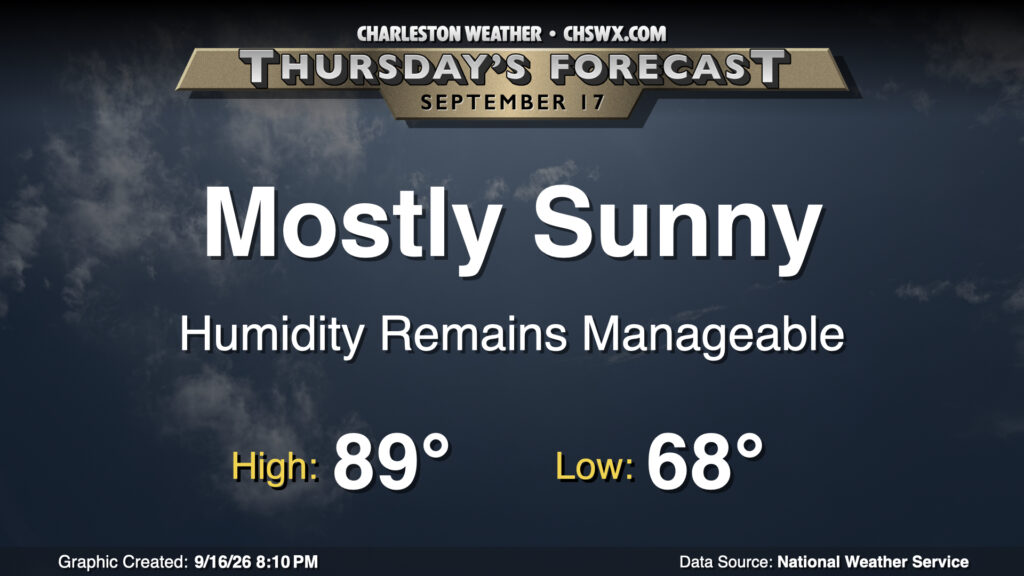
Another warm mid-September day lies ahead for Thursday as high pressure remains the dominant weather feature at the surface and aloft. We’ll get off to another pleasant start with lows in the upper 60s warming to the upper 80s in the afternoon with dewpoints in the mid-to-upper 60s away from the coast, where dewpoints will settle in the 70-72° range. Dry air in the atmospheric column will make for mostly sunny skies, with just a few passing clouds expected.
Friday & the weekend: Moisture returns, and so do storm chances
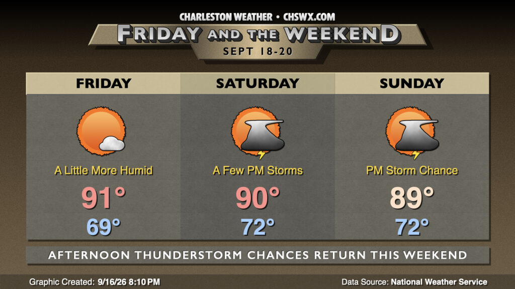
We begin to see more moisture return to the area starting Friday as a mid-level low slips south of the area. Dewpoints will run in the upper 60s as opposed to mixing out into the mid-60s during the day, and with temperatures heading into the low 90s, it’ll feel closer to 95° or so. We should stay rain-free for Friday, though.
That won’t be the case as we get into Saturday and Sunday as dewpoints climb back into the 70s. The increase in deeper moisture will give the inland-moving seabreeze a little fuel to kick off some afternoon showers and thunderstorms each day. Certainly not a washout, but be ready to bring outdoor plans inside.
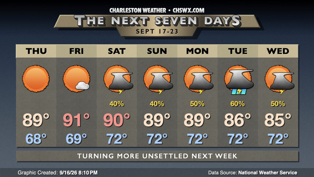
As we look ahead into next week, unsettled weather will persist through at least midweek as a trough persists at the surface and an upper low stalls out in the Gulf. Onshore flow and periods of showers and thunderstorms will keep highs pinned into the 80s, especially as we get into midweek.
Follow my Charleston Weather updates on Mastodon, Bluesky, Instagram, Facebook, or directly in a feed reader. Do you like what you see here? Please consider supporting my independent, hype-averse weather journalism and become a supporter on Patreon for a broader look at all things #chswx!