Weekend forecast: Warm and muggy as thunderstorm chances return
An upper low stalling out over Florida combined with an approaching (then stalling) front will help turn things a little more unsettled this weekend.
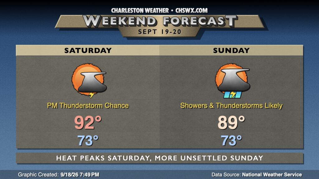
We’re back to muggy mornings starting Saturday as lows only fall into the low-to-mid-70s. Expect highs to peak in the low 90s in the afternoon before showers and thunderstorms get going. The greatest risk for thunderstorms will be found in the mid-afternoon to early evening hours. Not expecting anything severe, but be ready to head inside if a storm approaches.
We should see a bit more coverage on Sunday as the front gets just to our north and stalls out. Once again, we can expect decent coverage of showers and thunderstorms especially as we get into the afternoon. It won’t be a rainout, but like Saturday, be ready to bring outdoor activities inside. A few thunderstorms could produce heavy rain, with minor flooding not out of the question in a couple spots. Temperatures will peak in the upper 80s owing to an uptick in cloud cover and thunderstorm coverage.
Looking ahead: Storm chances persist, but looking more seasonable by the end of the week
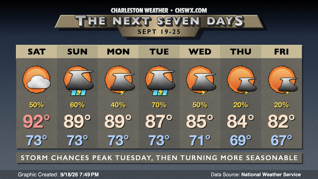
Shower and thunderstorm chances will continue heading into next week as the upper low over Florida drifts northward. We should see a secondary peak in storm chances heading into Tuesday, with the potential for a strong storm or two ticking up slightly as instability improves. Getting into the second half of the work week, though, we start to see temperatures trend downward as high pressure wedges in from the north, enhanced by low pressure developing off the Mid-Atlantic. Highs by the end of the week may only peak in the low to mid-80s, which is around if not perhaps a tick or two below normal for late September. While dewpoints remain in the 60s, limiting the crispness of the air, it will certainly feel a little more like it should this time of year.
Tropics: Brief window for development near the Azores
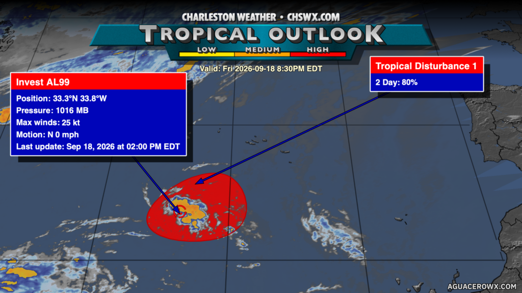
Finally, there is an area in the tropics (dubbed Invest 99L) near the Azores with a high probability (but a short window) to develop into a tropical cyclone over the weekend. With that in mind, it’s very far out and not really a factor. Closer to home, there are no immediate threats, but as we head into October, we start to see the favored areas for tropical cyclone development shift back closer to home with stalling fronts becoming more common. Stay tuned…
Follow my Charleston Weather updates on Mastodon, Bluesky, Instagram, Facebook, or directly in a feed reader. Do you like what you see here? Please consider supporting my independent, hype-averse weather journalism and become a supporter on Patreon for a broader look at all things #chswx!