Tuesday: Turning breezy, with elevated evening tides and a beach erosion threat
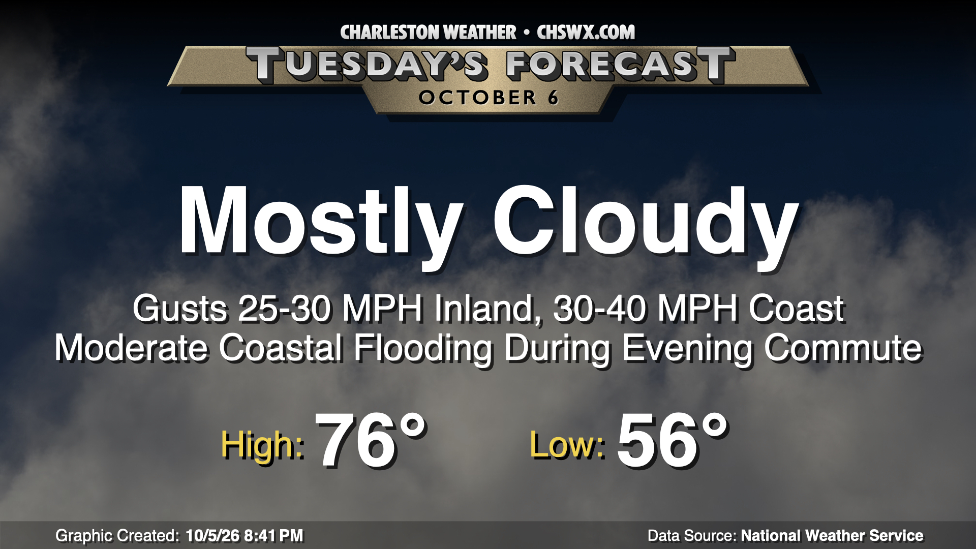
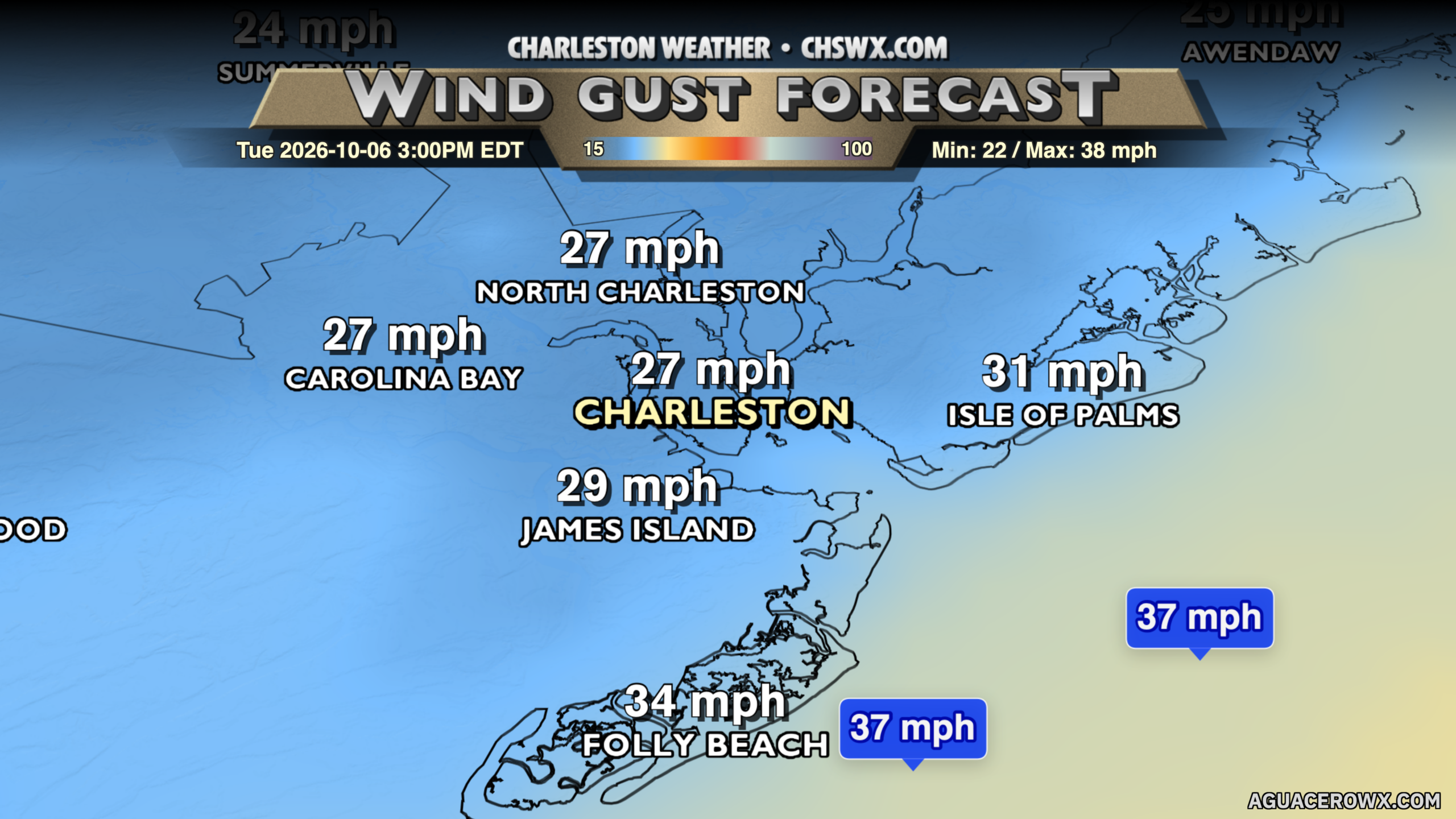
Drier air will continue to push into the area overnight into Tuesday, but it won’t be enough to totally erode the cloud deck as some low-level moisture will remain trapped due to a wedge of high pressure building in from the north. We should see some breaks in the clouds, but otherwise, expect another mostly cloudy day across the area. We’ll start in the mid-50s, warming to the mid-70s in the afternoon (though that may be generous if cloud cover remains more stout). Of greater concern will be winds, especially the closer you get to the coast. Gusts will range from 20-25 MPH inland to 35-40 MPH at the coast. It could be a tricky drive over the bridges at times, so be alert to that. There’s not a formal Wind Advisory yet, but that may yet come with the overnight forecast update from NWS.
Of more concern will be coastal flooding, particularly with the Tuesday evening high tide around 5:28 PM. Moderate flooding looks probable with that tide, which will be enough to close roads in downtown Charleston during the evening commute. When water levels head into moderate flood (from 7.5-7.9′ MLLW), we start to see water get over the top of the Highway 61 offramp from Highway 17 heading into West Ashley. It wouldn’t shock me to see this closed due to flooding for a time right at the height of the evening rush, so be ready to spend some time in traffic if you’re headed home to West Ashley.
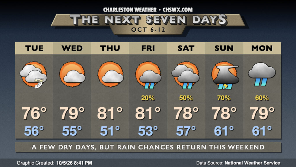
The onshore winds begin to relax on Wednesday, and we’ve got a couple partly cloudy and seasonable days ahead with high pressure remaining in control. Temperatures warm to the mid-70s Wednesday and the low 80s Thursday and Friday. We will start to see moisture return to the area beginning Friday and especially heading into the weekend as a possible Gulf tropical system moves northward. While the system doesn’t seem to pose a direct threat to the Lowcountry, it will help draw plenty of Gulf moisture northward, which will enhance rain chances this weekend, especially on Sunday as low pressure passes nearby.
Tropics: Next tropical system likely developing soon in the Gulf
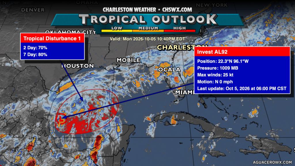
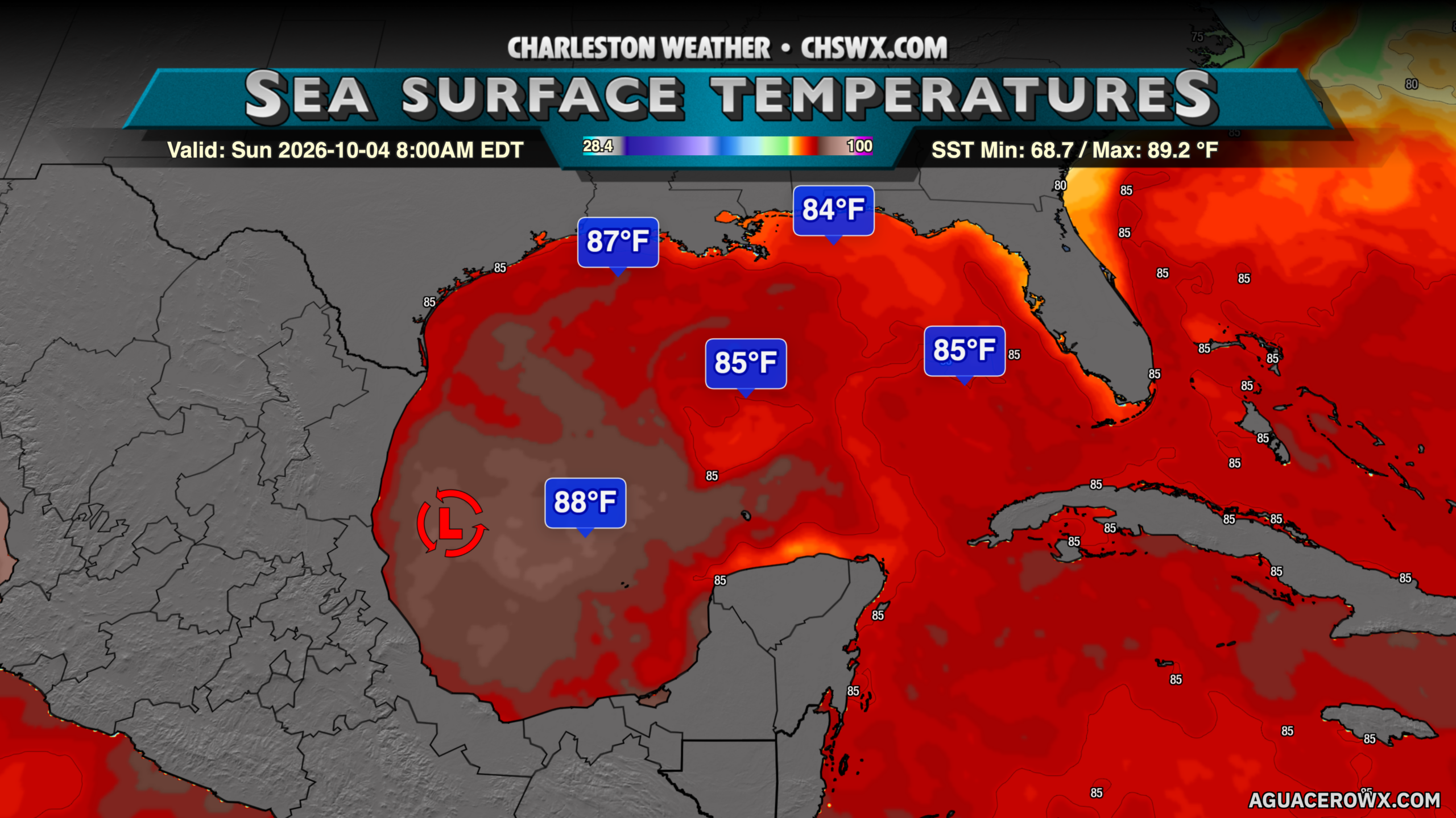
As mentioned, we’re watching the Gulf for what appears to be likely tropical development in the next day or two from an area identified as Invest AL92. It should develop as it moves eastward through very warm and largely untapped water. The upper-air configuration appears favorable for decent strengthening, so we’ll be watching as we head into the weekend. It’s still too early to get into specifics about how strong or where it ultimately ends up, but once the center forms, we’ll start getting a better idea of where it’s headed. High pressure wedging across the area should hold and keep any direct impacts away from the Lowcountry, but as always, we’ll keep watch. The next name on the list is Isaias (ees-ah-EE-ahs).
Follow my Charleston Weather updates on Mastodon, Bluesky, Instagram, Facebook, or directly in a feed reader. Do you like what you see here? Please consider supporting my independent, hype-averse weather journalism and become a supporter on Patreon for a broader look at all things #chswx!