Rest of the work week: High pressure remains in place with a mix of sun and clouds
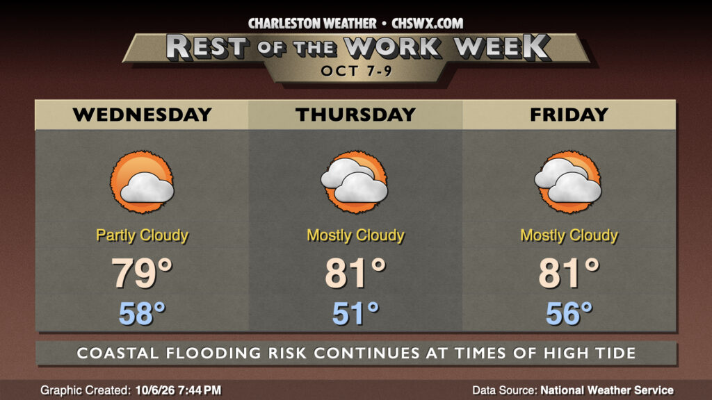
Generally quiet conditions will continue for the rest of the work week with a mix of sun and clouds accompanied by seasonable temperatures for this point of the year.
Wednesday begins in the upper 50s, warming to near 80° in the afternoon under partly cloudy skies. The pressure gradient between the high to the north and low to the south will continue to weaken, helping to bring winds down throughout the day. Still, a few 20 MPH gusts aren’t out of the question. We’ll keep seasonable temperatures in place for Thursday and Friday, with comfortable starts in the low to mid-50s yielding to highs in the low 80s with a mix of sun and clouds.
Minor coastal flooding possible at times of high tide through Thursday
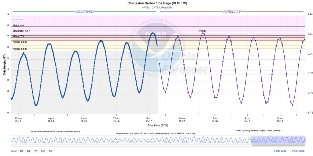
Lingering onshore flow and an approaching new moon will keep the risk for minor tidal flooding in place with times of high tide through at least Thursday, but likely lasting into the weekend as high pressure wedges back in from the northeast. Timing will be such that there will be impacts on the morning and evening commutes once again, so stay alert for Coastal Flood Advisories from the National Weather Service.
Tropics: Tropical Depression Nine forms, expected to become the season’s first hurricane
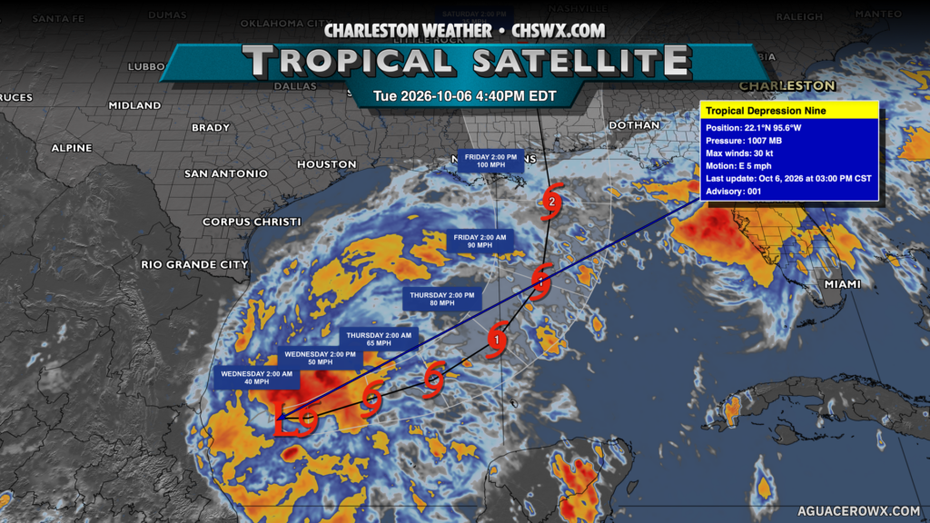
Tropical Depression Nine developed earlier this evening in the Gulf, and the National Hurricane Center believes it could become the season’s first hurricane. Nine will move westward before being steered more northerly by high pressure over the East Coast. There is some uncertainty in the intensity forecast especially as Nine approaches the Gulf Coast, but a hurricane impact is expected between Louisiana and the Florida Panhandle. The next name on the list is Isaias, and Nine could very well be re-christened by the time we wake up Wednesday.
Looking ahead: Tropical moisture surges in for another wet weekend
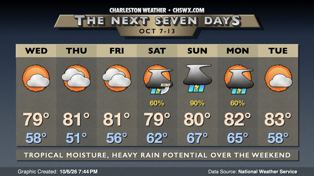
As Nine/future Isaias pushes northward, we should see a surge of tropical moisture atop the high pressure wedge, helping to bring in another round of showers and thunderstorms for the weekend. The best chances for rain will be Sunday as a coastal trough develops and moisture return is maximized across the area. There will be some instability available, so thunder is a distinct possibility in addition to the rain, which may be heavy enough to cause some pockets of flooding. There may also be a sneaky severe weather threat depending on how far to the east Nine tracks; if the wedge can erode somewhat or at least get displaced inland, shear could be enough for some spinning storms. It’s highly unlikely at this point, but tropical systems coming ashore from the Gulf can sometimes cause these issues, so we’ll watch it.
Follow my Charleston Weather updates on Mastodon, Bluesky, Instagram, Facebook, or directly in a feed reader. Do you like what you see here? Please consider supporting my independent, hype-averse weather journalism and become a supporter on Patreon for a broader look at all things #chswx!