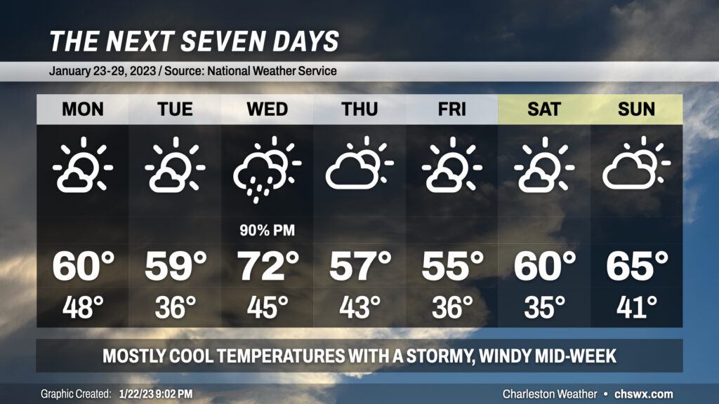
The week ahead will feature temperatures generally at or slightly below normal for this point of the year aside from Wednesday, when temperatures will head into the low 70s ahead of a cold front.
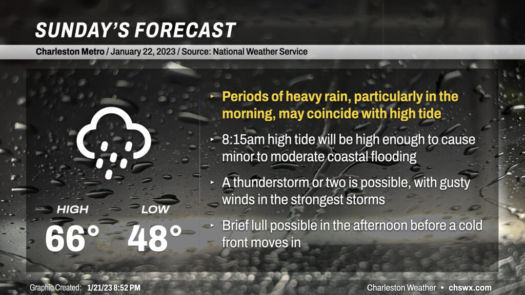
Sunday will be an active weather day across the area as a somewhat complex storm system moves through the Southeast US. Needed rain will fall throughout the day, but some of that rain might be heavy at times near a morning high tide that would cause flooding on a sunny day.
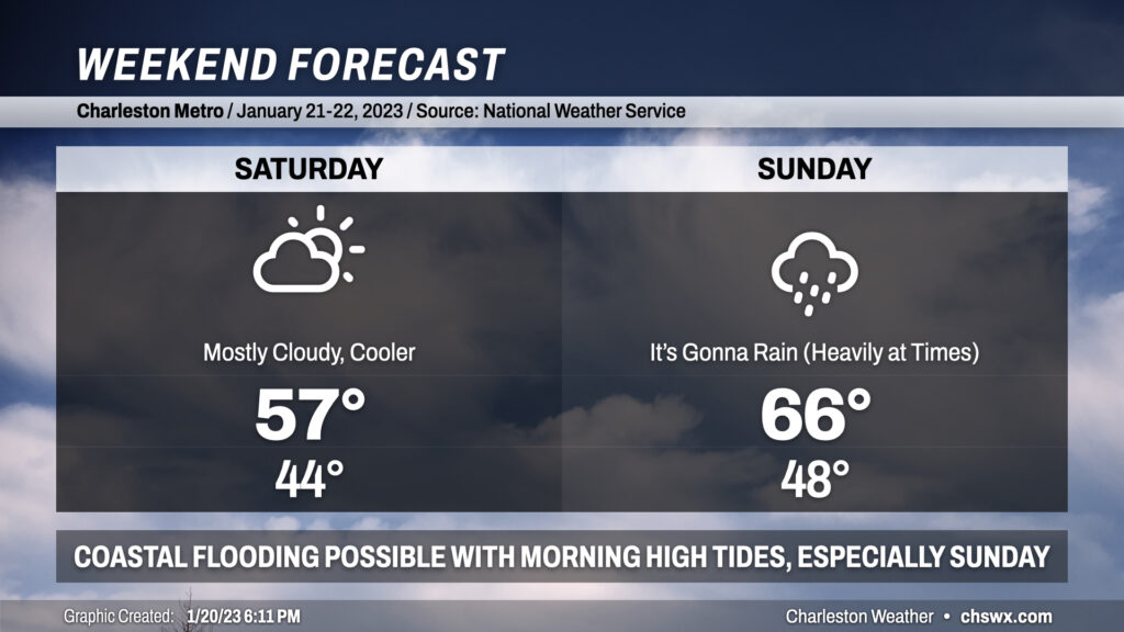
Despite thickening cloud cover and a cool wedge of high pressure building in Saturday, it’ll be the day to do anything outside as Sunday looks more active with some heavy rain at times and maybe some coastal flooding in the morning to boot.