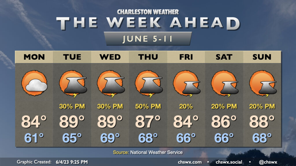
The summertime feel continues into Wednesday, as temperatures look to top out in the low 90s in the afternoon before thunderstorms develop once again in the afternoon thanks to a combination of the seabreeze and a backdoor front that slowly approaches the area throughout the day. A few stronger storms are possible with gusty winds and hail, so be on the lookout if you have evening plans to celebrate getting over the hump.
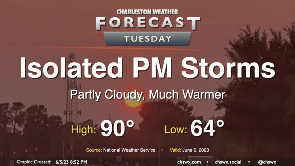
June makes a triumphant return on Tuesday as high pressure slips offshore and winds go southwesterly, transporting more warm and humid air into the area. Temperatures should reach 90° after a mid-60s start under partly cloudy skies. We should see a few isolated storms pop up in the afternoon as the seabreeze makes its inland trek. A strong pulse storm with gusty winds and maybe even a little hail can’t be totally ruled out given decent instability; this will be most likely near outflow boundary collisions.
There will be a risk of some minor coastal flooding around the 10:58 PM high tide, but the westerly component to the wind will make this a much more limited threat compared to the past few days. Still, watch for some salt water around the Citadel and on Lockwood late Tuesday evening.
After a prolonged period of below-normal temperatures (not that a lot of us are complaining, mind you), temperatures will begin to feel a little more like June at times this week as the series of cool high pressure wedges takes a little breather. The warming trend starts Monday, as highs top out in the mid-80s — still a little below normal, but much closer than we saw on Sunday with a high of only 75°. Skies will be partly cloudy to mostly sunny, another nice change from Sunday’s generally overcast disposition.