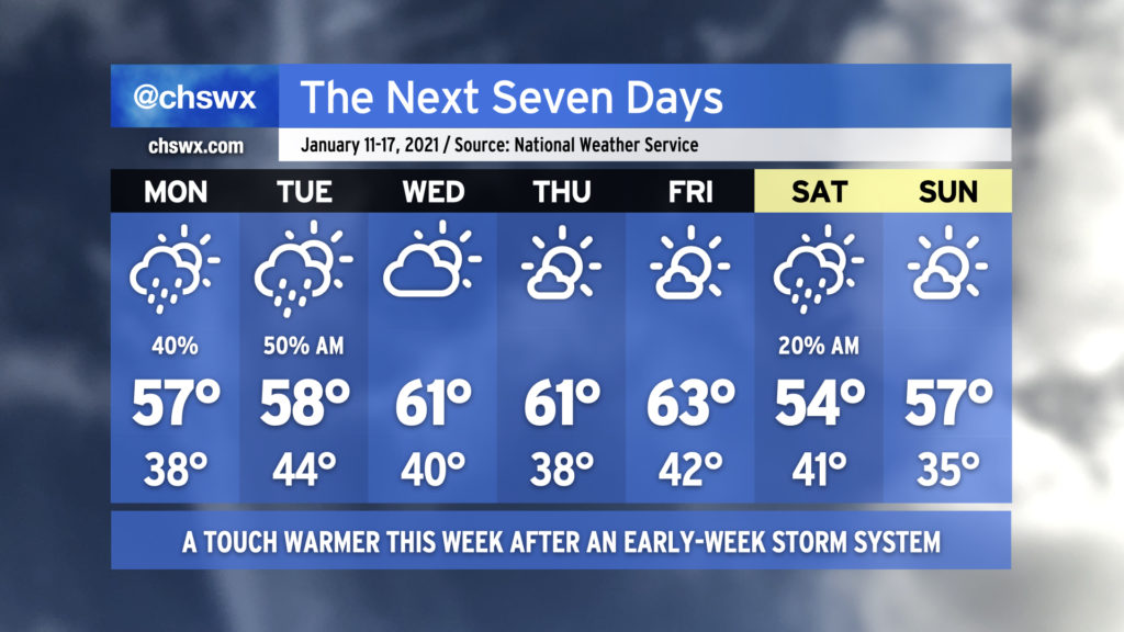
The week ahead will be characterized with a few showers to start before warming up and clearing out in the second half. Clouds will increase overnight into Monday, with showers potentially developing over the ocean and moving inland starting in the afternoon. Shower chances will continue into Tuesday as a wave of low pressure affects the area. Once the disturbance clears the area, we’ve got a few nice days to close out the work week, with temperatures topping out in the low 60s each afternoon. A cold front will swing through early Saturday that may bring a shower or two, but other than that, we’ll cool back to around or a little below normal for the weekend.
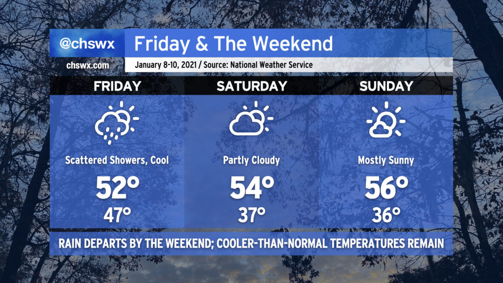
We have a cool and quiet weekend ahead in the Lowcountry. Tonight’s rain will exit the area early Friday morning as a cold front swings through the area, but the storm system’s parent upper low will continue to lumber through North Carolina, potentially spawning scattered showers as the day goes on in our neck of the woods. Rain chances will decrease even further after sunset Friday, leading to a dry weekend.
Temperatures will remain cooler than January normals throughout the weekend, with mid-50s the norm as we sit between the departing low pressure system and high pressure in the upper Midwest. Relatively dry air will keep cloud cover generally thin, especially on Sunday.
Our next storm system arrives Monday as another upper low ushers through a front to start the week.
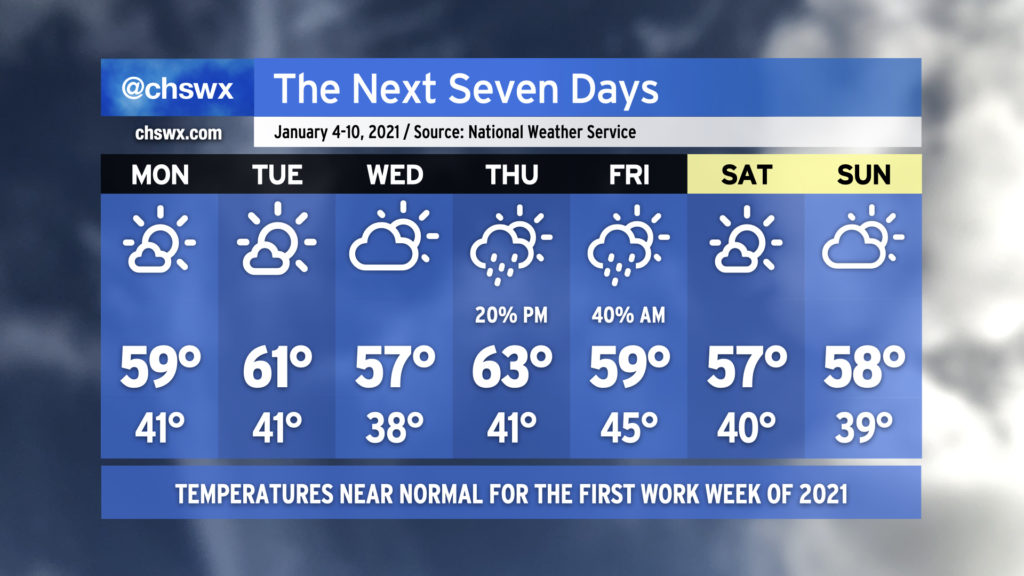
The first work week of 2021 will generally arrive with little weather fanfare, with temperatures at or slightly above early January normals for much of the week. Rain chances tick up Thursday into Friday as a storm system moves through, but quiet weather returns for the weekend.