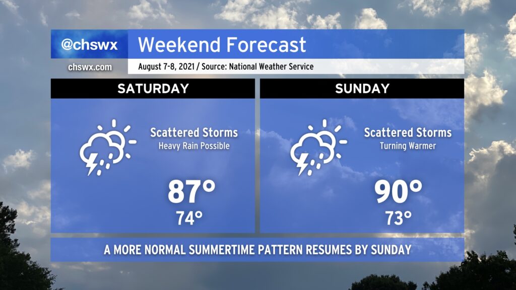
Scattered showers and thunderstorms will continue to feature prominently in the forecast as we get into Saturday, with perhaps another round of morning storms to greet us as a mid-level trough and some embedded energy draws closer to the area. With the warm front north of us, peeks of sun should allow temperatures to continue to moderate into the mid-to-upper 80s in the afternoon.
By Sunday, the troublesome trough lifts out of the area and we get back into more of a traditional summertime regime. Scattered storms will continue, though they should be a little less numerous Sunday. Highs return to the 90s across the area and look to stay that way as we get into the new work week. But it’s the weekend, and there’s no reason to think about the new work week right now. 🙂
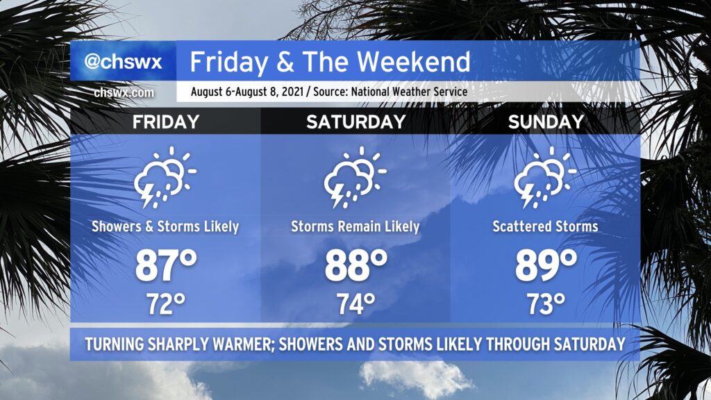
After two straight days of 70s — the earliest that’s happened in August on record — a warm front will lift across the area late tonight into Friday morning. Said warm front will scour out the cool season-esque wedge of high pressure that’s been in place for the last couple days and bring warm temperatures and humidity back to the Lowcountry. This, too, combined with good mid-level forcing from a trough approaching from the west, will keep plentiful showers and thunderstorms in the forecast through Saturday.
With the wedge scoured out, we shouldn’t have quite as much overcast as we’ve seen the past few days. The change in airmass and ensuing periods of sunshine between storms will allow high temperatures to rise through the upper 80s each day through Sunday. Mix humidity in, and it’ll feel closer to the mid-90s on Friday, and will feel closer to 100° Saturday and Sunday afternoons. (At least it’s not 115° like this time last week!)
The trough that’s responsible for Friday and Saturday’s shenanigans will shift eastward as Sunday goes on, giving way to weather that’s more characteristic of early August to start the next work week. The fall preview was nice, though, and it’s a nice reminder that we’re coming through the peak of summer now, with the cool season not too terribly far off.
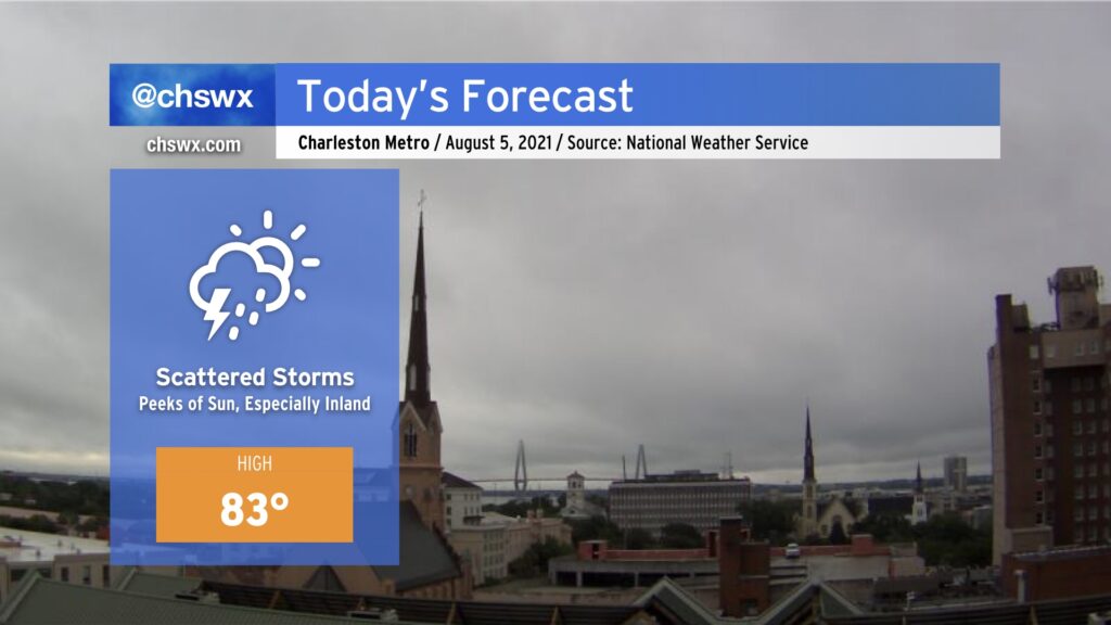
We woke up to some fairly rude shower activity generally along and east of 17-A this morning as the front repositioned a little further north. Lift across the boundary within an enhanced corridor of moisture is keeping us in cloud cover and showers this morning. We could see another round of showers in the next couple hours lift out of Savannah into the metro area. Guidance continues to indicate a dry slot for at least a few hours late this morning into early afternoon, but then begins to advertise scattered showers (and maybe a thunderstorm near the coast) returning to the picture later this afternoon.
We could still see some peeks of sun throughout the day, but the best chances of that are going to be further inland, generally west of 17-A to the I-95 corridor. Closer to the coast, we’ll remain within a plume of higher precipitable water values and somewhat better forcing in proximity to the front, which will certainly make it tougher to get some sunshine through. Depending on the strength and timing of the high pressure wedge lifting out, this could make for another significantly cooler-than-normal day for much of the Charleston metro area.
By tonight, rain chances will spread further inland as the front begins to lift back to the north in response to a trough, currently found over the Midwest into the southern Plains, pushing eastward. This will increase rain chances markedly for tonight into Friday.
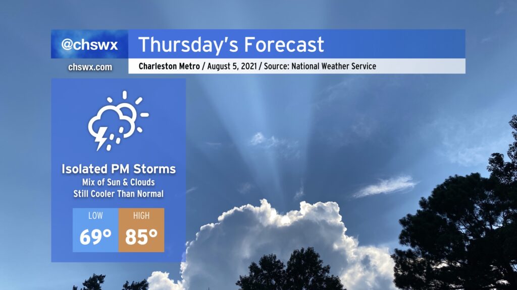
After a record cool day — Wednesday’s high of 77° breaks the record low maximum temperature of 80° set in 1969 — we’ll warm up by a few degrees for Thursday as more sunshine mixes in. Still, though, with high pressure wedging in from the north, we’ll stay cooler than normal once again.
The high pressure wedge will retreat a bit as Thursday goes on. This will allow for the seabreeze to help kick off a few showers and thunderstorms Thursday afternoon and evening, but we will still not have a ton of moisture to work with behind the front. Rain chances will steadily increase overnight Thursday into Friday as the front moves back north of us, increasing available moisture and instability.
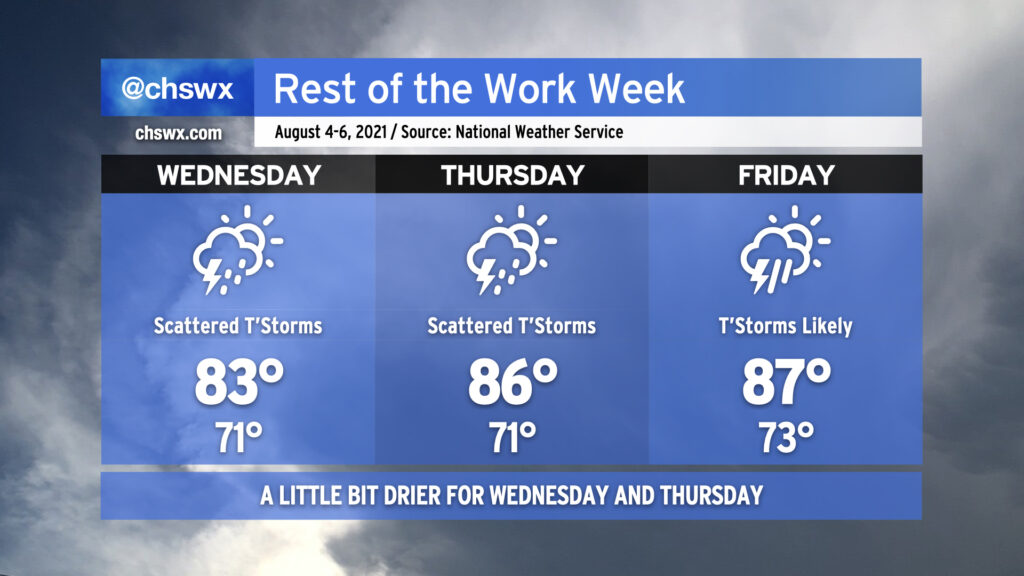
There’s a reason we tell y’all to stay tuned to forecast updates, and that’s because sometimes things change. In this case, it’s changing for the better thanks to a front that pushed a little further south and a trough moving a click or two more eastward.
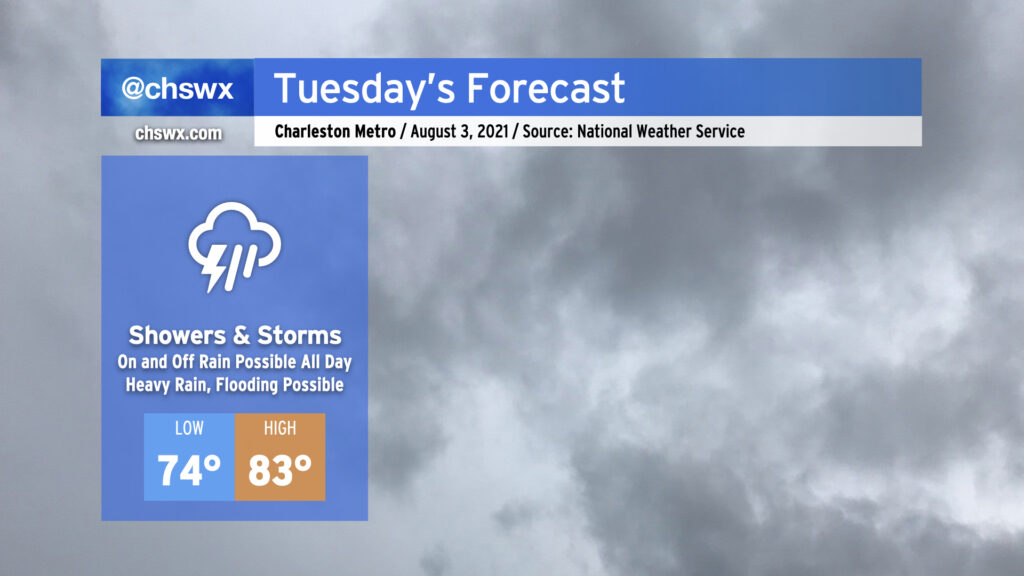
A soggy pattern takes shape beginning Tuesday as a stalled front and an open pump of Gulf of Mexico moisture combine to produce widespread showers and thunderstorms. It won’t rain all of the time all day — will generally be on-and-off — but keep the rain gear handy regardless as when it does rain, it could rain pretty heavily. Some guidance is pointing to a particularly heavy slug of rain coming through starting tomorrow afternoon into the evening hours, which is certainly worth monitoring for the evening commute. Flooding is certainly a concern, and trends will be monitored appropriately, especially as high tide comes up at 5:06 PM.
Temperatures will be kept handily in check thanks to the rainfall. NWS has a high of 83° at best across the area. Depending on how “on” the rain ends up being, it’s conceivable we might not make it out of the 70s. Quite a contrast to last week, that’s for sure.
Stay abreast to forecast updates on Tuesday and throughout the week as we keep close watch on the potential for flooding rain.