We’re in full-blown Command-C/Command-V mode here at @chswx HQ this week, as one would typically expect in a Charleston summer: Highs in the low 90s with isolated afternoon thunderstorms expected. This forecast is right on the dot with mid-July climatology, and there’s really not too much else to write home about.
If you’re headed to the beaches or out on the water this morning, there is the risk of a waterspout underneath any tall cumulus towers, and there will be a persistent rip current risk all day. These are the only caveats — mind these and you’ll be in good shape.
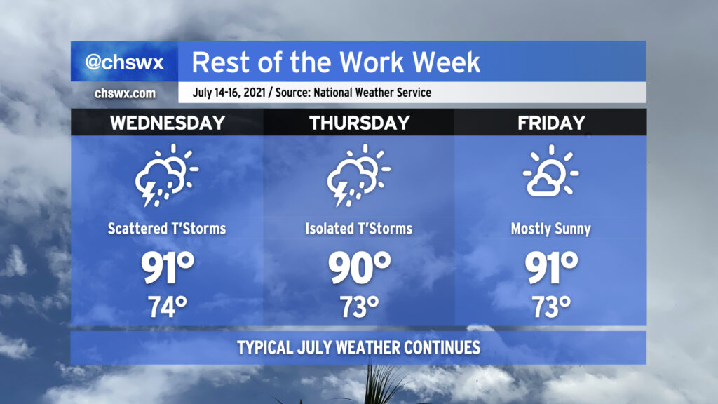
The work week rolls on with pretty standard July weather as we remain under the influence of Atlantic high pressure. We’ll stay warm and muggy with lows in the low to mid-70s away from the coastal communities (where lows likely won’t dip below 80°). Highs each afternoon will continue to top out around 90-91° — right around where we should be for this time of year. Rain chances come down a touch on Friday, with mostly sunny skies currently expected.
Overall, brief heavy rain will be possible within any thunderstorms, though storms today did show a propensity to train a bit, with 2″ of rain recorded at a gauge in Mt. Pleasant within a persistent round of thunderstorms earlier today. The strongest storms could produce sporadic wind damage, but widespread severe weather is not in the forecast by any stretch.
Rain chances stay around normal for July heading into the weekend before ramping up a bit as we get into next week.
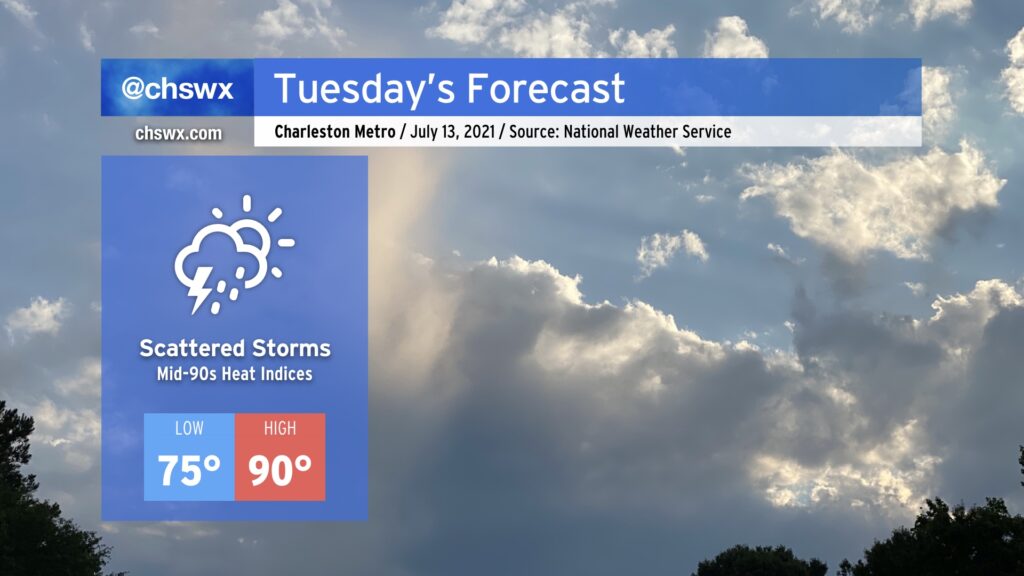
Another rather normal July day is in store for Tuesday. Expect a muggy start with lows in the mid-70s heading toward a high of around 90° in the afternoon. Like today, scattered showers and thunderstorms will factor into the weather picture possibly right out of the gate in the morning near the coast. This scattered storm risk progresses inland during the day with the seabreeze, leaving rain-free conditions in many spots by evening.
Heat indices will peak in the mid-90s in the afternoon, particularly around seabreeze passage as dewpoints surge in its wake, so be aware if you’re working outside around this time.
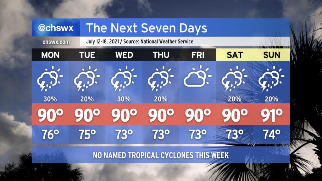
For the first time in three weeks, we do not have any concerns about a tropical cyclone influencing our forecast. Hooray! We’ll have a much more typical July week of weather ahead featuring temperatures around 90° each afternoon and a chance for isolated to scattered storms pretty much each day, mostly in the afternoons (though Monday could get started and end a little earlier). The only severe weather that might occur this week would be where thunderstorm outflow boundaries interact and enhance lift, perhaps bringing a brief damaging wind threat via downburst winds. Atlantic high pressure building across the area will otherwise put a lid on more widespread shower and thunderstorm activity.
Southerly winds around the high will give us a little bit of an onshore component to the wind, which will help regulate temperatures to near normal levels. We won’t be able to escape the 70s dewpoints, though, so be ready for heat indices in the upper 90s to near 100°, especially around the time the seabreeze circulation passes your location.
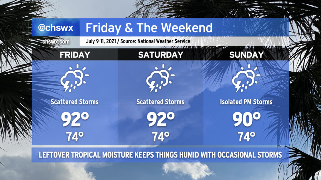
A little more normal July weather greets us for Friday and the weekend. Temperatures will run in the low 90s each day; humidity will push heat indices into the low 100s. We’ll see isolated to scattered showers and storms each afternoon as daytime heating and a little residual upper energy combine to fire off convection across the area. Isolated areas of heavy rain will be possible. Severe weather looks unlikely, but a couple wet microbursts can’t be ruled out where outflow boundaries collide. (At least it’s not a tropical storm.)
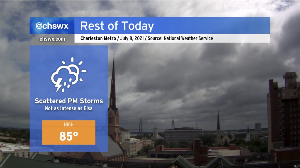
After a raucous night with Tropical Storm Elsa, we find ourselves in a lull this morning as the storm lifts quickly away to the northeast. Winds are slackening and we are drying out after a very soggy night — 4” is on the low end of rain totals around parts of the Charleston metro area. I’ll discuss more of Elsa’s aftermath later today as damage is assessed and additional rain totals come in.
For now, though, we get a bit of a break, but showers and thunderstorms are expected to fire back up this afternoon as a little energy aloft ripples through and induces some additional development with a little daytime heating. The good news is that additional severe weather is not expected. Rainfall amounts should generally be around a quarter-inch.
Highs top out in the mid-80s; the humidity will make it feel in the 90s.
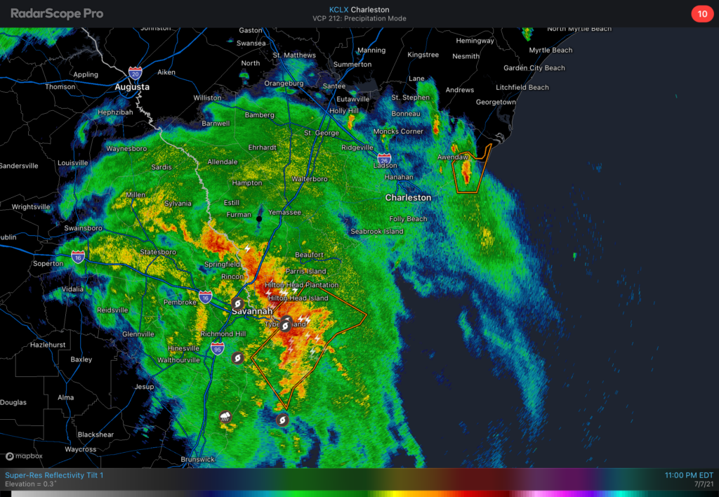
We continue to monitor Tropical Storm Elsa as it moves through southeast Georgia overnight tonight. A Tornado Watch is in effect until 5am across the Lowcountry. The primary concern for tornadoes will be a strong feeder band that is moving north of Savannah into far southern SC as of this writing. It looks like this band will move into the Charleston metro area in the 1-3am timeframe. This band will produce the heaviest rainfall — observers have measured 3”/hr rain rates from this band in Georgia — and provide the best opportunity for an isolated tornado over the next few hours. Discrete cells ahead of this band could also briefly produce tornadoes.
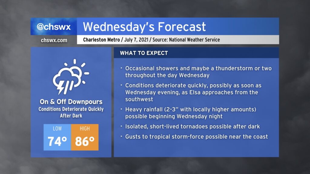
The weather spotlight turns sharply onto Hurricane Elsa as it becomes the primary weather-maker for our neck of the woods through Thursday evening. Based on the current National Hurricane Center track, it looks as if the bulk of the bad weather associated with Elsa will arrive later Wednesday, with periods of very heavy rain being the overwhelming concern through Thursday morning.