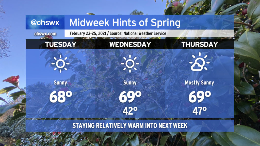
We’re about to embark on what arguably will be the nicest stretch of weather so far this month. Temperatures will top out near 70° each day, with mostly sunny skies prevailing as high pressure remains in control for a few days. And while slight rain chances return to the picture Friday, the cold does not: expect above-average temperatures to continue as we roll into the beginning of March. I feel like we’ve earned this. Enjoy!
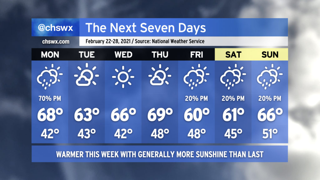
Rain chances will make a brief return to start the week, but without the ridiculous tap of moisture that characterized the last few rainstorms. The recent deluge has led to river flooding in spots on the Edisto as well as on the Santee at Jamestown, with homes being threatened in Ridgeville. Overall, though, expect a quieter week of weather with warmer temperatures than we’ve been used to.
As mentioned before, Monday starts ahead of a cold front with scattered showers coming onshore for a fair bit of the day. However, the best chance of showers will be in the afternoon and evening hours as the front passes. Temperatures will rise into the upper 60s and could even crack 70° in a few spots.
Tuesday through Thursday look really nice, with ample sunshine and progressively warmer temperatures, again potentially touching 70° on Thursday.
Our next rain chance arrives Friday afternoon in the wake of another front. Isolated showers will be possible each afternoon through the weekend, but right now we should not see any washouts. Temperatures will remain near or slightly above normal.
This is the last week of meteorological winter; meteorological spring begins on March 1st. (Meteorologists and climatologists use March 1 to mark the start of spring as it is a consistent point for record-keeping. The vernal equinox, which ushers in the more traditionally accepted definition of spring, is on March 20.)
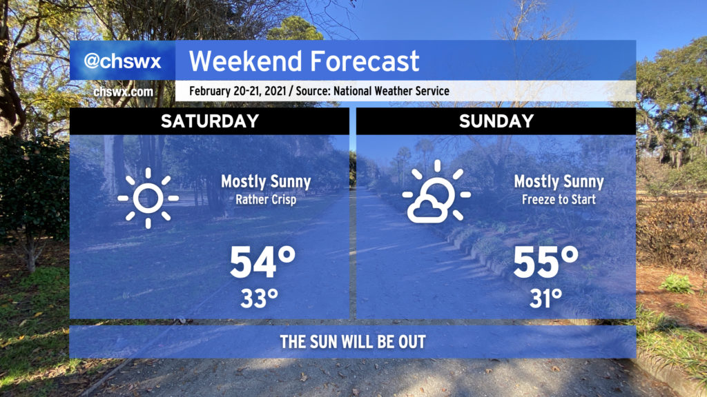
High pressure will assert control of the weather through the weekend. It’ll be chilly out — highs in the low to mid-50s and lows around or below freezing will be common — but the sun will be shining, and that alone is worth celebrating. Have a great weekend, everyone.
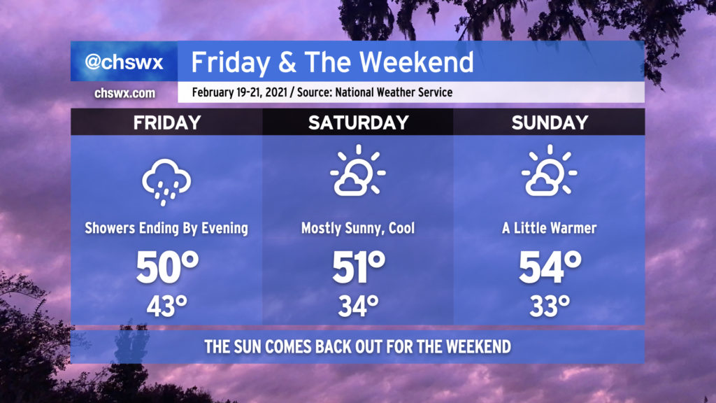
We have a chilly but mostly sunny weekend ahead. Now all we have to do is just hang in there through Friday as showers taper off throughout the day as the cold front slowly moves through the area and gets offshore. Temperatures will remain pretty chilly — only expect highs to top out around 50° tomorrow as the front moves by and cooler air begins filtering in.
Skies will clear Friday evening and overnight, and by Saturday, expect mostly sunny skies with high temperatures peaking around 50° as chilly high pressure moves over the region. Clear skies overnight Saturday should allow temperatures to drop to the low-to-mid-30s by Sunday morning, with freezing temperatures possible inland from the coast. The airmass will modify a little bit Sunday, and highs should warm into the mid-50s under mostly sunny skies.
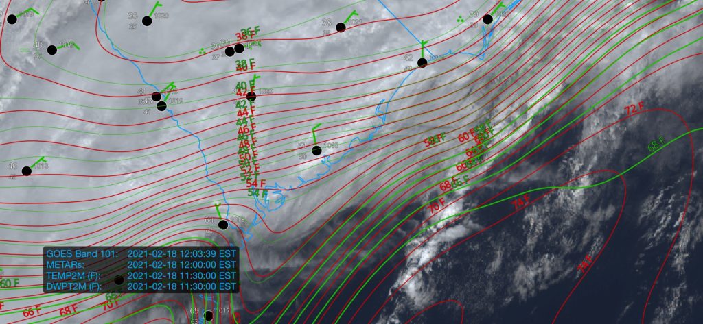
We’re once again in the gloom with periods of heavy rain moving through the area this afternoon. This is good, though, as these clouds and rain are reinforcing the inland cold air damming wedge which, in turn, is keeping a warm front from advancing too far north into the Lowcountry. All this to say that the severe weather threat, which was never terribly high in the Charleston metro to begin with, remains rather marginal. If the warm front does sneak a little further north than projected, the risk for damaging wind gusts would come up some. The best risk for any severe storms today remains southwest of us in Georgia.
The main issue today, especially inland of 17-A, will be the potential for flooding in spots. Some areas have already received 2-3” of rain in the I-95 corridor with more to come through tomorrow. Closer to the coast, the forecast continues to call for 1-2” through tomorrow with locally higher amounts.
As always, I’ve got an eye on it. Keep an ear out in case conditions change quickly, but so far, so good.
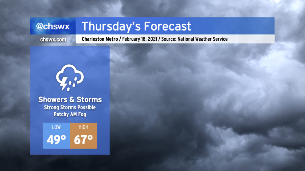
We’re back into the rain on Thursday as another storm system affects the area. Expect periods of showers and storms at any time throughout the day, and be ready for the potential for a couple storms to be strong.