After a fairly glorious day of weather Saturday, Sunday will make a 180° right back into more unsettled territory as high pressure moves offshore ahead of a cold front. A wave of low pressure will develop back in Georgia, helping to drag a warm front across the area in the morning. We’ll see an uptick in shower and thunderstorm activity possibly as soon as mid-morning, but the most likely time for rain will be in the afternoon hours through about sunset. Heavy rain will be possible, with the potential for rainfall in the 2-3″ range for some locations. Isolated flooding will be possible as a result. Additionally, the aforementioned surface low pressure looks to track inland of the area, and could enhance some low-level shear. If instability can develop — and that is a big if — a strong to severe storm or two will be possible, and there may even be a couple rotating cells. We’ll keep an eye on this, but the risk for severe storms generally remains low especially given the rain-cooled air. We start the day in the upper 60s, but highs only top out in the low 80s given the risk for widespread rain in the afternoon.
After this passes, it looks like we get off to a solid start to the work week (weather-wise, anyway), with mid-80s highs, comfortable low 60s dewpoints, and ample sunshine.
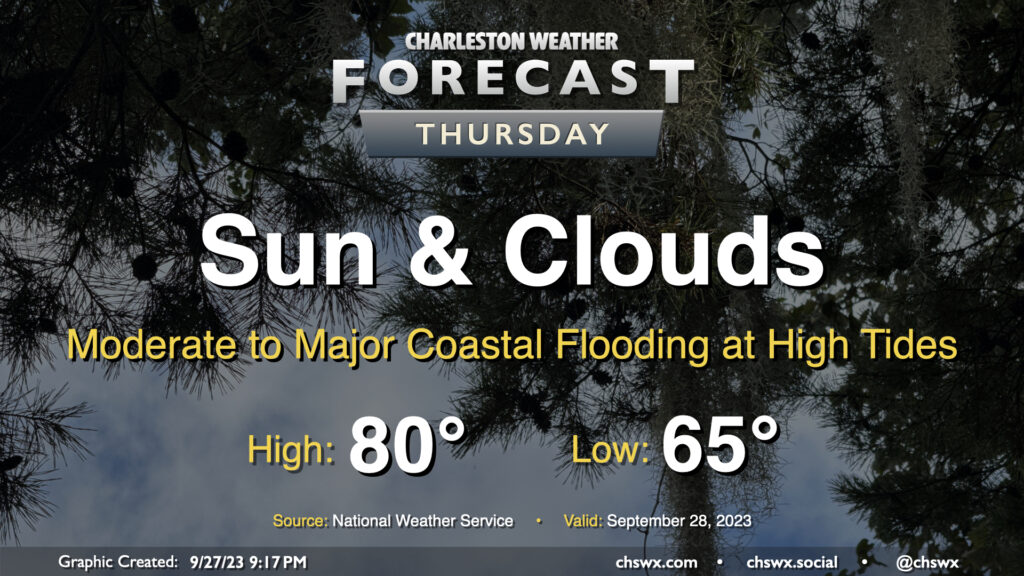
A cold front will slip offshore early Thursday morning, but we won’t quite be feeling it just yet as some showers and thunderstorms will still be possible as moisture lingers across the area during the day Thursday. Highs top out once again in the upper 80s before showers and a few storms fire. Instability isn’t great and severe weather is not expected, though some heavy rain will yet be possible at times. The best chance to see a shower or storm looks to be in the afternoon and early evening hours.
Tuesday’s forecast will once again feature a seasonably warm and humid airmass that’ll give rise to some showers and thunderstorms in the afternoon, generally along and ahead of the seabreeze. We start the day in the low-to-mid-70s. Some fog may be around as we start the day, so be ready for possible visibility reductions particularly as you get further inland. Highs top out around 90° in the afternoon before a few storms fire, which will cool things off for some of us. A couple strong storms are possible, but don’t expect a widespread severe weather issue.
Sunday should have a similar flair to Saturday with scattered storms and sunshine mixing in afterward. Like Saturday, we could see a few storms possible in the morning before gradually pushing inland during the day. And like Saturday, we should also see some decent sunshine kick in as well, with highs approaching 90° in the afternoon. Overall, not expecting a full rainout anywhere, but a few spots could see some heavy downpours with a quick inch of rain or so possible (much like parts of West Ashley and North Charleston saw this morning!)
We have one more rain-free and rather warm day coming up on Thursday. Expect highs to once again top out in the mid-90s under partly cloudy skies, with some humidity mixing in to drive heat indices to the upper 90s to around 100°. It’s worth noting that the NWS forecast high of 95°, if it did indeed come to pass, would tie the daily high temperature record set in 1941 and then tied in 1947 and 2019. (For reference, last year’s high on September 7 topped out a degree shy of the record.) Ridging will weaken throughout the day, but much of us should expect to get the day in rain-free. I don’t know that I’d totally rule out a shower or storm closer to I-95, though.
After a somewhat wild day at times with Idalia, Thursday will provide much, much better weather. Lingering breezy conditions and cloud cover will give way to mostly sunny skies by afternoon, with highs topping out in the low 80s as northwest winds bring some drier air into the area. This will kick off a nice Friday and long weekend, too. We’ve earned it, methinks.
Thanks for following along, as always, throughout Idalia. Your reports were invaluable to NWS warning operations and helped your neighbors stay in the know about what was happening. Social media, for all its problems, can still be super cool in times like these.
Hurricane Idalia, which as of this writing was a strong Category 2 hurricane with 100 MPH maximum winds, will make landfall as a major hurricane in Florida later Tuesday or early Wednesday. From there, Idalia will turn more northeast, bringing heavy rain, gusty winds, coastal and freshwater flooding, and the risk for a tornado or two within rain bands to the area later Wednesday into early Thursday morning. Trends have been for the storm to track a little more inland of the coast than we’ve seen forecasted in the past day or so, and there is pretty good agreement that this will be the case, expanding the heavy rain threat further inland along with the tornado threat in the evening. Here’s a full rundown of what to expect.
Tuesday will be another warm and muggy day as we prepare for Idalia’s arrival in the Lowcountry. We start the day in the mid-70s and warm to around 90° with heat indices approaching 100° within the increasingly tropical airmass. Showers and thunderstorms should begin to fire along the seabreeze in the afternoon and become somewhat numerous at times. Heavy rain capable of minor flooding will be possible. We’ll also need to watch the risk for coastal flooding in the evening, with minor to moderate flooding possible as water levels approaching 7.5′ with the 7:31 PM high tide. Due to the Storm Surge Watch in effect, there will be no Coastal Flood Advisory, so keep that in mind.
Sunday will be yet another warm and muggy late-August day across the Lowcountry. We’ll start the day in the mid-to-upper 70s before highs head to the low 90s in the afternoon. Heat indices should peak in the low 100s. From there, we should see a scattering of showers and thunderstorms along and ahead of the seabreeze. We may also see some activity from the north near a stalling cold front trying to infiltrate the area as well. The strongest storms will be capable of heavy rain and gusty winds, though widespread severe weather is far from in the cards. Overall, no washout of a day, just be ready to move outdoor activities inside if storms approach.
The air on Wednesday evening is fairly glorious — dewpoints in the mid-60s behind the seabreeze, with even some 50s dewpoints ahead of it — thanks to a cold front that pushed through earlier in the day. We’ll keep some of this dry air around for Thursday, which will keep the high of 92° feeling closer to 93-94°. We’ll see a few clouds across the area, but otherwise, it’ll be another reasonably pleasant late-August day.