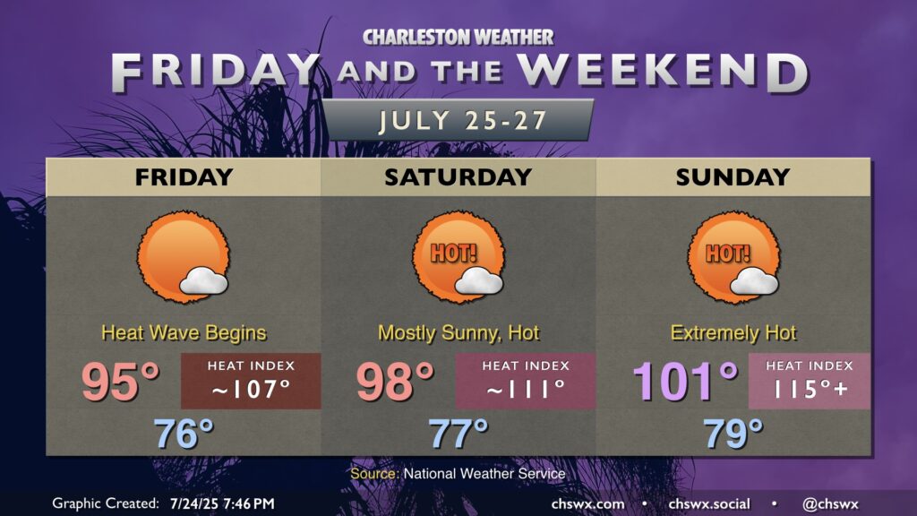
Anomalously strong high pressure builds in aloft starting Friday, bringing about the hottest weather of the year. We’ll challenge record high temperatures as well as record warm low temperatures, with heat advisories and even Extreme Heat Warnings a likelihood.
We continue to rewrite the record books as a strong ridge of high pressure remains firmly entrenched over the Charleston area, with three straight days of 100° temperatures and counting. The streak may continue for one more day, followed by a gradual falloff of temperatures (and a small increase in shower and thunderstorm chances) as we get into the weekend.
After a record-breaking Memorial Day weekend, the heat wave continues as stifling high pressure remains in force over the Charleston metro area. Temperatures approaching the century mark away from the immediate coast are once again expected. While heat indices will not pose a major issue, low humidity will instead elevate the wildfire risk. Changes are coming later this week, though.
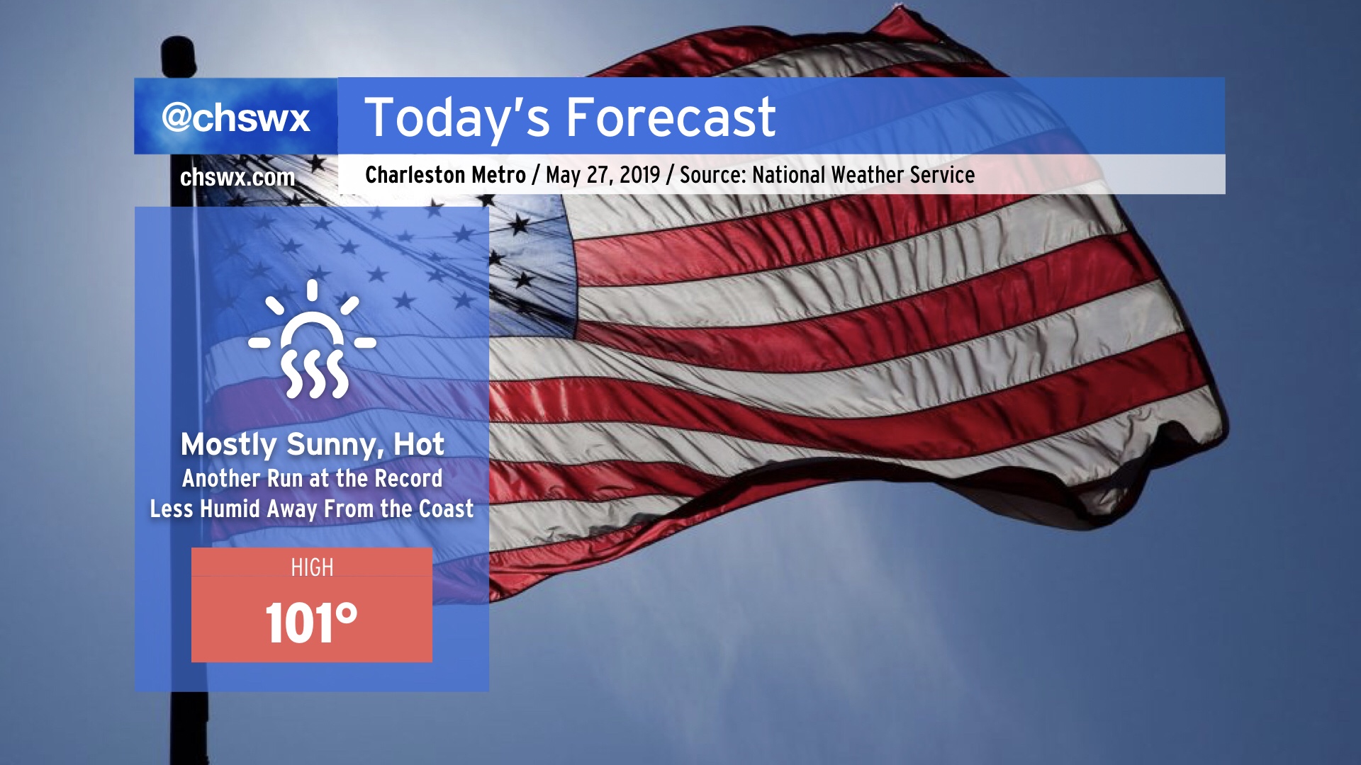
We will make another run at the century mark today, with a decent chance of at least tying the all-time May high temperature record set yesterday (100°). In fact, this morning’s NWS forecast has the airport breaking that record once again today. While there is no Heat Advisory today as heat indices will remain below 105° (pre-July 1 threshold), it will still be plenty hot (even at the beaches, where low 90s are possible) and you should still keep heat safety precautions in mind when observing Memorial Day today.
Today is day one of a potentially long-duration, early-season heat wave that will continue into at least next week. Record heat is forecast today, with a high of 98° expected. If this verifies, this would break the record of 97° set in 1953. Air conditioning is best today (and for the next several days), but if you must be outside, take frequent breaks, drink lots of water, and seek shade regularly.
High pressure is aligning at the surface and aloft to bring us quite the early-season heat wave starting tomorrow, featuring a run at the all-time warmest May day on record and little to no rain for many of us.
Today is the “calm before the warm” as the pattern begins to kick into place for a significant, long-duration heat wave starting tomorrow. (More on that later today.) A shower or storm can’t be ruled out early today, but as the ridge builds, clouds will decrease. The vast majority of us remain bone dry. Temperatures will range from the upper 80s in the Charleston metro to the low 90s closer to I-95.
Summer-like weather will continue this week. The heat will really turn on by the end of the week, as we look to flirt with mid-to-upper 90s temperatures across much of the area. Unfortunately, very little heat relief in the way of thunderstorms appears probable after Tuesday.