A chilly couple days ahead, with a rebound for the weekend

We are getting off to a rather chilly start this morning on the southern periphery of a significant Arctic blast of cold air. While we may be starting in the upper 20s, at least we are in the upper 20s above zero — can’t say the same for our friends in the Upper Midwest.
Today: BRRR
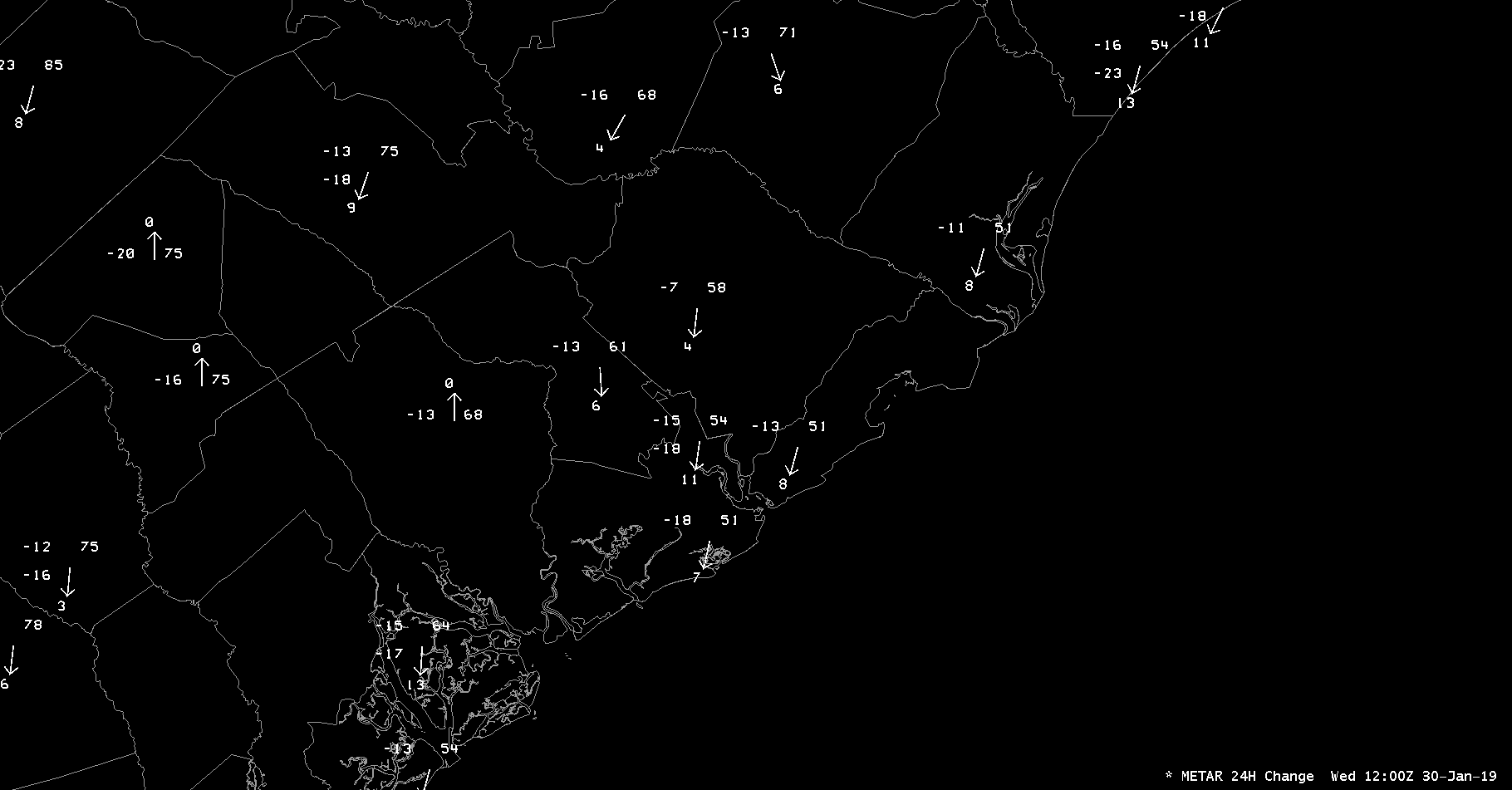
We start today some 10-15° cooler than we started yesterday at most stations. (We are almost 20° colder on Johns Island!) This is in the wake of a cold front that moved through early Tuesday evening. Said front is responsible for helping usher in a frigid, Arctic airmass to the upper Midwest. It won’t get to -20° here, but this morning’s temperatures are amongst the coldest air this season. In fact, the low of 27° at the airport is indeed the coldest temperature recorded so far in January 2019 and, indeed, all winter.
We will struggle to warm into the upper 40s today under a mix of sun and clouds. Winds will continue to blow out of the west and northwest at 5-10 MPH, keeping wind chills suppressed into the 30s at times. Bundle up!
One more chilly day followed by a warming trend

The Arctic intrusion continues for one more day on Thursday, with another chilly morning in the upper 20s expected. Temperatures begin to moderate from here, with 60s returning to the forecast by Friday, and perhaps some 70s as we kick off the new work week.
With the warmth comes a bit more unsettled weather, though; we’ll be watching for rain chances starting Sunday afternoon into next week as we get caught on the edge of the prevailing storm track. Decent uncertainty exists here, so keep checking back, but right now, don’t expect a rainout.
Tonight on Carolina Weather Group: 2018 in review

Tonight on Carolina Weather Group we’ll be joined by Corey Davis, applied climatologist at the North Carolina State Climate Office, to discuss the year of 2018’s weather for North Carolina. Our panelist Melissa Griffin, Assistant South Carolina State Climatologist, will review the year that was in South Carolina weather. It’ll be a very informative show, and I hope you can join us! Send your questions along via our social channels.
Carolina Weather Group streams live on Periscope, Facebook Live, and YouTube every Wednesday night around 8:15 PM Eastern. The podcast is generally available the day after recording wherever you get your podcasts, such as Stitcher, TuneIn Radio, or Apple Podcasts. Enjoy the show!