Here comes some legit fall weather, at least for a couple days
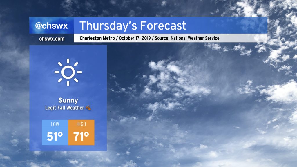
After the wettest day since Dorian, a ridge of high pressure will usher in fall weather for a few days, with the potential for the first 40° readings of the season Thursday and Friday mornings. Then, a slug of tropical moisture will bring in another solid rain chance late this weekend into next week.
Much-needed rainfall fell across the Lowcountry
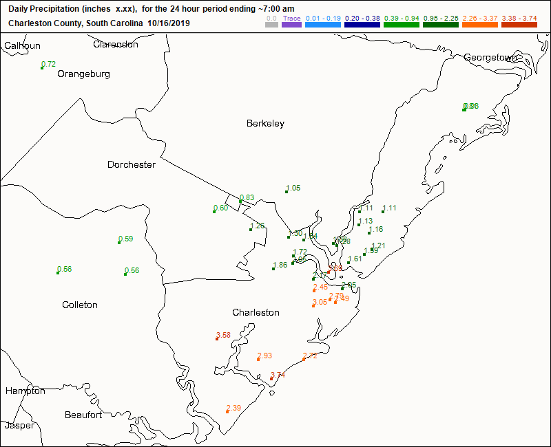
Ahead of the cold front that’s bringing us our first true round of fall weather, we got some much-needed rainfall. Cooperative observation stations in southern and central Charleston counties often recorded rainfall totals over 2″ ending at 7am today. Rain totals tapered off further north, with gauges reading under 1″ around Summerville and McClellanville.
We have another shot at beneficial rain coming this weekend and into next week — more on that shortly.
A few days of sweater weather
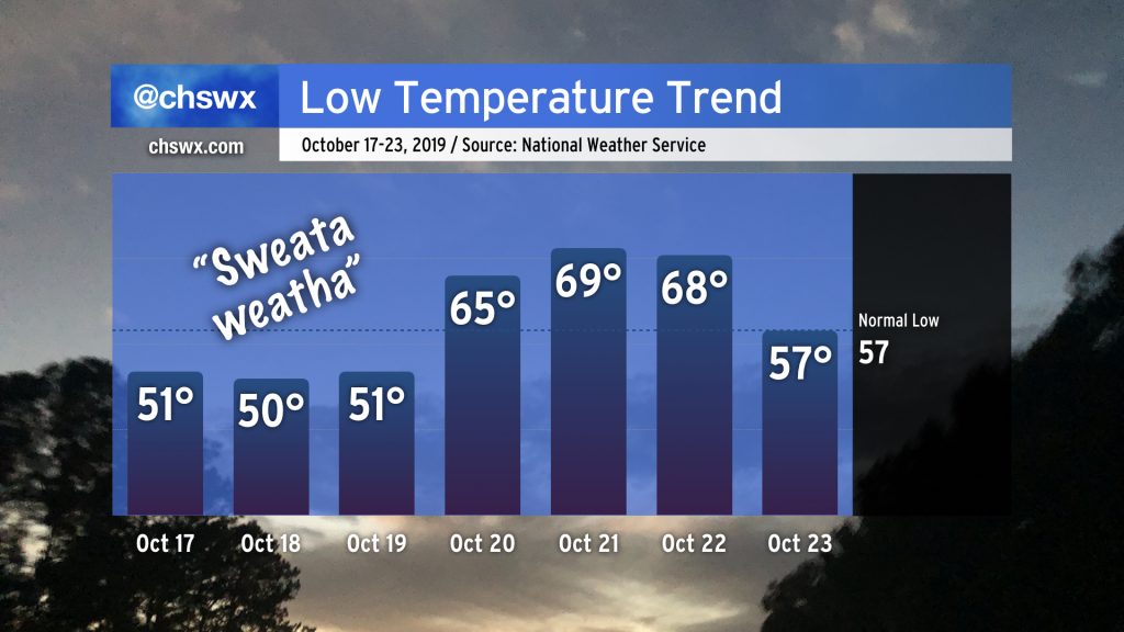
We have some legitimate sweater weather headed our way as high pressure builds in from the north and west in the wake of the cold front. Lows in the Charleston metro area will drop to around 50° each night through Saturday, with highs topping out only around 70-71° on Thursday and Friday. We’ll begin to see some warmer air move back in during the day Saturday as a tropical disturbance — which may become a tropical cyclone of some type — approaches the Gulf Coast.
It’s worth a quick reminder: Fall is a transitional season. We’re going to get a tug of war between warm and humid air and cool and dry air over the next couple months as we head toward winter. So, while this current spate of sweater weather won’t last too long, don’t fret — more is on the way.
Tropical update

Yes, it’s still hurricane season.
The National Hurricane Center is watching a disturbance in the Gulf of Mexico for the potential for developing into a tropical or subtropical cyclone over the next few days. Regardless of whether the storm develops into a named storm, it appears that a pretty decent slug of moisture is headed our direction, which is more good news for the drought. Timing for rainfall appears to be Saturday afternoon and evening through Sunday. It’s tough to pin down amounts this far out, but another 1-2″ of rain is certainly in the cards for some locations.
Even if the storm becomes named (the next name is Nestor), it is unlikely to develop into anything very strong at all, especially this late in the year. We’ll watch it, but right now this just looks like a rainmaker.
Follow my Charleston Weather updates on Mastodon, Bluesky, Instagram, Facebook, or directly in a feed reader. Do you like what you see here? Please consider supporting my independent, hype-averse weather journalism and become a supporter on Patreon for a broader look at all things #chswx!