A few more showers for Tuesday; latest on Eta

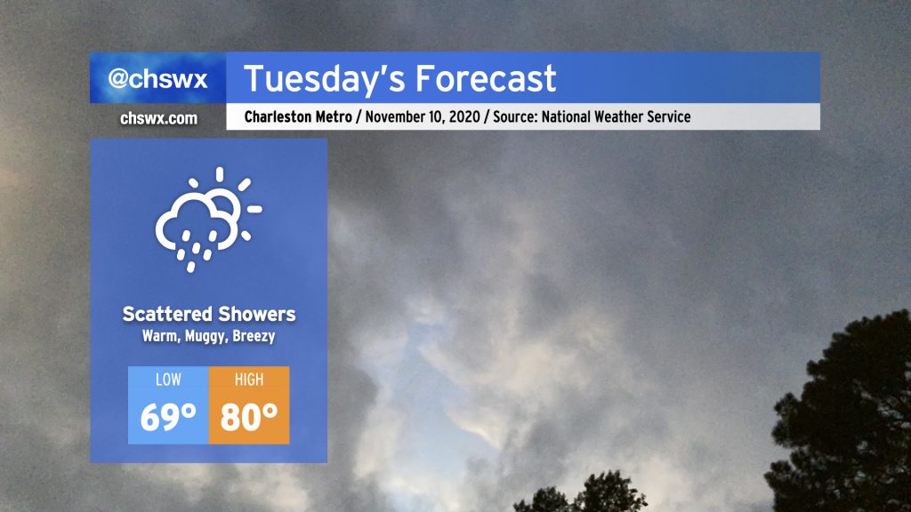
Expect a bit more in the way of cloud cover and showers for Tuesday as a moisture plume courtesy of Tropical Storm Eta begins to spread northward. Temperatures will remain rather warm for this time of year. We’ll start the day in the upper 60s to low 70s (especially near the coast). Temperatures will top out in the low 80s, with periods of cooling where showers develop. Shower chances will continue to ramp up with time on Tuesday, with thunderstorms becoming likely as we head into Wednesday.
Marginal coastal flood risk continues

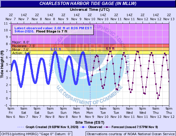
The latest tide forecasts from the National Weather Service continue to show high tides approaching 7′ in the harbor Tuesday and Wednesday afternoon. While flooding is not explicitly forecast, minor salt water inundation falls within the margin of error here. Keep an ear out for coastal flood statements/advisories from the National Weather Service.
Latest on Eta

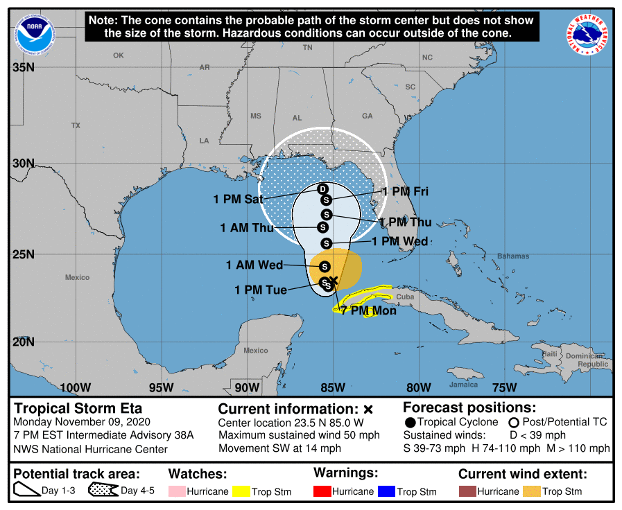
Tropical Storm Eta remains a thorn in the side of the National Hurricane Center this evening. As I mentioned yesterday, Eta’s steering is going to be a big question mark as we get into later this week. The latest NHC forecast from 4PM changes the track up a fair bit and begins to favor more westerly solutions which weaken the storm as it drifts northward into the northeast Gulf of Mexico by this weekend. This will cut down on the potential for additional coastal flooding if this verifies. I’ll continue to monitor this storm, but aside from the moisture plume it is casting northward, I am not concerned about impacts in the Lowcountry.
Follow my Charleston Weather updates on Mastodon, Bluesky, Instagram, Facebook, or directly in a feed reader. Do you like what you see here? Please consider supporting my independent, hype-averse weather journalism and become a supporter on Patreon for a broader look at all things #chswx!