Claudette to bring downpours and storms on Father’s Day

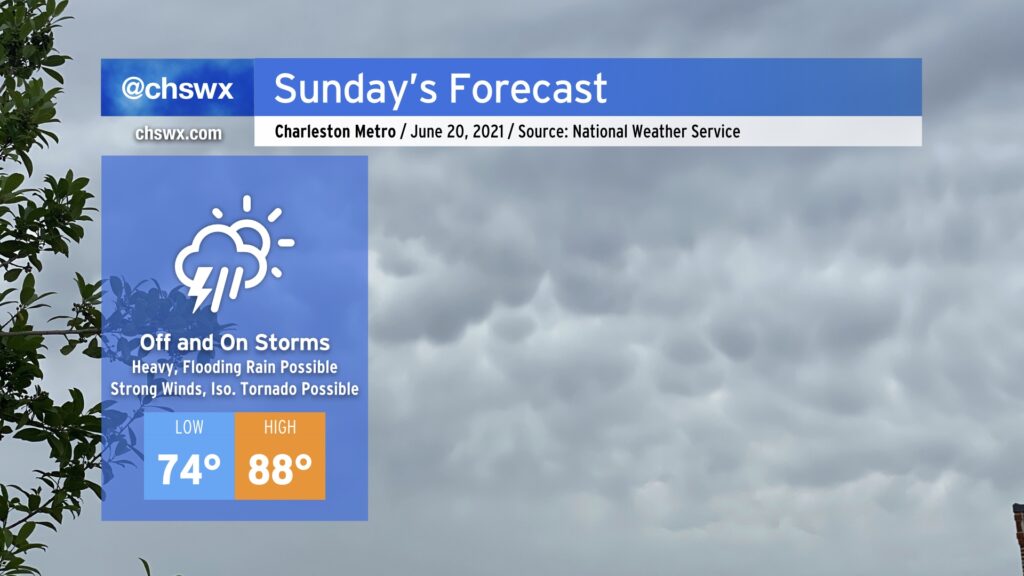
Tropical Depression Claudette, which is moving through western Alabama this evening, will be taking a bit more of an easterly turn around the subtropical ridge, heading through northern Georgia and SC during the day on Sunday. This will, in turn, bring along another plume of tropical moisture into the area, setting up another round of heavy and perhaps flooding rain in spots, along with the risk for strong to severe thunderstorms with damaging wind gusts and maybe a tornado or two.
Rainfall forecast

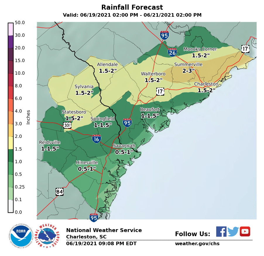
As is almost always the case with tropical systems, rain is going to be the primary concern from the passage of Claudette. We’ve been pretty waterlogged as of late, and NWS forecasting another 2-3” through Monday afternoon is certainly concerning for the potential for flooding across the area.
The first round of rain could come early Sunday morning as a feeder band moves through. We could see a few lulls throughout the day, but when it rains, it should be rather heavy. Right now, the high resolution ensemble members are coming in with the heaviest rain generally around Sunday evening into early Monday morning.
Earlier arrival of heavy rain could portend a greater flooding risk for downtown Charleston. High tide on Sunday evening will arrive just ahead of 5PM, so any heavy rain a few hours before or right around then could be trouble. We’ll want to watch radar trends closely.
Severe weather threat
Depending on how much instability can develop early in the day, a few strong to severe thunderstorms can’t be ruled out as shear ahead of Claudette looks favorable. A reasonably strong low-level jet is modeled to develop across the area, and this could contribute to a few damaging wind gusts. Shear profiles also appear favorable for possibly a tornado or two within low-topped supercell thunderstorms. While the risk is low, it is non-zero, so I’ll urge you to have multiple ways to get weather warnings on Sunday in case severe weather approaches your location.
Follow my Charleston Weather updates on Mastodon, Bluesky, Instagram, Facebook, or directly in a feed reader. Do you like what you see here? Please consider supporting my independent, hype-averse weather journalism and become a supporter on Patreon for a broader look at all things #chswx!