Friday and the weekend: Turning rainier as deep tropical moisture returns
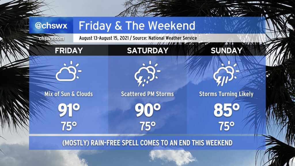
Friday gives us one more day of warm and mostly rain-free weather before the pattern turns back toward being more unsettled. Like today and the past few days, expect highs to top out a little over 90° in the afternoon, with heat indices in the low 100s. As always, a stray shower or thunderstorm can never be ruled out because, well, summer.
Our quieter weather pattern begins to shift back toward a more unsettled setup as the weekend wears on. Expect scattered thunderstorm coverage on Saturday, with highs topping out around 90° outside of those storms.
A front will sag southward into the area as we get into Sunday, stalling out over the Carolinas as Fred — forecast as a tropical storm — approaches the Florida panhandle (based on the current NHC forecast). The influx of tropical moisture with the nearby frontal boundary could spell some heavy rainfall at times across the area starting Sunday and into early next week. Stay tuned to forecast updates as the rain threat evolves.
Fred continues to struggle, but should regain strength
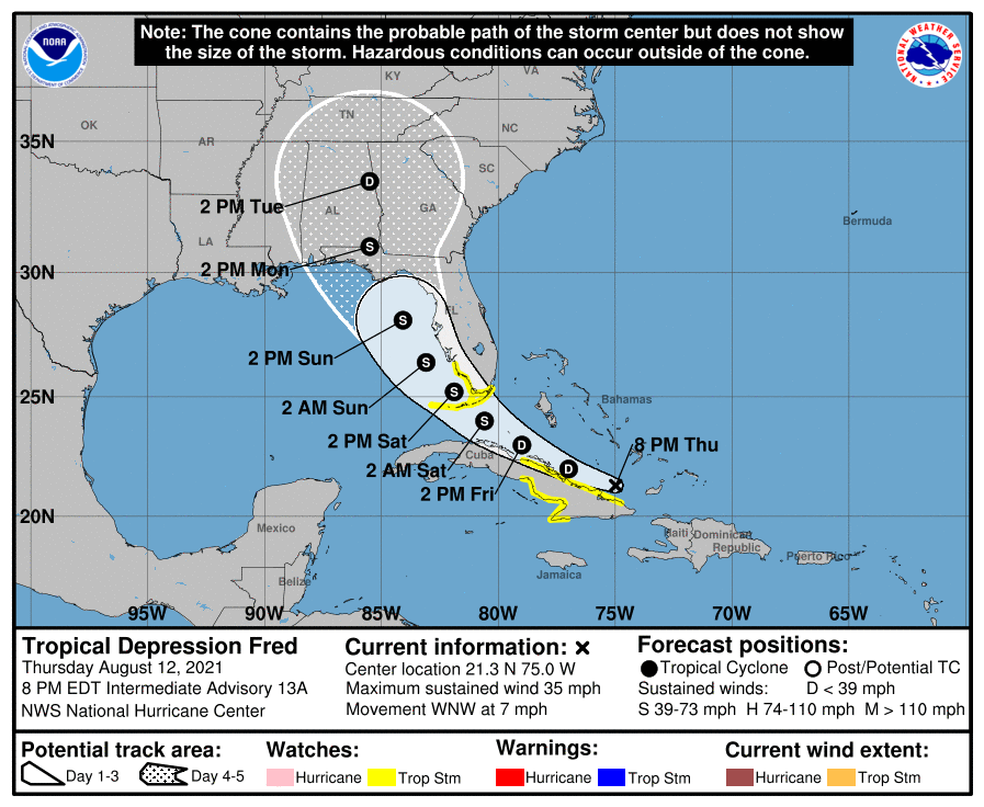
Tropical Depression Fred is not in a good way this evening. It came through Hispaniola with its circulation intact, but is still struggling with land interaction and wind shear as it moves west-northwest at 7 MPH. NHC does expect Fred to overcome some of these struggles as it approaches the Florida Keys on Saturday, forecasting it to strengthen back to a tropical storm as it begins to round the ridge of high pressure in the mid-levels on course for a landfall somewhere between Mobile, AL and Cedar Key, FL on Monday morning.
It’s still tough to say if Fred is going to cause any additional weather problems for the Lowcountry beyond the expected influx of tropical moisture. On this front, the best advice I have is to stay tuned as track forecast changes could yet be quite significant this far out, which in turn would have material effects on what impacts we see beyond the rain.
Follow my Charleston Weather updates on Mastodon, Bluesky, Instagram, Facebook, or directly in a feed reader. Do you like what you see here? Please consider supporting my independent, hype-averse weather journalism and become a supporter on Patreon for a broader look at all things #chswx!