Turning hot on Thursday; a strong storm or two is possible as well
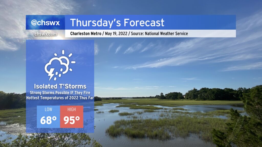
The hottest weather thus far in 2022 looks to arrive on Thursday. We’ll start the day in the upper 60s and warm well into the mid-90s in the afternoon. The record high of 96°, set in 1996, will be challenged under partly cloudy to mostly sunny skies. Heat indices could run close to 100° in the afternoon, so be sure to hydrate and take breaks accordingly.
As a series of mid-level disturbances ripple through the area, there will be a chance for showers and thunderstorms to fire off and move through in the late afternoon and evening hours. IF storms can fire — and this is a big IF — they could be on the strong to severe side. The thermodynamics certainly look good for storms to produce damaging wind gusts and large hail, but it remains to be seen if they can get going thanks to a strong cap on the atmosphere. Gonna be a game of wait, see, and watch the satellite and radar in the meantime.
Friday & the weekend: Heat continues, then turning unsettled in the afternoons
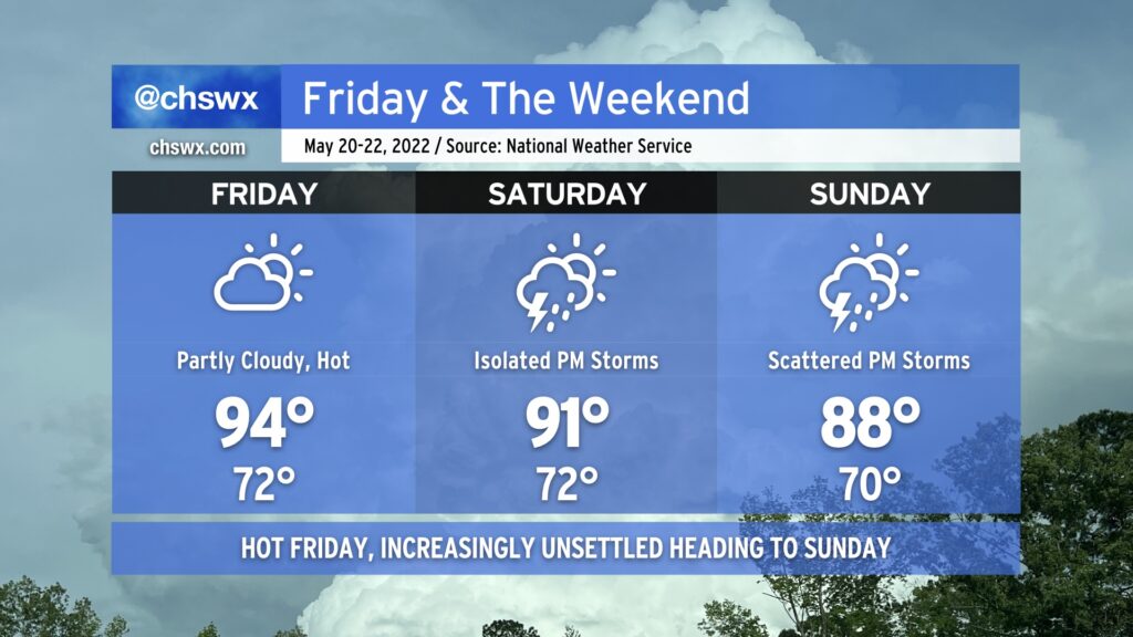
We stay hot on Friday as high pressure rebuilds aloft, which will also tamp down on any possible relief via thunderstorms. Expect highs to once again top out in the mid-90s, with heat indices feeling closer to the upper 90s. High pressure aloft subsequently weakens heading into the weekend, improving the risk for some showers and thunderstorms each afternoon. This will moderate the heat a little bit — highs in the low 90s on Saturday and upper 80s on Sunday — but it’ll still be plenty warm and muggy. Saturday afternoon should feature isolated storms while greater coverage of storms is expected Sunday afternoon. Nothing to ax weekend plans over, just make sure you’ve got an indoor option available.