Sunday: Scattered storms expected, but no total rainout

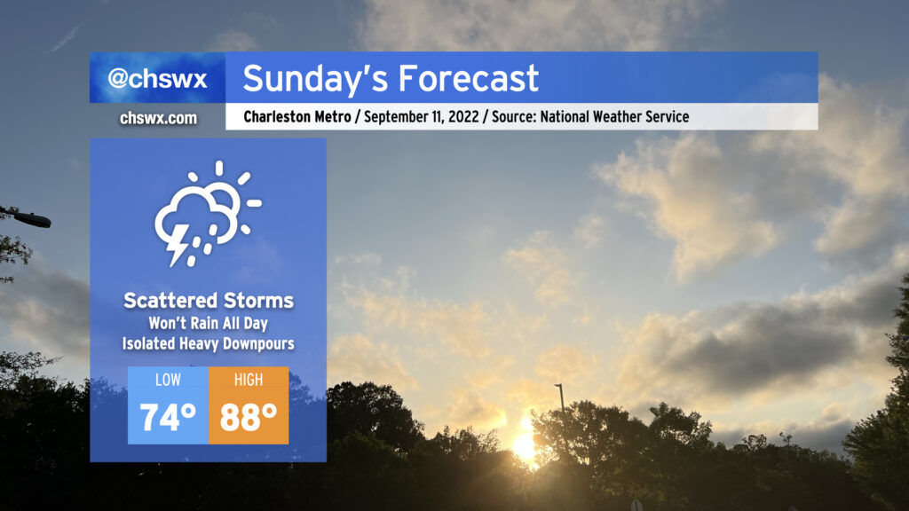
Expect another round of scattered showers and thunderstorms for Sunday as moisture continues to pump into the area from the Gulf and beyond. We may see some pre-sunrise showers and storms in the area to start the day, but the greater probability of precipitation will arrive in the afternoon as the seabreeze begins trekking inland and thunderstorms get rolling. Heavy rain and lightning will be the main concerns for any thunderstorm that develops. Once again, don’t expect it to rain all day at any one location — just be ready to move outdoor activities inside if thunderstorms approach.
Given the scattered cloud cover, expect temperatures to head into the upper 80s in the afternoon. Mix in the humidity, though, and it’ll feel closer to 100-102°. Given just how much rain has fallen in the last few days, too, grassy areas without much tree cover may be especially heinous.
Elevated rain chances continue for Monday, but we will start to see a bit calmer weather Tuesday and especially Wednesday before a front stalls out nearby Thursday, which will bring some scattered rain chances back into the picture — though right now, it looks nothing like we’ve been experiencing recently.
Tropical update: Peak of the season arrives, and all is (mostly) quiet

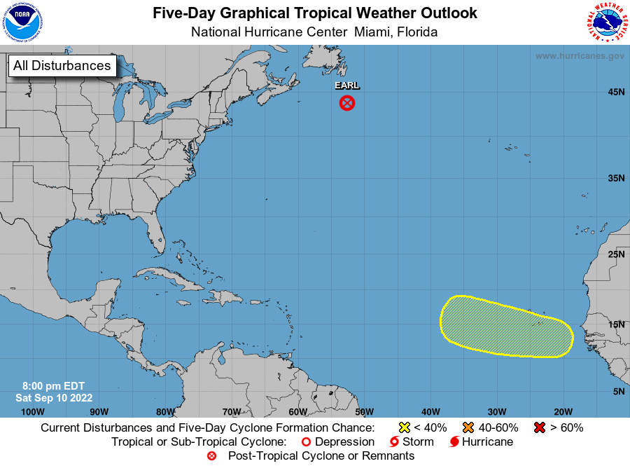
September 10 marks the climatological peak of the Atlantic hurricane season, and the tropics are largely quiet. A wave should come off Africa early next week, which NHC is giving 30% odds to develop into a tropical cyclone in the next five days. As far as named storms, Danielle is no more, and Earl went post-tropical today, leaving us once again with no active named tropical cyclones in the Atlantic basin.

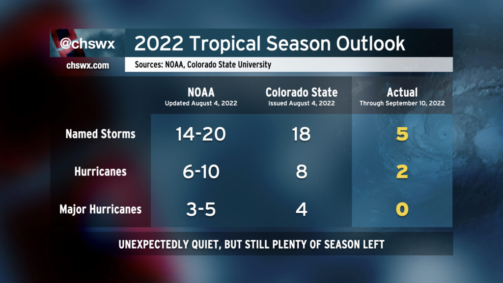
To say 2022 has been surprisingly quiet is to understate it slightly. To this point, we’ve seen five named storms, with two of those — Danielle and Earl — becoming hurricanes. None have reached major hurricane (Category 3+) status (though Earl tried its best). It’s been pretty fantastic to not have to worry about the tropics much so far this season, but there’s still a long way to go. The benchmark storm for our area, Hugo, was a mid-to-late September storm, and we’ve run into problems a couple times with October storms in recent memory (Matthew certainly comes to mind). Keep tabs on your hurricane plan just in case, and let’s hope we can sail into the home stretch of the season with few, if any, issues.