The week ahead: An end-of-summer blowtorch before another taste of fall
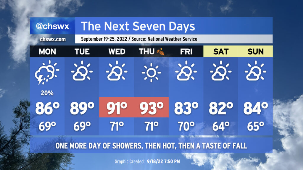
It’ll be a tale of two seasons this week — both figuratively and literally — as we reach the autumnal equinox on Thursday to usher in astronomical Fall. Summer’s gonna have one final parting shot, though, as a ridge expands across much of the southern US during the middle of the week.
We’ll still be dealing with a pesky coastal trough on Monday, which will toss some occasional showers and maybe a thunderstorm ashore. Temperatures will head up to the mid-80s away from the immediate coast; humidity will make it feel more like the low 90s. As the aforementioned ridge of high pressure builds in, though, the coastal trough will move away from the area, setting us up for a warm stretch mid-week. Tuesday’s highs will approach 90° as northerly to northwesterly flow aloft keeps cloud cover to a minimum. We get even hotter for Wednesday, with highs in the low 90s expected. Thursday’s going to be the hottest day of the set as compressional heating ahead of a cold front pushes temperatures close to the mid-90s — not quite meteorological conduct becoming of the first day of fall. Dry air in the area will limit cloud cover, much less any thunderstorm activity, so don’t count on that for any relief.
What we can count on, though, is the cold front to actually bring in a decent airmass change. Cooler and drier air will punch into the area overnight Thursday into Friday as the cold front gets through. We’ll start Friday on the warm side, but cool advection will kick in and keep temperatures from getting much warmer than the low 80s in the afternoon. The weekend is looking quite excellent, with a northeasterly breeze keeping temperatures a bit below normal for this point in the year and cloud cover to a minimum. We’ve just gotta get through this hot stretch first.
Tropical update: Fiona a fiasco for Puerto Rico; to generate swell and rip currents for next week here
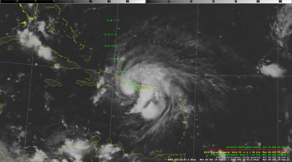
There’s no good way to put this: Hurricane Fiona has been devastating Puerto Rico today with rainfall measurable in feet and wind gusts well over 100 MPH. The island is fully without power, and likely has a whole day to go before the firehose of rain finally lets up as Fiona moves northwestward on Tuesday. This is terrible news for an island that has struggled to recover from Hurricane Maria just a few years ago — likely quite a setback. Keep them in your thoughts.
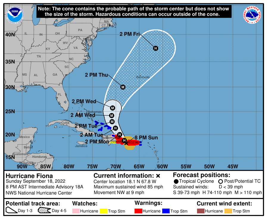
Fiona is expected to continue northwest through Tuesday before making more of a northerly turn Tuesday night into Wednesday, likely as the first major hurricane of the season. During the day Wednesday, an easterly turn should begin, making for a potentially tough Thursday evening for Bermuda as Fiona looks to sideswipe that island.
As for impacts to the Charleston area, the main thing to expect is an increase in the rip current risk for much of the week as swell from Fiona makes it to the East Coast. Be cautious if you wade into the Atlantic waters, especially if you are an inexperienced swimmer. Otherwise, no other impacts are expected. And outside of Fiona, the tropics are pretty dang quiet. Let’s keep it that way, shall we?