Tuesday: Turning warmer as ridging builds aloft
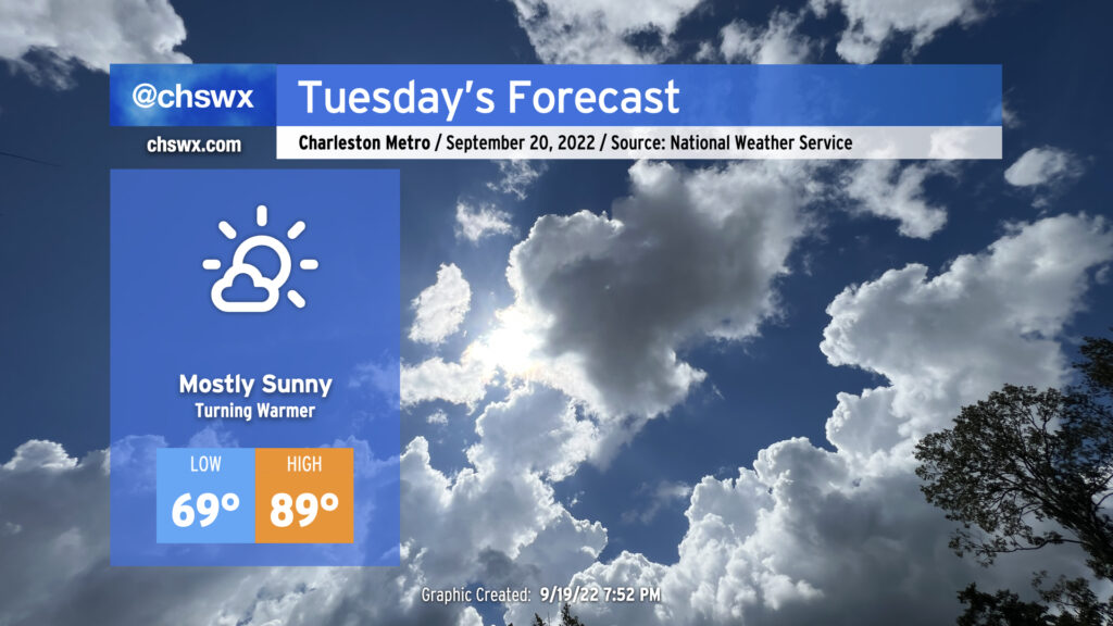
Tuesday will kick off a period of quiet and warming weather as expansive high pressure at the surface and aloft builds into the region from the west. This’ll put the lid on much in the way of cloud cover, much less thunderstorm activity, allowing temperatures to approach 90° in the afternoon. Humidity won’t be terribly heinous, but will be enough to push the heat index to around 92° or so. Temperatures, especially highs, will run several degrees above normal through Thursday (which could approach the mid-90s) before a trough digs in to our north and drives a cold front through, which will make for a rather pleasant Friday and weekend of weather. (Not that I’m counting down or anything.)
Tropical update: Fiona approaches major hurricane status, and a new wave to watch
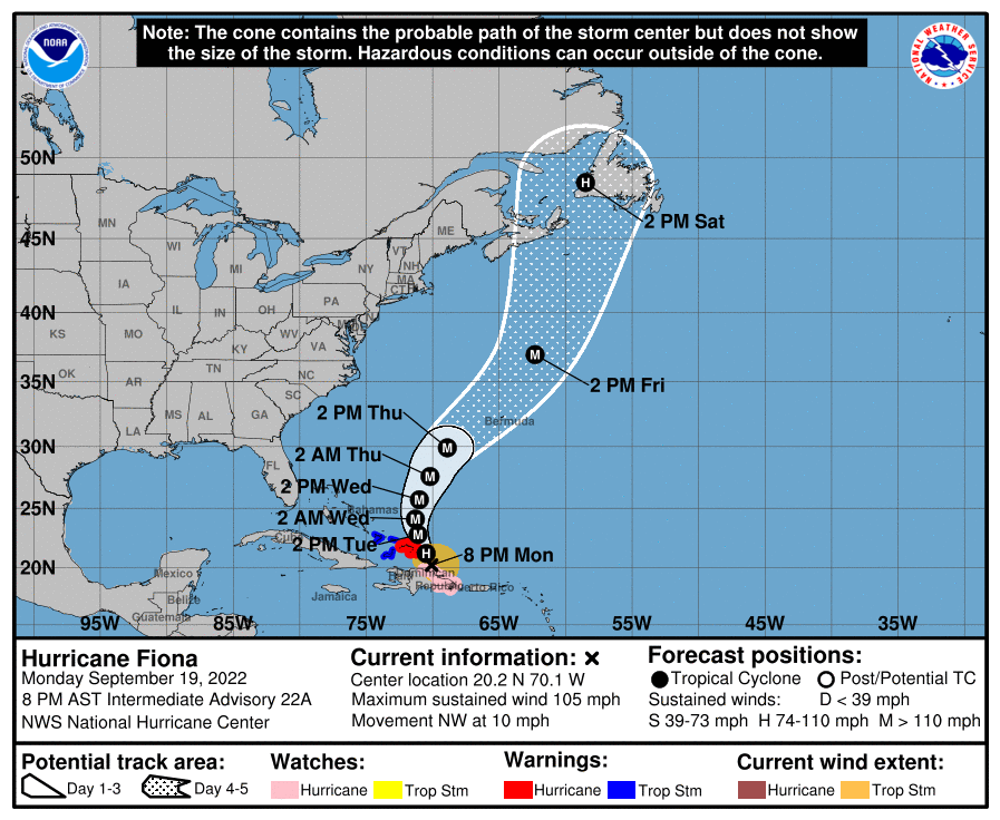
Hurricane Fiona, which has been devastating Puerto Rico with a foot or two of rain over the past couple days, is beginning to move northwest and away from the Greater Antilles. Just in the past couple hours, it has cleared out an eye and is heading quickly toward major hurricane status, a first for the 2022 hurricane season. This will become quite a problem for Bermuda and eventually Nova Scotia and Newfoundland as we head toward the weekend, with the storm expected to turn more northeasterly by Wednesday afternoon and increasing in forward speed as a trough — the same trough that will help drive our cold front through, in fact — picks up Fiona and steers it away from the continental U.S. That won’t mean we get off scot-free, though: Swell from Fiona will cause rough surf and a high risk of rip currents starting mid-week through the weekend.
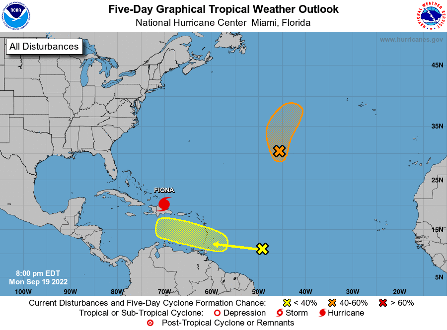
Looking elsewhere in the tropics, the Hurricane Center has highlighted two areas of interest. One spot pretty much smack-dab in the middle of the Atlantic has a 40% chance of becoming a tropical cyclone in the next five days. It’ll pose an issue to shipping traffic and perhaps little else in the near term, and is no threat to us in the Lowcountry.
We do have a new wave to watch, though. It’s located very roughly around 49° west longitude and 11° north latitude, and has a 30% chance of development as it moves into the Caribbean this weekend. Today’s model guidance has been pinging on this one getting organized later next week, and conditions should be favorable for further development as it moves westward. How strong it gets and where it ends up are questions nobody can confidently answer right now. We’ll need to see if today’s model guidance, which between both the GFS and ECMWF global models shows a hurricane in the Gulf later next week, is a blip or the start of a trend. Given that we’re at the edge of fantasyland in the models, take any Scary Model Runs with a giant grain of salt — things can and often do change at this range. For now, it’s not more than a wave to watch, and I’ll be keeping an eye on it.