The week ahead: Starting quiet, but Ian’s impacts possible later this week
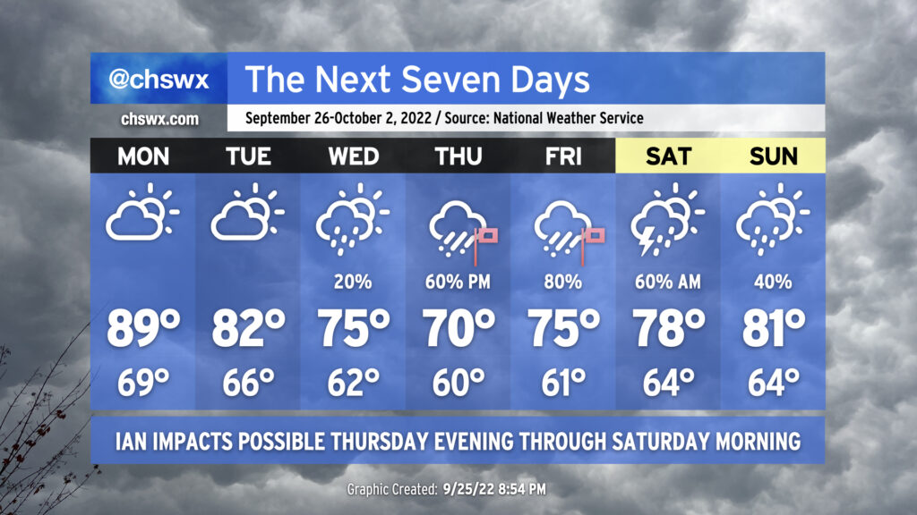
The week ahead will be punctuated by rough weather conditions courtesy of what is currently Tropical Storm Ian, which is finally beginning to intensify as I write this. It is expected to intensify into a major hurricane by as early as Tuesday morning, head over the western tip of Cuba, and then into the Gulf of Mexico where it moves up peninsular Florida’s Gulf Coast on the way to a landfall late Thursday/early Friday.
The week starts out innocuously enough; highs will head toward 90° on Monday ahead of a cold front which will push southeastward across the area throughout the day with maybe a shower, but the vast majority of us stay dry. Said front will knock Tuesday’s highs back to the low 80s under partly to mostly cloudy skies as high pressure wedges southward into the area. The front that got through Monday will then stall out and begin to retreat northwestward as a warm front on Wednesday as Ian approaches Florida. This could help spread a little shower activity in our direction, but otherwise expect mostly cloudy skies and significantly cooler temperatures — highs topping out only in the mid-70s underneath increasingly breezy northeasterly flow as the gradient between Ian to the south and high pressure centered to our north begins to tighten.
Ian’s expected impacts
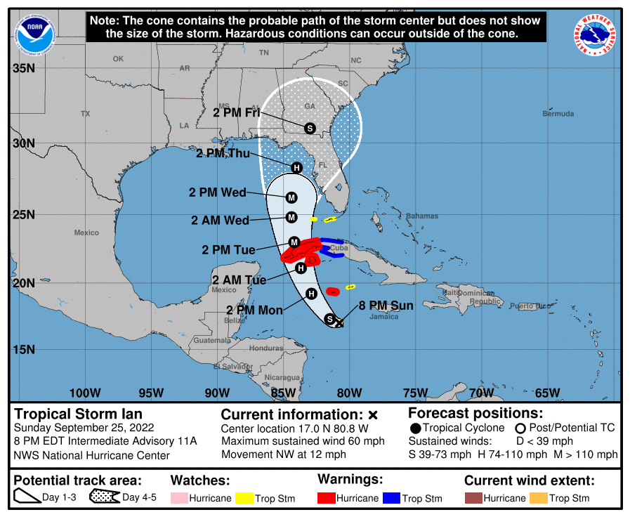
As things stand right now, Ian should make its closest approach Thursday afternoon through Friday, with improving conditions expected Saturday into Sunday as Ian quickly transitions to an extratropical cyclone and is whisked away by a trough. It’s during this time we can expect the greatest risk of torrential tropical rainfall, potentially major coastal flooding (especially around times of high tide), gusty winds (especially at the coast, where gusts may exceed tropical storm force [39+ MPH]), and even a tornado or two given favorable shear parameters and sufficient instability in the right front quadrant of the cyclone. Timing these impacts exactly remains difficult, and a lot will depend on Ian’s track and forward motion over the next few days. Stay tuned to forecast updates throughout the week as the timing and expected severity of impacts continues to be revised.