Tuesday: Mostly cloudy but mostly quiet; front arrives Wednesday-Thursday
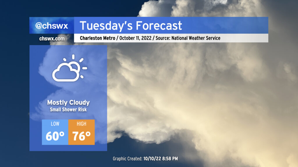
Not much weather to write home about for Tuesday as we get one more mostly dry day in ahead of a cold front which should bring the most substantial rain since Ian to the area for later Wednesday into Thursday. Cloud cover blanketing the area will help keep lows elevated to around 60° to start the day. Breezy onshore winds and continued cloud cover will keep high temperatures capped in the mid-70s. Much as we saw today, there is a small chance of a shower or two in the afternoon, but these won’t be horribly disruptive and should be short-lived if they do end up firing.
Another round of minor to moderate coastal flooding will be possible a couple hours around the predicted 9:40am high tide. Be ready to use alternate routes in case of flooded or closed roads in downtown Charleston.
Rest of the work week: Cold front brings shower and thunderstorm chances Wednesday and Thursday, setting up an awesome weekend
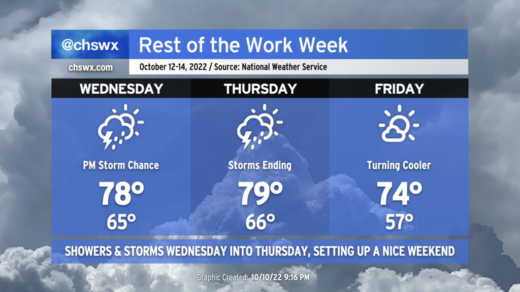
Better chances for showers and thunderstorms — indeed, the highest since Ian came to town a couple weeks ago — are in the forecast for Wednesday and Thursday ahead of a cold front. Timing remains somewhat in flux, but the general thinking is that shower and storm chances will head up Wednesday afternoon, peak overnight, and then taper off by Thursday afternoon. Rainfall amounts will generally run from about a half to three-quarters of an inch with locally heavy amounts. A strong storm or two is not out of the picture just yet, either, but the risk looks pretty low right now. Temperatures will run in the mid-60s Wednesday and Thursday mornings, with highs topping out in the upper 70s to around 80° each afternoon.
Once the front clears the area later Thursday, winds will go northwest to northerly and cooler air will begin to work its way into the area. We’ll wake up to lows in the mid-50s — around 10° cooler — Friday morning. Highs will top out in the mid-70s despite abundant sunshine thanks to cooler and drier air advecting into the area throughout the day. This will set up a great weekend of weather, with a solid fall feel for Saturday and a little warmer weather for Sunday under sunny skies.
Coastal flooding continues through Thursday
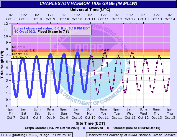
Periods of coastal flooding will be possible especially with the morning high tides through Thursday. Minor to moderate flooding will be possible both Tuesday and Wednesday mornings, with the potential for flooded and closed roads in downtown Charleston about 1-2 hours either side of high tide. Brief coastal flooding could also take place with the evening high tide Tuesday. The coastal flooding risk begins to decrease Wednesday evening as winds take a more westerly track, but there’s still the possibility for some brief, minor coastal flooding with the Thursday morning high tide as the lingering effects of the recent full moon hang on for just a little longer. Once the front is through, that should do it for this round of coastal flooding as winds turn more unfavorable and we get more distance from this past weekend’s full moon.
Tropical update: No concerns for the Lowcountry
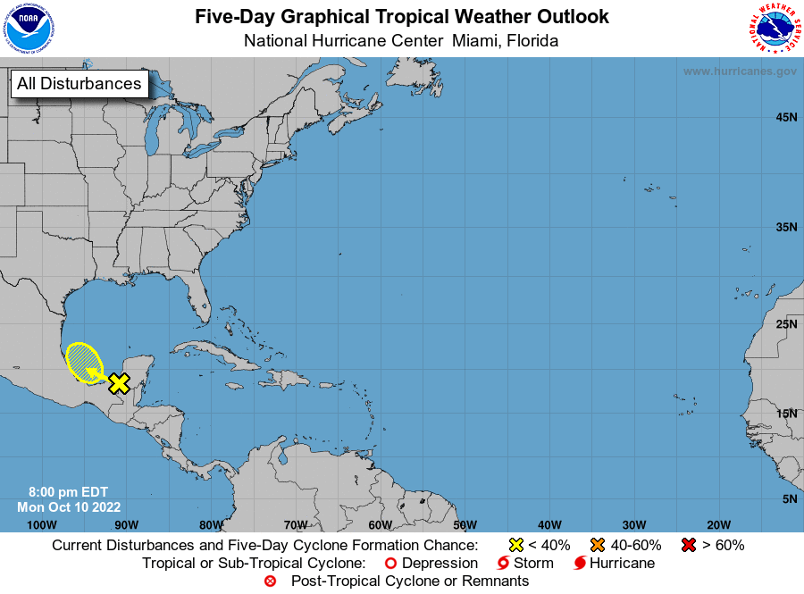
The tropics remain mostly quiet in the Atlantic basin this evening. The only area of interest for NHC this evening is the potential for the remnants of Julia to perhaps spin up a short-lived circulation in the Bay of Campeche later this week. However, 50+ knots of wind shear over much of the Gulf won’t let that one get too far. This area has a 30% chance to develop over the next five days.
Elsewhere, it’s pretty quiet. A tropical wave around 52° W isn’t producing much in the way of thunderstorm activity, and climatologically speaking, we are getting to the point in the season where we’re once again looking closer to home for any tropical development, and there’s just not much else to hang your hat on right now. (Let’s hope it stays that way.)