Thursday: Showers begin late heading into a stormy first part of the holiday weekend
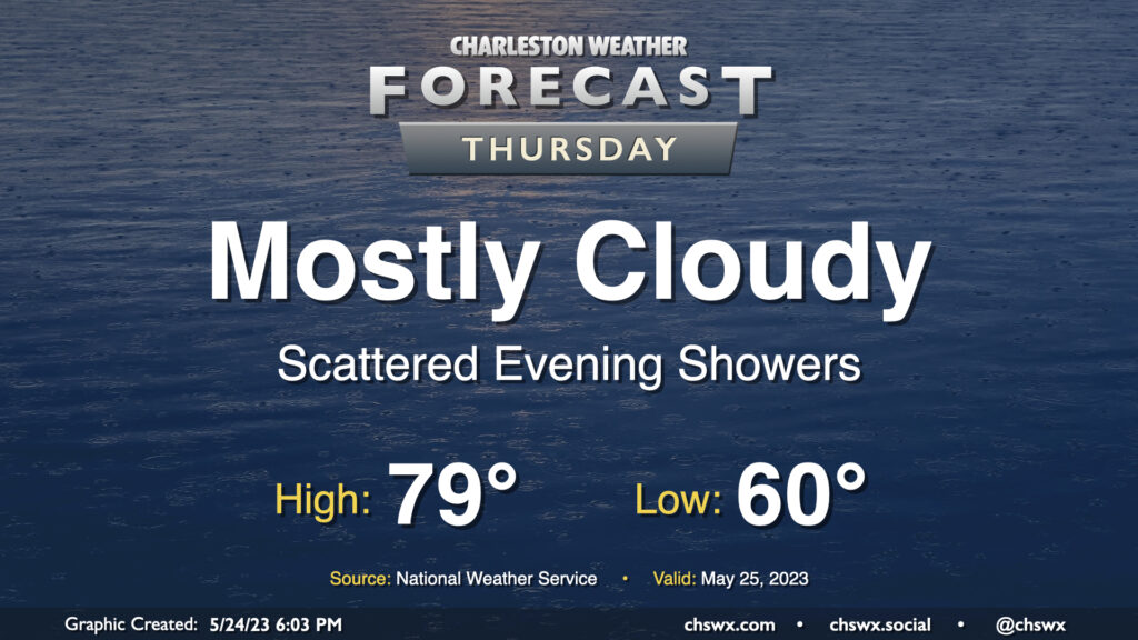
We start to see a shift toward more unsettled weather beginning Thursday as low pressure begins to organize offshore, sending more moisture and some windy conditions our way. We start the day around 60° as high pressure remains wedged in place. We’ll get a fair bit of the day in rain-free as highs top out around 80° in the afternoon. As low pressure begins to organize offshore later Thursday, we’ll start to see a risk for a few evening showers.
Friday and the weekend: Turning unsettled and windy as low pressure moves by
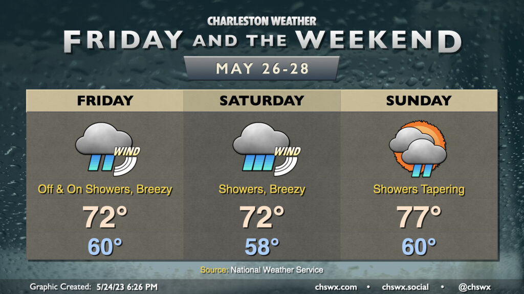
Friday and Saturday will not offer the finest start to a Memorial Day weekend we’ve ever seen here in the Lowcountry. Low pressure approaching the area is currently forecast to start spreading showers across the area Friday, peaking overnight Friday into Saturday, then starting to taper off Sunday. Some periods of heavy rain are possible, with some pockets of flooding perhaps as a result. Winds will be another issue — gusts to 30+ MPH appear possible as a pressure gradient tightens between the wedge of high pressure inland and the incoming low. This will also generate hazardous marine conditions, including high surf, rip currents, and potentially gale-force winds.
Temperatures will run well below normal — lows around 60° will only warm to the low 70s Friday and Saturday afternoons thanks to stiff onshore winds and widespread showers. With showers tapering on Sunday and cloud cover beginning to break, we should see highs top out in the mid-to-upper 70s. Memorial Day itself is looking okay — a few showers and maybe a thunderstorm will be possible, but it’s not a rainout.
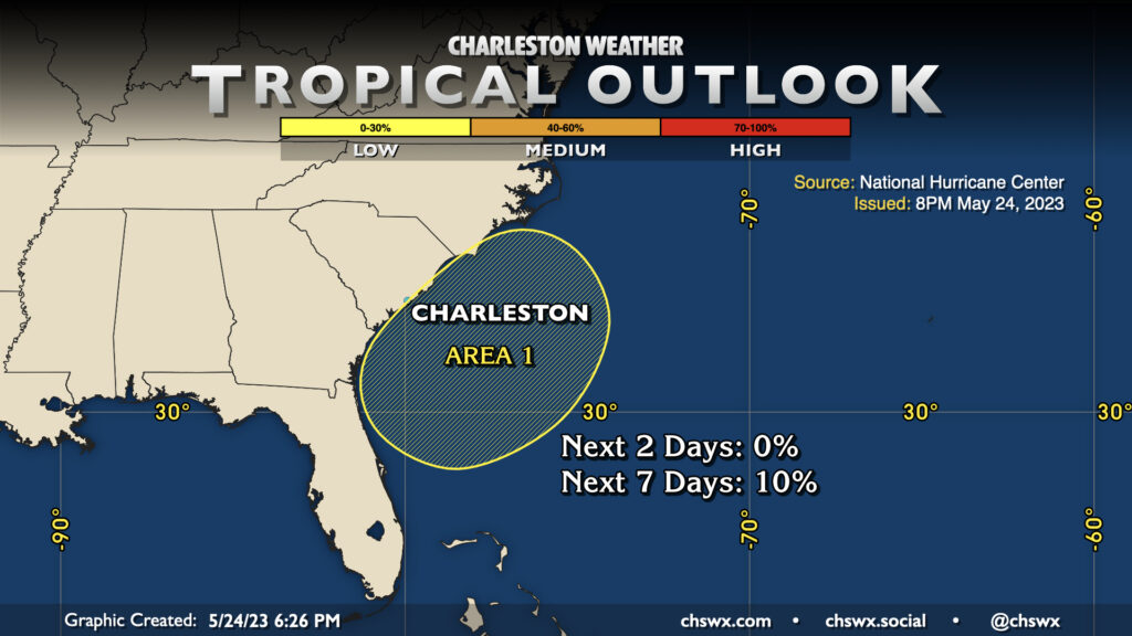
Given the time of year, the National Hurricane Center is keeping an eye on the low, but it is unlikely to gain tropical or subtropical characteristics, with just 10% odds of this happening. If the storm does take on some subtropical or tropical characteristics and gets classified as such, the expected impacts wouldn’t materially change, so don’t worry about getting too preoccupied there.
Follow my Charleston Weather updates on Mastodon, Bluesky, Instagram, Facebook, or directly in a feed reader. Do you like what you see here? Please consider supporting my independent, hype-averse weather journalism and become a supporter on Patreon for a broader look at all things #chswx!