Weekend forecast: Calming down, warming up

Weather much more becoming of June arrives this weekend as the upper low continues to pull away and we get a break in the action. We return to the 90s each day this weekend, with only a slight chance of afternoon thunderstorms on Saturday. Sunday could be even warmer, with highs approaching the mid-90s under partly cloudy skies. While a stray storm can never be totally ruled out, it’s looking like the vast, vast majority of us get Sunday in rain-free — some welcome drying out time after the soggy week that was.
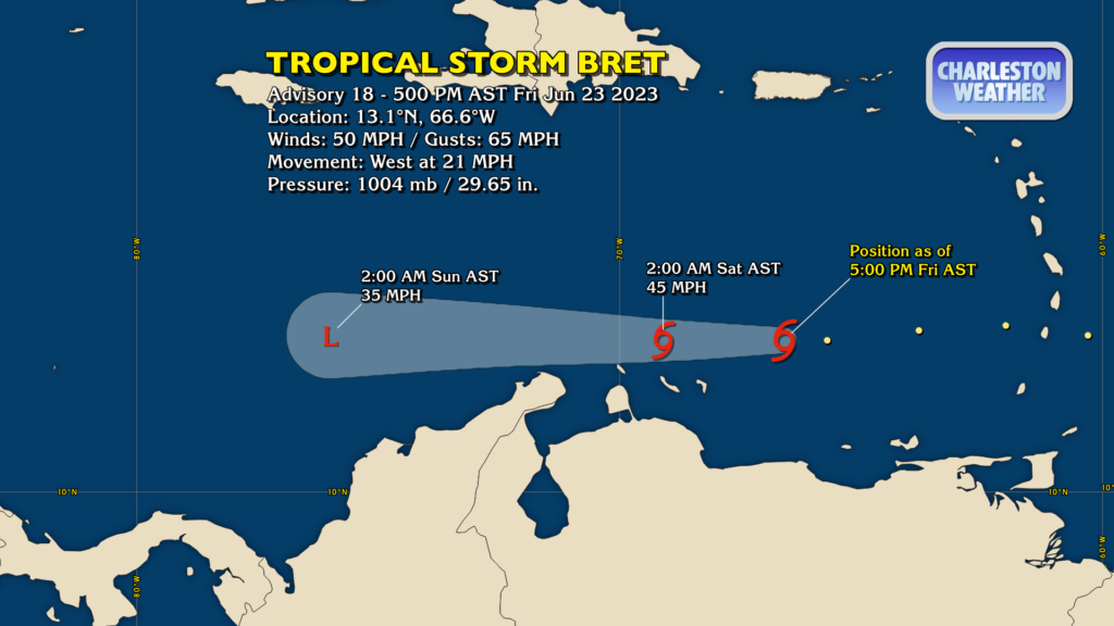
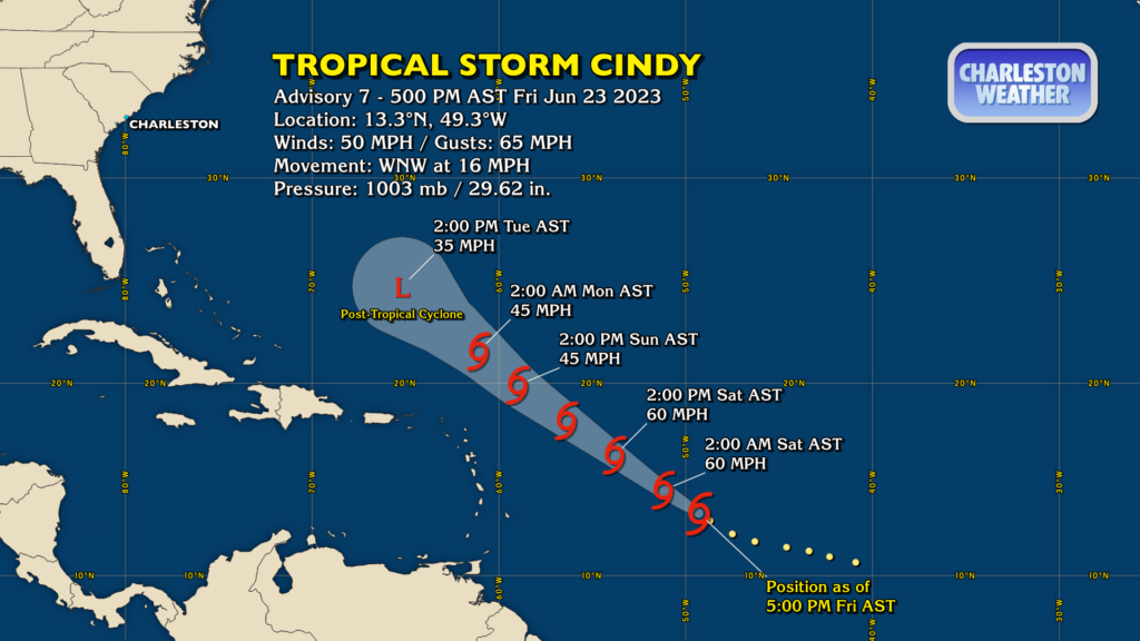
Tropical update: Bret to dissipate this weekend, Cindy to follow suit Tuesday

Tropical Storm Bret has crossed the Lesser Antilles and is into the Caribbean, entering a hostile atmosphere for tropical cyclone maintenance. It’s expected to wind down to an open wave over the weekend, and should not directly threaten any additional land areas.

A similar fate will befall Tropical Storm Cindy, which has 50 MPH winds as of the 5PM advisory Friday. It should strengthen a little bit more, but stay well below hurricane strength as it moves northwest across the central Atlantic. Troughing nearby will impart wind shear onto Cindy, disrupting its organization and eventually winding it down to a post-tropical cyclone by Tuesday.
Neither Bret nor Cindy pose any risk to the Lowcountry.
Follow my Charleston Weather updates on Mastodon, Bluesky, Instagram, Facebook, or directly in a feed reader. Do you like what you see here? Please consider supporting my independent, hype-averse weather journalism and become a supporter on Patreon for a broader look at all things #chswx!