Thursday: One last reasonably non-humid day before a much warmer and muggier weekend

The air on Wednesday evening is fairly glorious — dewpoints in the mid-60s behind the seabreeze, with even some 50s dewpoints ahead of it — thanks to a cold front that pushed through earlier in the day. We’ll keep some of this dry air around for Thursday, which will keep the high of 92° feeling closer to 93-94°. We’ll see a few clouds across the area, but otherwise, it’ll be another reasonably pleasant late-August day.
Friday & the weekend: The heat returns

Unfortunately, this spell of slightly cooler and drier air will be short-lived. Highs jump back into the mid-90s on Friday, head into the upper 90s on Saturday, and back to the mid-90s on Sunday. Winds go south to southwest as we head into Friday, allowing higher-dewpoint air to start to sneak back in. Heat indices will approach 105° on Friday, and could get close to 110° on Saturday as mostly sunny skies persist thanks to ridging aloft. We’ll start to see some pattern changes take place later Saturday into Sunday, though, which will bring the chance for some heat relief in the form of scattered storms back into the forecast on Sunday afternoon. Still, you’ll want to be taking it a little easy in the afternoons with the heat index well into the danger zone.
Tropics: Franklin might make some waves
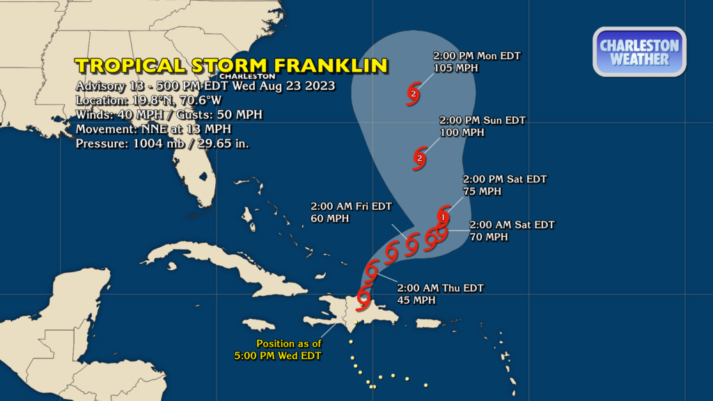
Tropical Storm Franklin is now the only named storm in town (for the moment, anyway) as it re-emerges into the Atlantic north of the Dominican Republic this evening. Max winds are 40 MPH with gusts to 50 MPH as the mountainous island has, like it often does, disrupted Franklin’s circulation. However, it’s expected to strengthen once again, and should become a hurricane as it moves NNW across the western Atlantic over the weekend. Right now, it looks like it’s going to split the difference between the east coast of the US and Bermuda. No concerns for direct impacts from Franklin here in the Lowcountry, though the surf could get a little exciting this weekend. (And with high surf comes a high risk of rip currents, too — be careful if you’re going to try to get into the water.)
Follow my Charleston Weather updates on Mastodon, Bluesky, Instagram, Facebook, or directly in a feed reader. Do you like what you see here? Please consider supporting my independent, hype-averse weather journalism and become a supporter on Patreon for a broader look at all things #chswx!