Rest of the work week: Heat’s back; a storm or two Friday
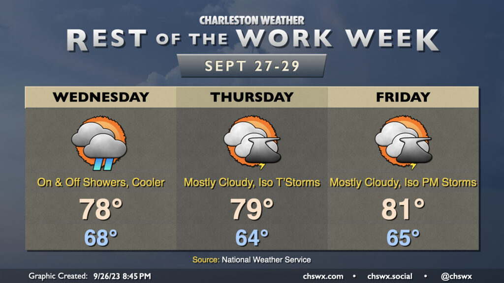
The forecast for the rest of the work week is generally on track: Temperatures in the mid-90s will continue through Thursday with peak heat indices around 100° thanks to some, but not too much, humidity. Skies will generally run partly cloudy to mostly sunny. Storm chances don’t return to the picture until Friday, and even then, it looks like coverage will be more on the isolated side. The weaker ridge will keep temperatures running a little lower (low 90s) on Friday, but above-normal temperatures look to continue heading into the weekend despite steadily increasing storm chances as a front arrives and stalls out nearby. (Remember, normal is looking a little lower these days: normal highs for this week generally run around 87°.)
Tropical update: Lee develops, is forecast to become a major hurricane
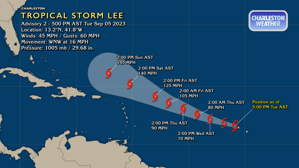
Tropical Storm Lee was named at 5PM after being classified as Tropical Depression Thirteen earlier in the day. Lee is forecast to become a very powerful Category 4 hurricane by this weekend as it moves northwest near the Leeward Islands and Puerto Rico. From there, the global ensembles have largely agreed to this point that Lee takes a turn to the north and stays out of our hair, but that is an awfully long way out to know for sure. Lee is a storm to watch due to its latitude and forecast intensity, but right now does not pose an imminent threat to us here at home. There’s plenty of time to keep an eye on it to make sure it behaves; just check in on forecast updates occasionally to stay in the loop.
Follow my Charleston Weather updates on Mastodon, Bluesky, Instagram, Facebook, or directly in a feed reader. Do you like what you see here? Please consider supporting my independent, hype-averse weather journalism and become a supporter on Patreon for a broader look at all things #chswx!