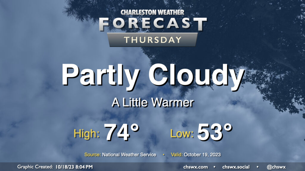
Thursday: Clouds on the increase, a little warmer

Expect clouds to be on the increase on Thursday as a coastal trough develops nearby, spreading some cloud cover onshore. Somewhat more southerly trajectories will allow temperatures to run a little warmer (but still below normal). Expect to start the day in the low-to-mid-50s before temperatures head to the mid-70s in the afternoon. Despite increasing clouds, expect one more rain-free day ahead of a cold front arriving Friday.
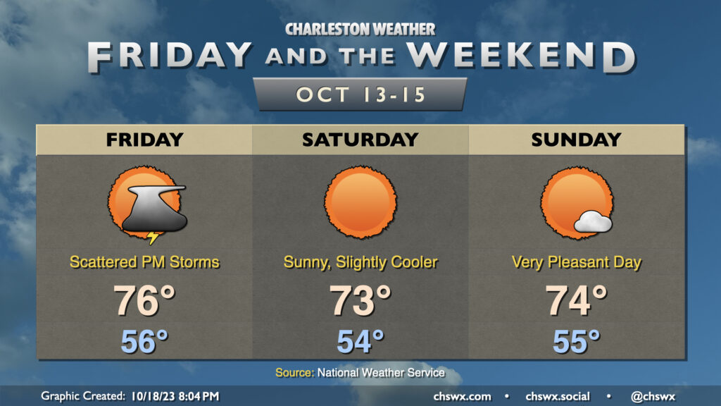
Friday & the weekend: Some wet weather Friday, but a great-looking weekend awaits

The only rain chance in the foreseeable future for the Lowcountry arrives Friday as the aforementioned cold front pushes through the area. Generally expect scattered showers and thunderstorms to develop along and ahead of the front in the afternoon and evening hours. Some spots could see a half-inch or rain in the heaviest storms, but the available moisture and overall dry conditions don’t support any flooding concerns. Highs will peak in the mid-70s after starting out in the mid-50s.
High pressure builds back in for Saturday, and with winds out of the northwest, temperatures will rise nicely into the low 70s under unfettered sunshine. It’s a similar story for Sunday, with highs topping out in the mid-70s once again with plenty of sun. Cloud cover will be on the increase late as a dry cold front moves by; this front knocks temperatures down a few more degrees to start the new work week.
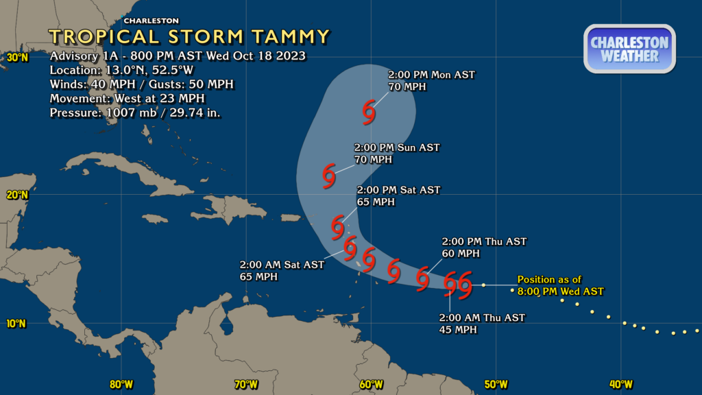
Tropics: Tammy develops; no concern for the Lowcountry

Invest 94L has developed into Tropical Storm Tammy, which will affect the Leeward Islands over the weekend before turning northward. Tammy is forecast to become a strong tropical storm, but will recurve well away from the United States, and thus poses no threat to us here in the Lowcountry.

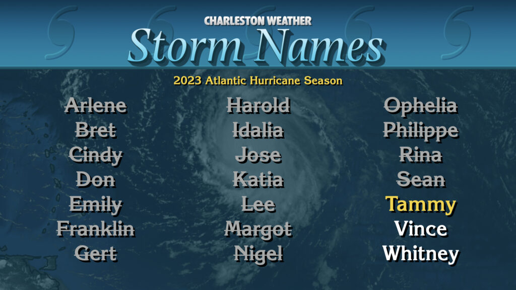
As you could probably surmise by the “T” name with our latest storm, we are running rather low on names in this year’s primary list. Only Vince and Whitney are left before we roll over to the supplemental name list established in 2021 as a replacement for the Greek alphabet. The good news is that there don’t seem to be any candidates to take the names Vince or Whitney out there in the Atlantic right now as we get into the second half of October.
Follow my Charleston Weather updates on Mastodon, Bluesky, Instagram, Facebook, or directly in a feed reader. Do you like what you see here? Please consider supporting my independent, hype-averse weather journalism and become a supporter on Patreon for a broader look at all things #chswx!