Frosty start Thursday; warming begins Friday

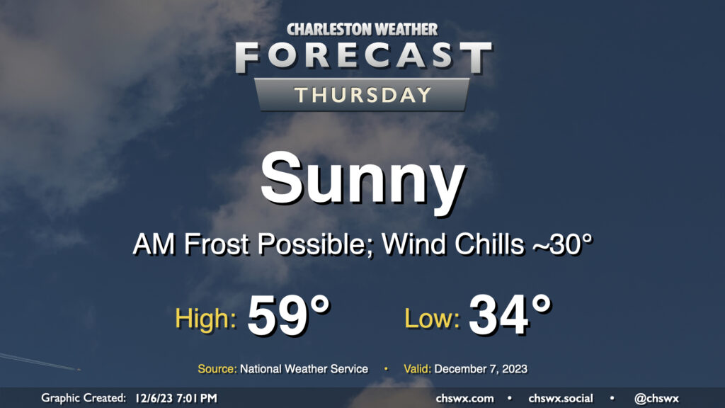
Thursday will represent the bottom-most point of this week’s temperatures rollercoaster, with lows bottoming out in the mid-30s across much of the metro with freezing temperatures further inland. Frost is a distinct possibility, and you’ll want to have pets and plants inside overnight Wednesday. Cool high pressure moves across the area during the day Thursday, limiting highs to the upper 50s to around 60° despite predominantly sunny skies.
Friday & the weekend: Warming up, next storm system Sunday

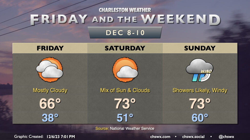
Thursday’s chill is short-lived, though, as high pressure kicks offshore at the surface, turning winds more southerly and helping to bring some warmer air into place. Friday will start again on the chilly side, with upper 30s away from the coast, before warming into the mid-60s under a mix of sun and clouds.
Saturday will be even warmer. Expect lows in the low 50s — a few degrees above December norms — to yield to highs in the low 70s under a mix of sun and clouds once again. A trough near the coast could send a shower or two toward the coast possibly, but right now it looks like we’ll get Saturday in rain-free.
We probably won’t be so lucky with Sunday. Rain chances will peak in the afternoon and evening hours as a cold front driven by a fairly dynamic storm system pushes through the Carolinas. It’ll be another warm day ahead of the front, with lows around 60° (the normal high for December 10 is 64°) yielding to highs in the low to mid-70s once again. A strong low-level jet will cause winds to be elevated at the surface, perhaps gusting upwards of 30-35 MPH at times with potentially higher speeds in more vigorous showers. Instability still looks rather tame, limiting the overall severe weather threat, though there could be enough for some rumbles of thunder. As always, stay tuned to forecast updates as more data comes in and timings can be fine-tuned further.
Follow my Charleston Weather updates on Mastodon, Bluesky, Instagram, Facebook, or directly in a feed reader. Do you like what you see here? Please consider supporting my independent, hype-averse weather journalism and become a supporter on Patreon for a broader look at all things #chswx!