Thursday: Front approaches, storm chances improve
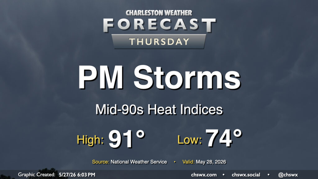
Heat peaks Thursday before scattered to numerous showers and thunderstorms fire along the seabreeze in the afternoon. From there, a cold front sags southward across the area, and keeps shower and storm chances going through Thursday night. We’ll start the day on the warm side with lows in the mid-70s. More westerly winds will keep things a bit drier to start the day, but these winds will help enhance convergence along the seabreeze for those aforementioned showers and thunderstorms as we get into the afternoon. Before thunderstorms begin to disrupt the temperature curve, highs will peak in the low 90s, and heat indices will easily run in the mid-90s, perhaps getting closer to 100° than we’d like in the Highway 17 corridor.
Severe thunderstorms aren’t expected, but some gusty winds can’t be ruled out. There’s plenty of available moisture for a lot of rain to fall in a short period in a few spots, too, but not everyone will see a downpour. However, it seems probable that most of us should be able to measure precipitation by Friday morning.
Friday & the weekend: Cooler but still unsettled
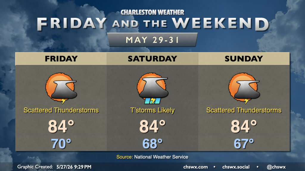
The front will stall out nearby, keeping clouds and showers in the forecast for Friday and the weekend. High-resolution model guidance suggests the front will get south of the Tri-County area, turning winds more northerly and northeasterly for Friday with even some drier air trying to punch in. Right now the forecast does call for the potential for some scattered thunderstorms as the GFS has the front buckling northward in the evening, allowing more moisture to head back into the area, but other higher-resolution models want to keep the area dry for much of the day, bringing the front back north later. See what happens, but be ready for some rain regardless.
Low pressure along the stalled front, which should lift north of the area by Saturday morning, will help instigate more in the way of showers and thunderstorms for Saturday. Don’t think it’ll be a washout, but we should still be able to measure some rainfall across much of the area. Temperatures will still run on the cool side, with lows in the upper 60s warming to just the mid-80s in the afternoon. Expect a similar story for Sunday, with confidence in precipitation coverage a little lower depending on where and when another wave of low pressure develops. Indications are that we will keep rain chances in play to start June, too — certainly not the worst thing as we try to make up some ground with this drought.
Follow my Charleston Weather updates on Mastodon, Bluesky, Instagram, Facebook, or directly in a feed reader. Do you like what you see here? Please consider supporting my independent, hype-averse weather journalism and become a supporter on Patreon for a broader look at all things #chswx!