The week ahead: Unsettled start, but turning quieter and warmer
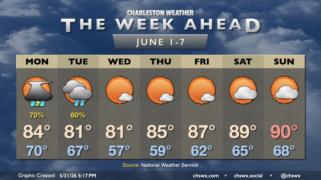
Meteorological summer begins on Monday, but it isn’t going to feel much like it for a few days with unsettled weather to start and cool high pressure for midweek before temperatures rebound toward 90° by the weekend.
Low pressure spinning up overnight tonight near the coast could spread some heavy downpours into the area as it does so. We may wake up to some decent rain totals near the coast, with the risk for some flooding — perhaps even isolated flash flooding — where the heaviest rains fall. The overall risk is low, but it is certainly non-zero. It may make for a messy Monday morning commute — be ready to spend some extra time on the road getting to where you need to go.
High-resolution guidance suggests that there could be a lull in activity around midday before another round of showers and thunderstorms fire on the seabreeze, which will again have a tough time pushing inland with northwest flow aloft. Temperatures should peak around the mid-80s during this lull. Overall, it will be welcomed rain, just as long as we don’t see too much of it at once — but as these things often go, a few of us may still see exactly that. Keep an ear out for possible flood advisories during the day Monday.
Later Monday into Tuesday, a cold front approaches from the north as dry high pressure starts to build down the Eastern Seaboard. This brings another round or two of unsettled weather to the area through Tuesday evening before the drier air really punches in and shuts off the rain. Temperatures Tuesday will be somewhat uncharacteristic of early June, with lows in the upper 60s warming to just the low 80s in the afternoon.
From there, we get a few days off from precipitation, and much more sunshine to boot. Wednesday looks fantastic, with lows in the upper 50s followed by highs in the low 80s under predominantly sunny skies. The spring throwback doesn’t last terribly long, though, with temperatures rebounding for the second half of the work week into the weekend. By Saturday, we’ll be flirting with upper 80s to low 90s once again, though lows will still run on the cool side of normal for this part of the year owing to the drier air.
Hurricane season begins
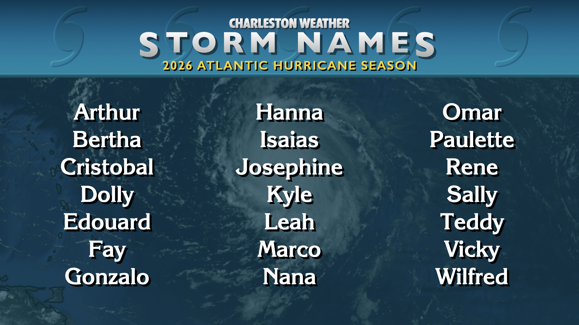
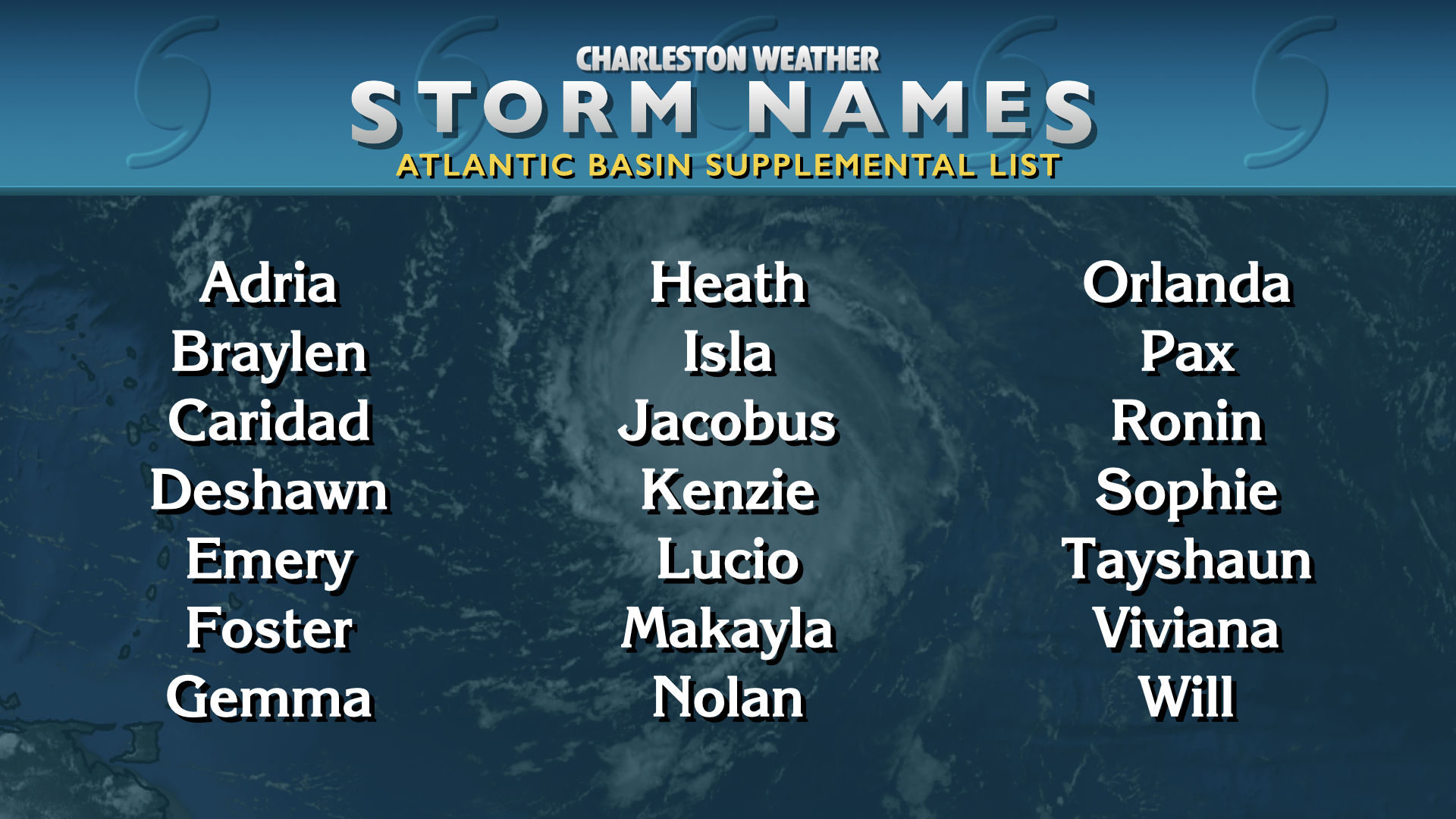
With the arrival of June also brings with it the arrival of hurricane season, which runs from June 1 to November 30 in the Atlantic basin. While this year’s name list was last used during the hyperactive 2020 hurricane season (minus the substitution of Leah for the now-retired Laura), this season should not be remotely close to as busy due to a strong El Niño that is developing in the Pacific. This tends to increase wind shear in the tropics, making for an overall more hostile environment to tropical development than normal. However, this doesn’t mean that the tropics will stay quiet all season, either — while NOAA tropical outlook forecasters strongly favor a below-normal season, they still believe between 8-14 named storms will be possible, with 3-6 of those becoming hurricanes. Of those hurricanes, 1-3 may become major hurricanes. It only takes one of these to make a season memorable for all the wrong reasons, so it’s still important to be prepared for the upcoming season. The South Carolina Emergency Management Division’s Hurricane Guide is a rather excellent resource for such things, especially if you are new to the state. The Know Your Zone tool is incredibly helpful so you can find out if you live in an evacuation zone (most of us do) and which zone you live in — very helpful information to have ahead of time rather than during the stressful crunch of a few days before a storm arrives.
I need to get this into a more static page at some point, but last year’s hurricane season post feels like a good encapsulation of my advice for how to get through it. Long story short: use trustworthy sources (especially the National Hurricane Center) for tropical forecast information, don’t get too caught up in trying to decipher weather models, and beware of the fear mongering in social media (which seems to have gone to another level with the proliferation of generative AI tools that forget the adage “just because you can doesn’t mean you should”). By sticking with the experts and getting your hurricane plan in place early, you will have no issues navigating the season. Good luck to us all!
Follow my Charleston Weather updates on Mastodon, Bluesky, Instagram, Facebook, or directly in a feed reader. Do you like what you see here? Please consider supporting my independent, hype-averse weather journalism and become a supporter on Patreon for a broader look at all things #chswx!