Thursday: Lots of sun, a little warmer
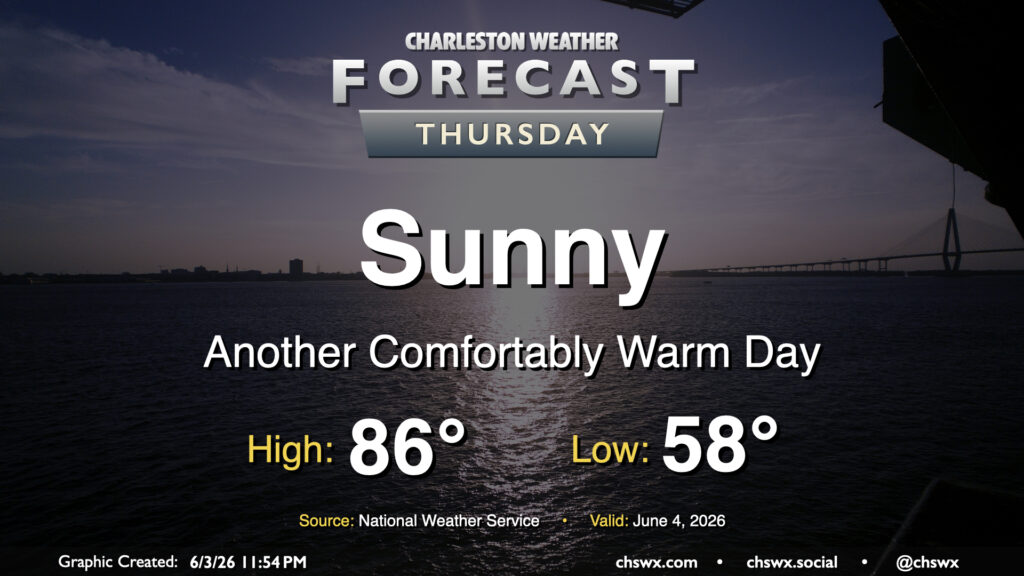
Another comfortably warm day lies ahead for Thursday as high pressure at the surface and aloft remain the dominant weather features. Temperatures will once again start well on the cool side of normal for this time of year, bottoming out in the upper 50s away from the coast. We’ll warm to the mid-80s in the afternoon, but low-50s dewpoints will help not to make it feel terribly uncomfortable.
Friday & the weekend: Turning more humid with rain chances looming again
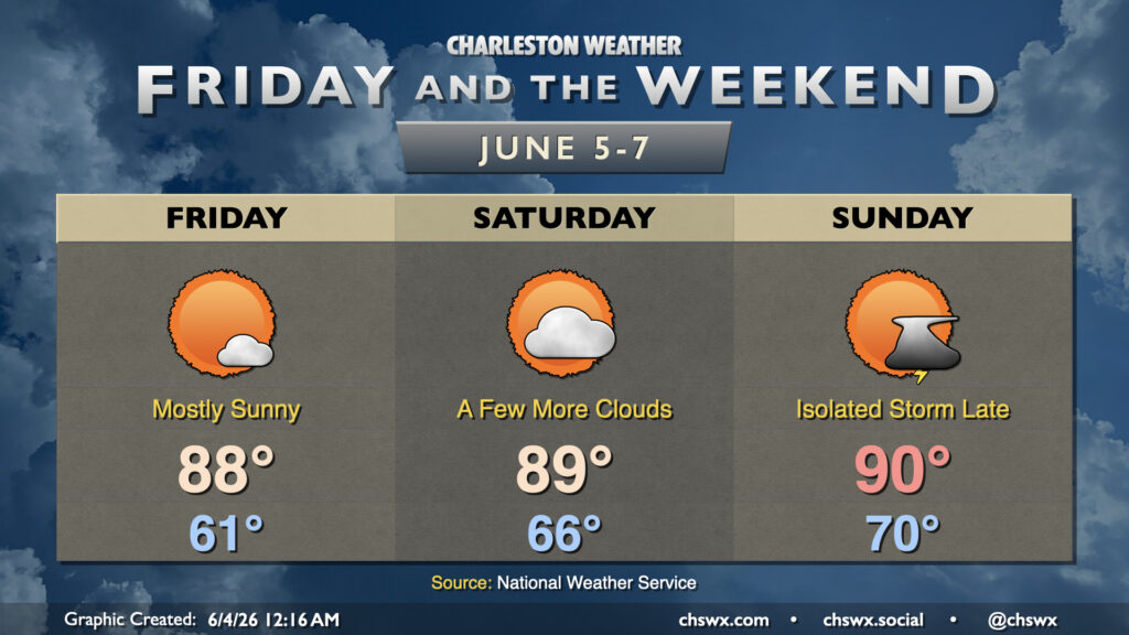
Friday & the weekend will remain generally quiet for the vast majority of the period, though a stray storm may be possible later Sunday. Temperatures will continue to trend warmer, getting much closer to early June norms and likely reaching 90° by Sunday. Cloud cover will gradually increase beginning Friday as surface high pressure slips offshore, allowing more in the way of moisture to move into the area. Dewpoints in the 50s on Friday warm to the upper 60s by Sunday, indicating the much more moist airmass taking root. However, it will still be a good weekend to get out and about with few, if any, weather concerns. Rain chances turn more likely beginning Monday and through at least the first half of next week.
Follow my Charleston Weather updates on Mastodon, Bluesky, Instagram, Facebook, or directly in a feed reader. Do you like what you see here? Please consider supporting my independent, hype-averse weather journalism and become a supporter on Patreon for a broader look at all things #chswx!