Thursday: Warming trend continues heading into the July Fourth weekend
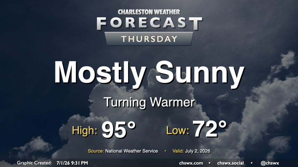
High pressure continues to dominate the weather pattern, which keeps things toasty and rain-free for Thursday. Fortunately, drier air will still be in place for one more day, which will allow for lows to drop to the low 70s in the morning. From there, we’ll warm to the mid-90s in the afternoon. Dewpoints will mix down to the mid-60s, keeping heat indices within a degree or two of the air temperature. It’ll still be plenty hot, but a drier heat will be appreciated.
Independence Day weekend: Turning hotter and more humid
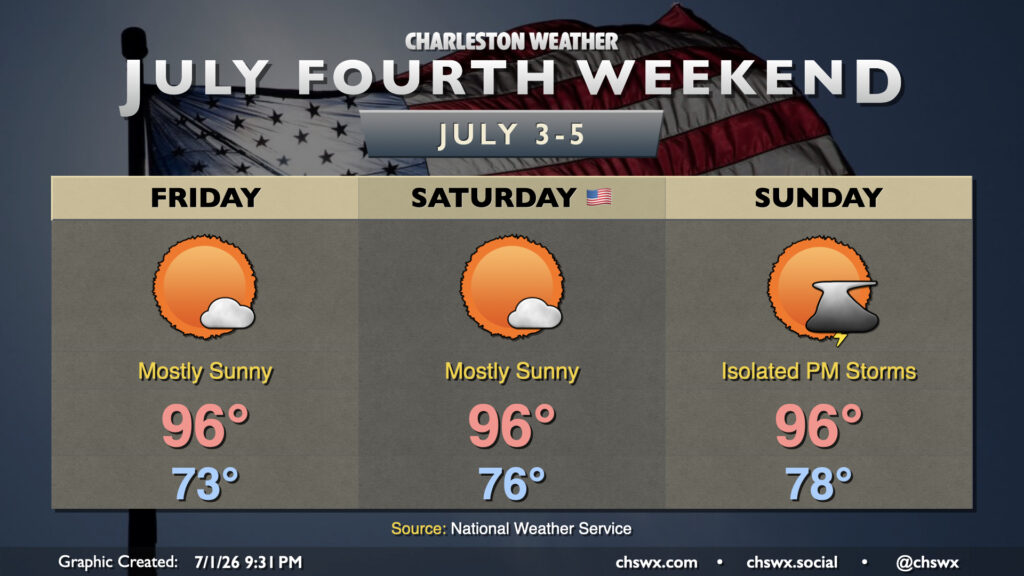
The high pressure ridge will start to weaken and move back into the Atlantic as we head into the holiday weekend, which will turn flow more southerly, bringing in warmer and more humid air. Temperatures Friday start in the low 70s, warming solidly into the mid-90s in the afternoon. Dewpoints will run in the low 70s, so heat indices will run a few degrees warmer than the air temperature, approaching 100-103° in the afternoon, warmest in the Highway 17 corridor where the best overlap of dewpoints and hot air temperatures will exist. The ridge should keep a lid on any thunderstorm activity for Friday, so don’t count on any relief in that way.
Humidity continues to build for the Fourth of July, which could feature heat indices approaching Heat Advisory criteria of 108° in the coastal corridor as air temperatures once again head into the mid-90s. The ridge will continue to weaken, and some guidance suggests a little more in the way of instability compared to previous days. This could lead to a stray seabreeze thunderstorm or two, but chances are quite low and rain, if it develops, should be short-lived. Otherwise, expect plenty of sunshine for your Fourth of July activities.
Slightly better afternoon thunderstorm chances return on Sunday as the ridge shifts back into the Atlantic and moisture return continues to improve. It’ll be another hot one, with highs in the mid-90s expected away from the coast once again. Lows at the coast and in downtown Charleston may not get below 80°, with high temperatures running a little “cooler” in the low 90s, but heat indices should easily clear 105°.
Follow my Charleston Weather updates on Mastodon, Bluesky, Instagram, Facebook, or directly in a feed reader. Do you like what you see here? Please consider supporting my independent, hype-averse weather journalism and become a supporter on Patreon for a broader look at all things #chswx!