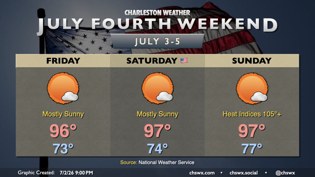
A hot and increasingly humid airmass will blanket the Lowcountry for the Fourth of July holiday weekend. Temperatures will run in the mid-90s each day, and with dewpoints climbing back into the 70s, heat indices will continue to escalate into the 100s, with the highest values each day being found in the Highway 17 corridor where the best overlap of dewpoints and air temperatures will be found. Heat indices will peak around 100-101° on Friday, 102-106° on Saturday, and should approach the Heat Advisory threshold of 108° on Sunday. Nights will impart increasingly less relief, too, with lows climbing into the upper 70s to around 80° by Sunday, warmest near the coast and in downtown Charleston. The warm nights will compound heat stress, especially for folks who don’t have adequate cooling, which is why it’s so important to take it easy during these hot stretches.
If you’re looking for thunderstorms to cool things off, I wouldn’t really count on those either. The atmosphere should stay capped Friday and Saturday, with a slightly better chance for a stray storm on Sunday but still low enough of a chance as to be technically unmentionable (~10%). If a storm can kick off, watch for frequent lightning and gusty winds. With that being said, the vast majority of us should get a rain-free holiday weekend in.
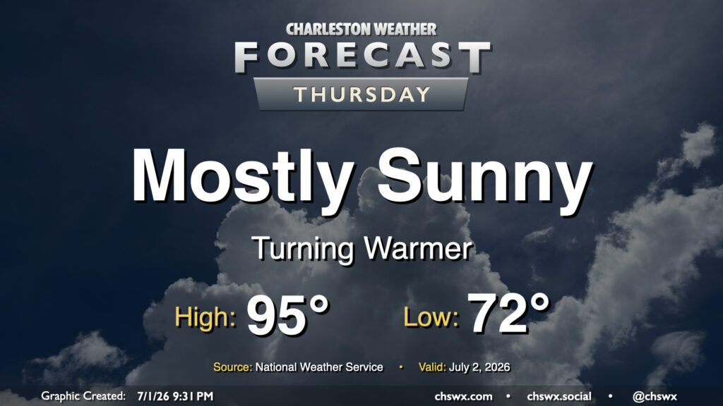
High pressure continues to dominate the weather pattern, which keeps things toasty and rain-free for Thursday. Fortunately, drier air will still be in place for one more day, which will allow for lows to drop to the low 70s in the morning. From there, we’ll warm to the mid-90s in the afternoon. Dewpoints will mix down to the mid-60s, keeping heat indices within a degree or two of the air temperature. It’ll still be plenty hot, but a drier heat will be appreciated.
After what ended up being Tropical Storm Colin absolutely drenched us yesterday, we find ourselves with some drier air beginning to punch in on the southwest side of Colin’s circulation. This will help tamp down — but not totally eliminate — the risk for a few showers and thunderstorms this afternoon as temperatures look to rebound into the mid-80s (pending cloud cover eroding, anyway). It’ll still be muggy, though, with dewpoints running in the low 70s.
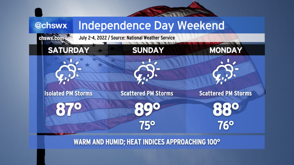
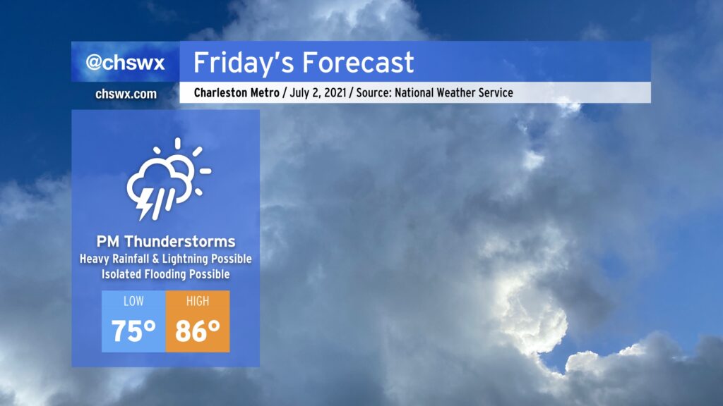
Thereafter, a more typical summertime pattern takes hold for the rest of the holiday weekend. Temperatures in the upper 80s to around 90° will be common; mix in dewpoints in the mid-70s and it’ll feel closer to 100°. Showers and thunderstorms will be possible each afternoon, with generally scattered coverage expected. A storm or two could be on the strong side with gusty winds on Sunday, so that’s something we’ll want to keep an eye on. Heavy rain will also be possible in any storm that fires up, and with precipitable water values generally returning to around 2″ this weekend, some localized flooding may be possible, especially in places that have been absolutely drenched over the past few days.
The bottom line, as it has been for the past few days, is to just make sure your outdoor July 4th plans have a solid indoor backup in case thunderstorms threaten. Severe or not, remember that every thunderstorm is dangerous because of the lightning it produces. (At least the tropical mischief will have long-since moved on!)
Rainfall this evening has thankfully been a little tamer than forecast, with the bulk of the heaviest rain developing just offshore this afternoon. We will still see a few showers later this evening and overnight, particularly as the cold front currently draped across the Midlands sinks into the area.
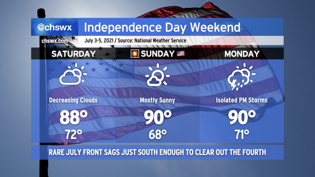
Said front will move well south of the area by tomorrow morning, and skies will clear in its wake, yielding what looks to be an excellent Fourth of July weekend. Temperatures will run in the upper 80s to around 90° each day through Monday, with mostly sunny skies for Saturday and Sunday. We may see a couple storms pop on the seabreeze on Monday, but most of us will stay dry. Then after that, we turn to Elsa.
After a couple days in a classic summertime Bermuda High setup, we’ll see that high continue to retrograde eastward, giving way to a cold front sinking south from the Ohio Valley. Said front will run into an incredibly juicy airmass courtesy of a robust moisture tap from the Gulf, and help to ignite numerous showers and thunderstorms in the afternoon. This will have the effect of holding temperatures down into the mid-80s.