Rest of the work week: Staying warm with plenty of sun
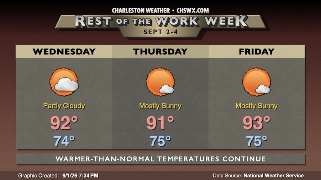
Highs in the 90s will continue over the next few days with plenty of sunshine as high pressure aloft remains the dominant weather feature.
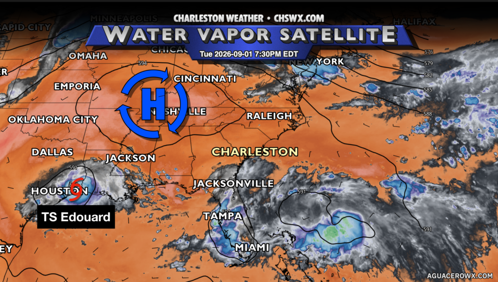
A ridge of high pressure centered roughly over Nashville combined with plenty of dry air kept things quiet today and will keep us high and predominantly dry for the next few days. Generally speaking, we can expect partly cloudy to mostly sunny skies each day through Friday, with lows in the mid-70s and highs in the low 90s each day. Heat indices will climb into the upper 90s to around 100° each afternoon. There’s a tiny chance that a popup shower or storm could kick off as we get toward Friday, but otherwise, things look to stay quiet.
Looking ahead: Periods of unsettled weather this weekend
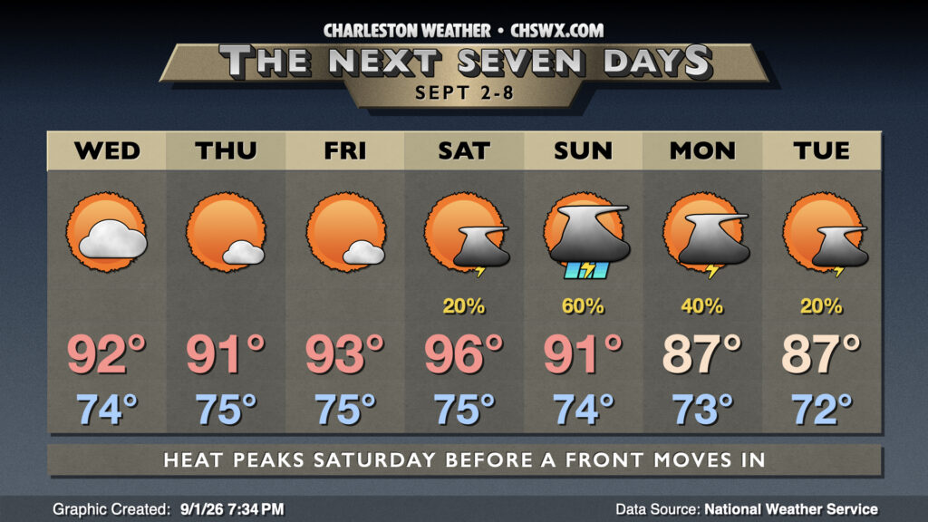
A trough of low pressure starts to dig across the Northeast over the weekend, driving a cold front our direction. Compressional heating ahead of the front will help bring temperatures up a few ticks for Saturday, with air temperatures peaking in the mid-90s and heat indices perhaps pushing 105-110° in spots. We should see a few afternoon thunderstorms, but they’ll be isolated, so don’t count on any relief. The front draws closer Sunday, and that kicks up the risk for showers and thunderstorms primarily in the afternoon and evening. Temperatures peak in the low 90s one more time before the front gets through, cooling us off a bit for the first part of next week (albeit with continued rain chances).
Tropics: Edouard makes landfall
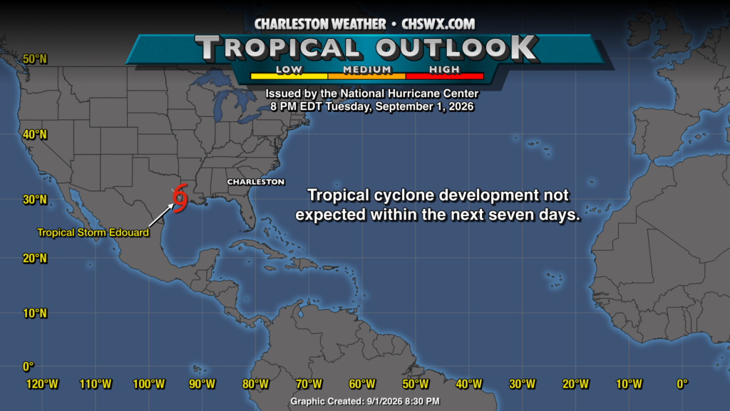
Tropical Storm Edouard made landfall near Johnson Bayou, LA around 2:20 PM Central, according to the National Hurricane Center. It continues to progress inland this evening in eastern Texas and will continue to weaken as it goes, likely losing tropical characteristics by tomorrow morning. Elsewhere in the tropics, NHC currently doesn’t highlight any areas of interest, with tropical cyclone development not expected within the next seven days.
Follow my Charleston Weather updates on Mastodon, Bluesky, Instagram, Facebook, or directly in a feed reader. Do you like what you see here? Please consider supporting my independent, hype-averse weather journalism and become a supporter on Patreon for a broader look at all things #chswx!