Friday & the weekend: Turning warmer ahead of a front
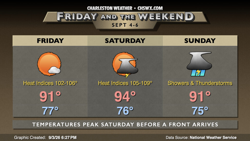
Summer won’t loosen its grip just yet, especially as we head into Friday and Saturday as a front approaches the area, sending air temperatures back to the mid-90s and heat indices close to heat advisory territory.
We’ve got one more generally quiet day on Friday, though a stray shower or storm can’t be totally ruled out (as we saw at the beaches today). Temperatures will be quite balmy to start, with lows in the upper 70s across much of the area. Highs peak in the low 90s in the afternoon, but dewpoints in the mid-to-upper 70s will drive heat indices well into the 100s, perhaps peaking around 106° downtown.
Saturday will run even warmer, with heat peaking in the mid-90s in the afternoon. Mix the dewpoints in, and you could see heat indices peak into Heat Advisory territory just inland of the coast. It remains to be seen if it will be hot enough for long enough for an advisory, but we’ll keep an eye on it. More interesting will be later Saturday into early Sunday as a round of strong thunderstorms could push in from the north along with a cold front. Showers and thunderstorms could hang around into Sunday, too, as the front may stall out nearby. Temperatures Sunday could still peak in the low 90s before numerous showers and storms fire and move across the area.
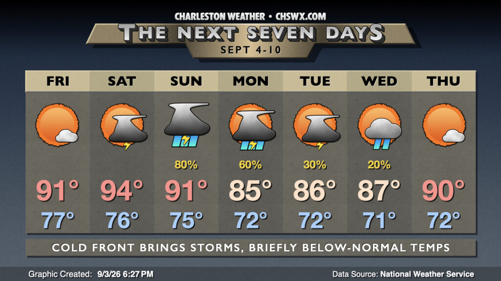
Unfortunately, showers and storms could hang around for Labor Day, but high pressure wedging southward will at least finally put a dent in temperatures for a bit. Highs on Labor Day peak in the mid-80s after starting in the low 70s. Isolated to scattered showers & storms will be possible Tuesday and Wednesday, but temperatures continue to run right around if not slightly below normal. However, temperatures will return to the 90s by Thursday and should hang around into the weekend.
Tropics: Nothing of note
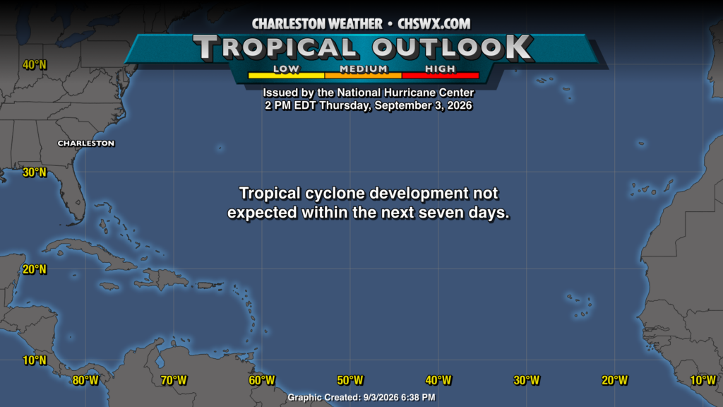
It is exceedingly rare to see a blank Tropical Outlook map in early September, but so it goes with El Niño. Climatologically, the season peaks September 10, but right now it doesn’t look like there’s going to be much to write home about for the next few days. With that in mind, stalling fronts can be a source of homegrown tropical issues as we start getting into the autumn months, so there’s still a need to be vigilant, especially since storms can intensify quickly in relatively untapped waters. But for now, we’ll enjoy the peace.
Follow my Charleston Weather updates on Mastodon, Bluesky, Instagram, Facebook, or directly in a feed reader. Do you like what you see here? Please consider supporting my independent, hype-averse weather journalism and become a supporter on Patreon for a broader look at all things #chswx!