Tuesday: Breezy and not quite as hot
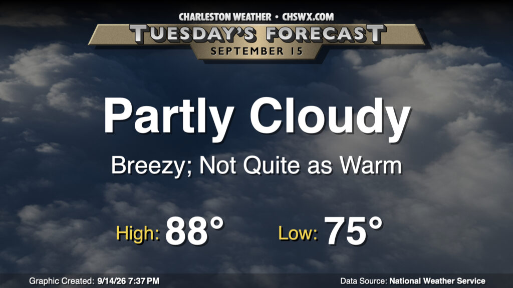
A front coming through on Tuesday will knock temperatures back from the record levels of the past two days, bringing some breezy conditions and maybe some coastal flooding in the process. We start the day in similar fashion to the past couple days, with lows in the mid-70s expected. High pressure building south will swing winds around to the east and northeast in the morning, turning things gusty in the process (especially at the coast). This wind may also help drive tidal departures higher, perhaps causing some minor coastal flooding with the midday high tide. Widespread flooding issues are not expected, though. We will see dewpoints begin to drop during the afternoon with highs peaking just in the upper 80s, right around mid-September normals.
Record high set at the airport Tuesday
After tying the daily high temperature record on Monday, we made another edit to the record books on Tuesday as highs soared into the mid-90s. Tuesday’s high of 95° at the airport broke the record of 94° first set in 1938 and again in 1991. Thankfully, more seasonable temperatures move in for at least the next few days.
Rest of the work week: A little less warm and humid
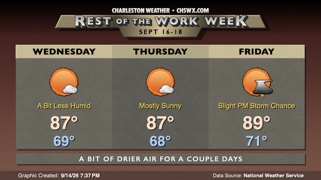
We start Wednesday in the upper 60s to low 70s, warming to the mid-to-upper 80s in the afternoon under mostly sunny skies. Dewpoints mix out into the low to mid-60s during the afternoon given plenty of dry air, making for much more comfortable warmth than we’ve felt in quite some time. The dry air sticks around for Thursday, with another upper 60s start yielding to mid-to-upper 80s highs once again. Unfortunately, we start to see moisture return to the area heading into Friday, with lows creeping back into the low 70s and highs peaking in the upper 80s to around 90° in the afternoon, with heat indices in the mid-90s and the risk for a stray afternoon storm back in the forecast.
Looking ahead: Late-summer weather returns
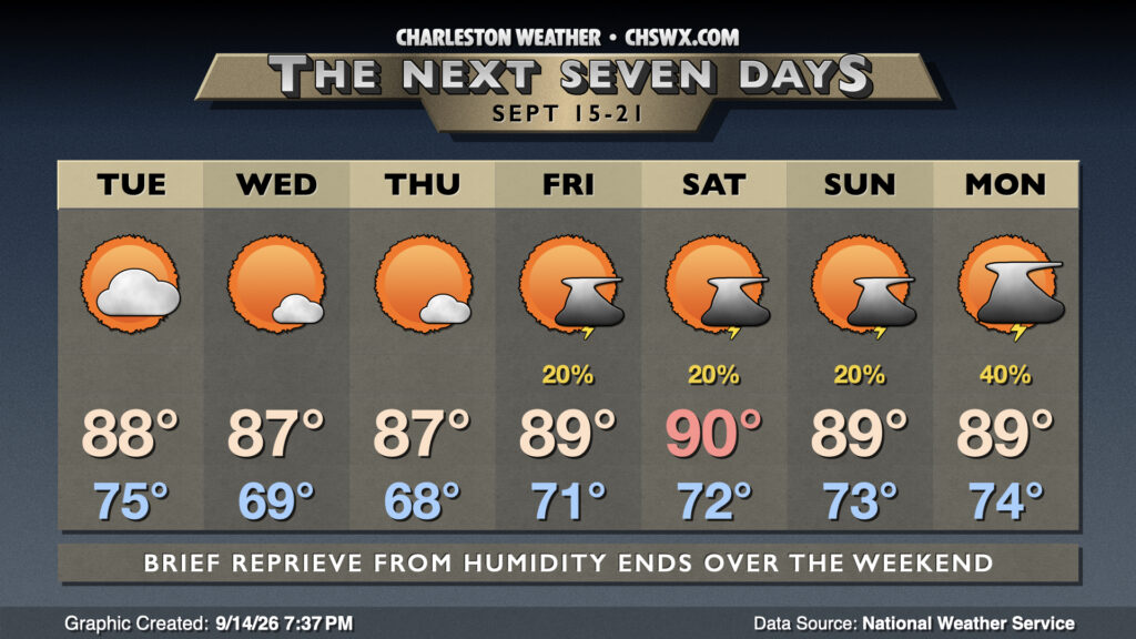
Warm and humid afternoons return for the weekend into early next week as another front moves into the area and washes out. We should see a chance for thunderstorms each afternoon, with chances ticking up a bit for Monday as a coastal trough takes shape.
Tropics: One area being monitored
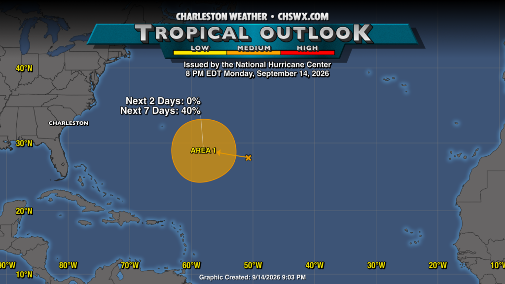
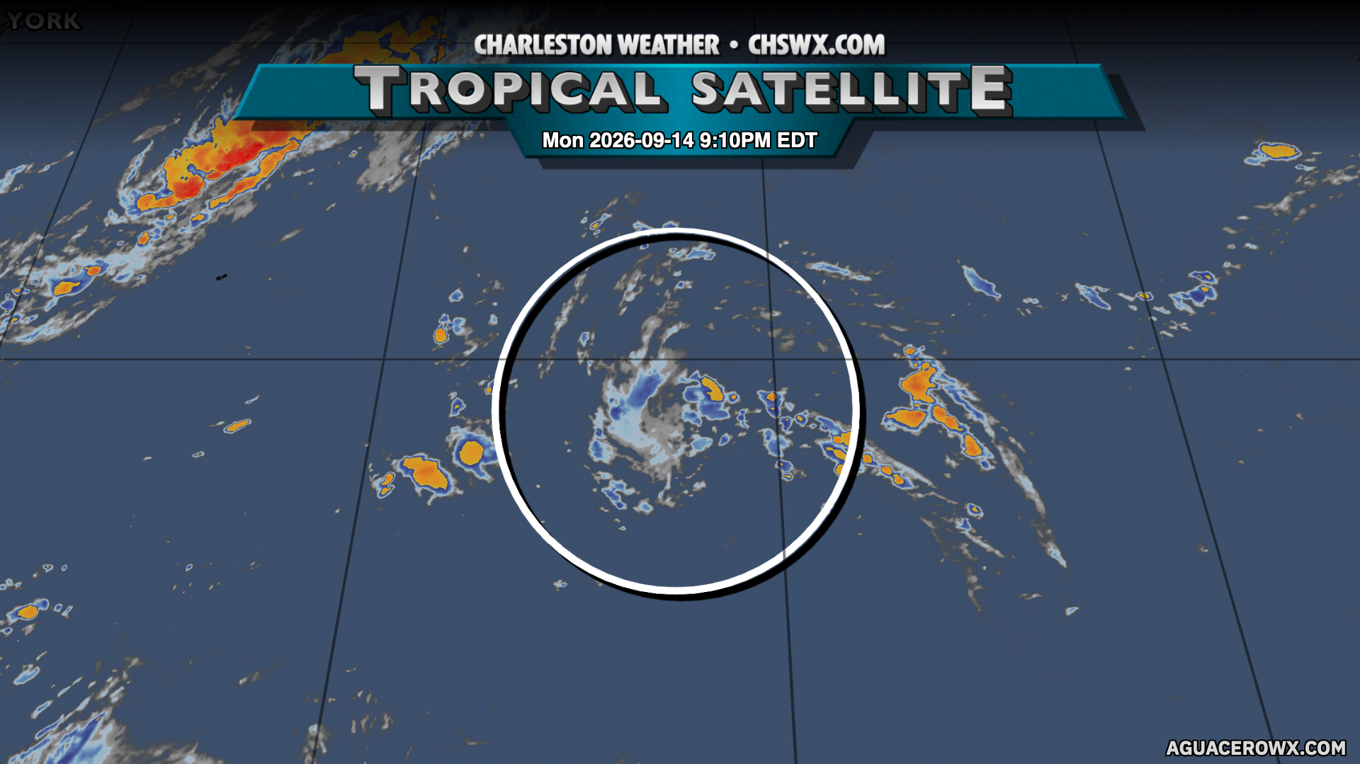
There’s an area of disturbed weather around 50°W and 28°N, or about 900 miles ESE of Bermuda, that has a medium chance to develop into a tropical cyclone over the next week as it continues to move WNW. The latitude is such where this shouldn’t become much to write home about in our neck of the woods, and models are not terribly bullish on it in general. We’ll keep an eye on it. Otherwise, things remain quiet.
Follow my Charleston Weather updates on Mastodon, Bluesky, Instagram, Facebook, or directly in a feed reader. Do you like what you see here? Please consider supporting my independent, hype-averse weather journalism and become a supporter on Patreon for a broader look at all things #chswx!