Thursday: Another cool and breezy day with a few showers
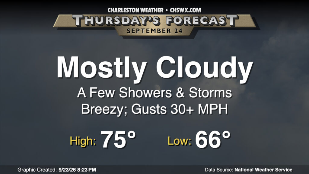
High pressure wedging in from the northeast made for a much cooler day on Wednesday — the high only reached 77°, the coolest high since 76° on May 31 — and we’ll keep that going into Thursday. Winds kick up a bit more Thursday as low pressure begins to spin up offshore, tightening the pressure gradient across the area. There could be some showers within the wedge at any point during the day, but nothing too out of control by any stretch. The main hazards will be a risk for coastal flooding at times of high tide. The 6:40am high tide could touch 7′ MLLW, producing some minor flooding in the most vulnerable locations. The evening high tide, which peaks around 7:10 PM, will run more than a half-foot higher, with moderate coastal flooding expected. Be ready for road closures downtown during the second half of the commute.
Friday & the weekend: Drier air moves in with more sunshine
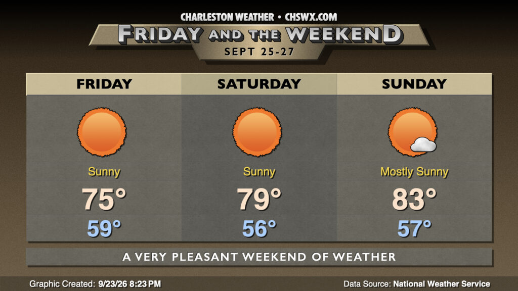
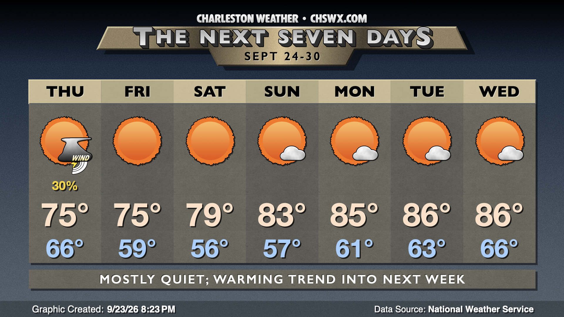
This weekend promises to have fairly stellar weather as drier air punches southward on the back side of a developing nor’easter. We should drop below 60° away from the coast for the first time since June 4 on Friday morning with lows dipping into the upper 50s. Highs will then head to the mid-70s in the afternoon under mostly sunny skies. Winds will remain breezy, but won’t be to the degree we should see Thursday.
A warming trend kicks in over the weekend as the airmass moderates. Lows Saturday, though, will drop to the mid-50s, with temperatures heading into the upper 70s to around 80° in the afternoon under sunny skies. We’ll get another morning in the 50s on Sunday as well, though temperatures will start to tick back into the low-to-mid-80s. The risk for minor to coastal flooding around times of high tide looks to continue as the influence of Saturday’s full moon and elevated seas from the offshore nor’easter remain in play.
The warming trend continues into next week with highs returning to the mid-80s by Tuesday. Skies remain partly cloudy to mostly sunny, and there’s no real rain chances in sight through at least Wednesday. Enjoy!
Follow my Charleston Weather updates on Mastodon, Bluesky, Instagram, Facebook, or directly in a feed reader. Do you like what you see here? Please consider supporting my independent, hype-averse weather journalism and become a supporter on Patreon for a broader look at all things #chswx!