Jared Smith founded @chswx on Twitter in 2008 as an experiment in disseminating weather data through social media. In the ensuing decade-and-a-half, @chswx has provided live coverage of tropical cyclones, tornadoes, severe weather, and even a couple bouts of winter weather to the good people of Charleston, SC.
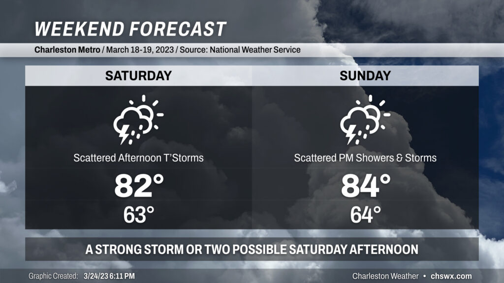
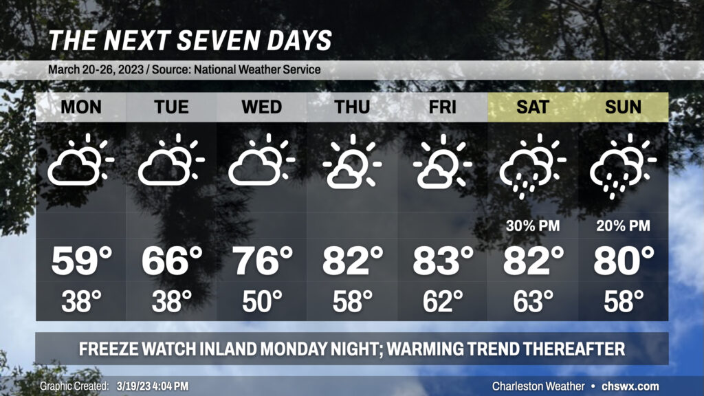
We stay warm this weekend despite a weak front that’ll move in Saturday and stall out across the area. Highs each afternoon will peak in the low to mid-80s, with lows solidly in the low-to-mid-60s.
The aforementioned front will be the focal point for increasingly unsettled weather. As the front approaches Saturday, scattered showers and thunderstorms — a couple of which may be on the strong side — will be possible primarily in the afternoon through early evening. Outside of thunderstorms, winds will be gusty at times, with gusts approaching 30 MPH especially on higher bridges.
Sunday starts on a dry note, but as the afternoon progresses, the lingering front will act as a focal point for developing additional showers and maybe a few thunderstorms. Rain chances will last well into Monday and Tuesday before the front is shoved out of here by high pressure. Still, expect highs to climb into the mid-80s.
Bottom line for this weekend: No total washout expected, but you’ll want to keep an eye to the sky if you’re outdoors.
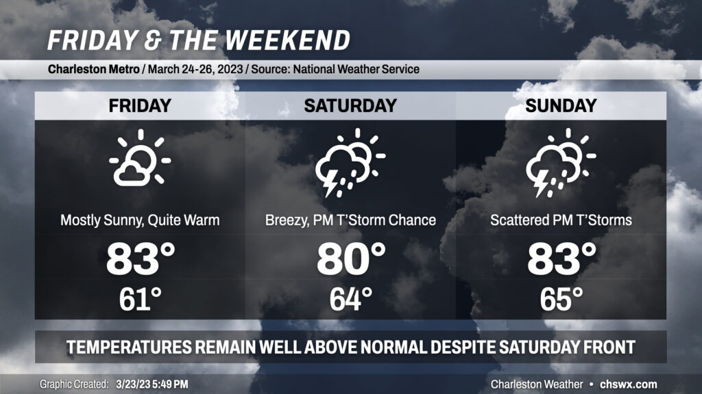
We stay quite warm for Friday into the weekend. Temperatures will remain in the low to mid 80s each afternoon despite a “cold” front projected to swing through later Saturday.
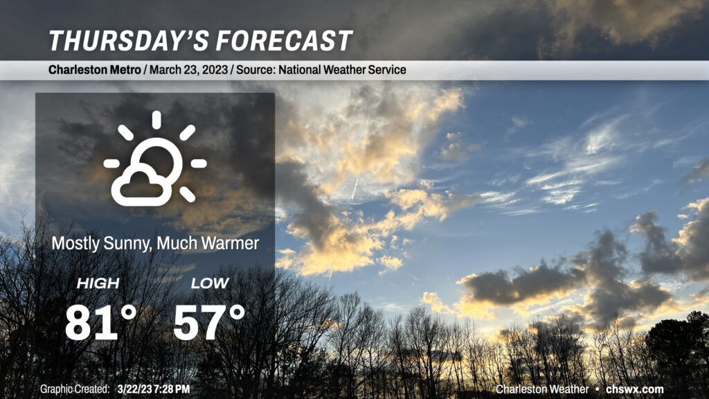
A warm front will lift north of the area tonight, clearing out the light rain and bringing back the 80s to the area for the next several days. We start Thursday in the mid-to-upper 50s, with temperatures warming into the low 80s away from the slightly cooler coastline in the afternoon under increasingly sunny skies. For reference, normal highs for this point in the year are in the low 70s, though we will remain well under the record high of 87° set in 1995. Winds out of the south and southwest will be a little breezy, which might add to some slight complications for any outdoor lunch plans. Other than that, though, a pretty decent late-March day.
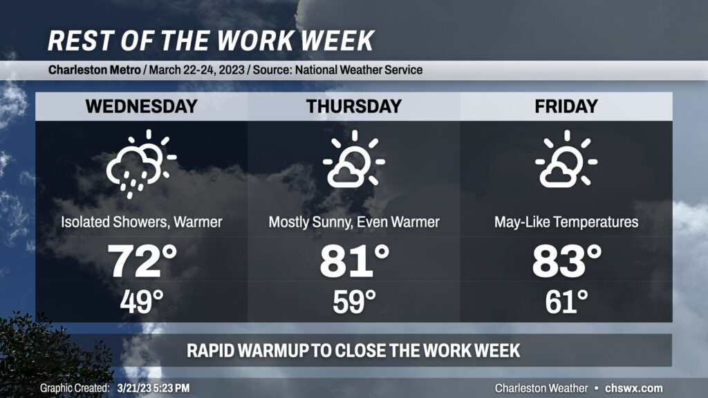
Freeze Warnings will become a distant memory by the end of the work week as we warm rapidly into the 80s by Thursday.
Temperatures moderate nicely into the upper 40s Wednesday morning with highs topping out in the low 70s. A coastal trough moving inland might spread a few showers around, but rain amounts should be generally light and most of us should get the day in rain-free.
From there, things get a lot warmer. Thursday starts ~10° warmer than Wednesday did, with lows not dropping far below 60°. Highs soar into the low 80s under mostly sunny skies, with just a few passing clouds from time to time. Friday is largely a copy-and-paste from Thursday, just with slightly warmer temperatures expected. We look to stay in the 80s through the weekend and into early next week.
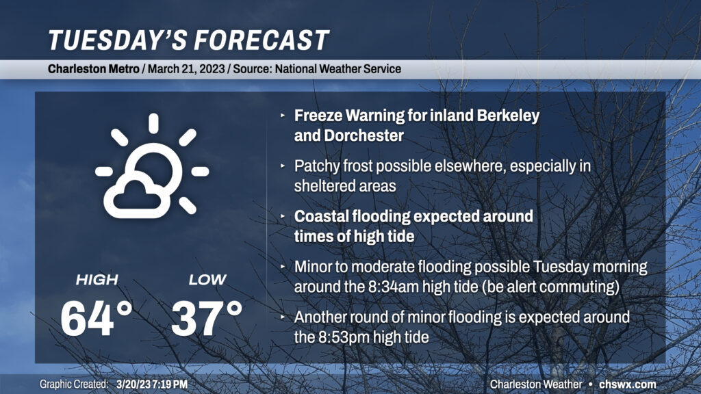
Welcome to Spring! A Freeze Warning is in effect for inland Berkeley and Dorchester overnight into Tuesday morning, with a risk for patchy frost in other sheltered spots. This will be the last one of these for a little while, though, as a warming trend commences. It will be subtle on Tuesday, with highs running in the mid-60s as opposed to the low 60s — still well below climatology for this point in March. Skies will generally run mostly sunny with a few more clouds in the afternoon.
Northeasterly winds and the new moon will combine to produce tidal flooding during the Tuesday morning commute. Water levels could approach 7.3-7.5′ around 8:34am, which should be enough to close a couple roads in downtown Charleston. Be ready for delays if downtown is in your plans, particularly the west side of the peninsula.
First off: If you’re heading out tonight, expect the rain to stay away from Charleston proper until around midnight. It may begin to rain earlier the further inland you are, though, so keep rain gear handy just in case.
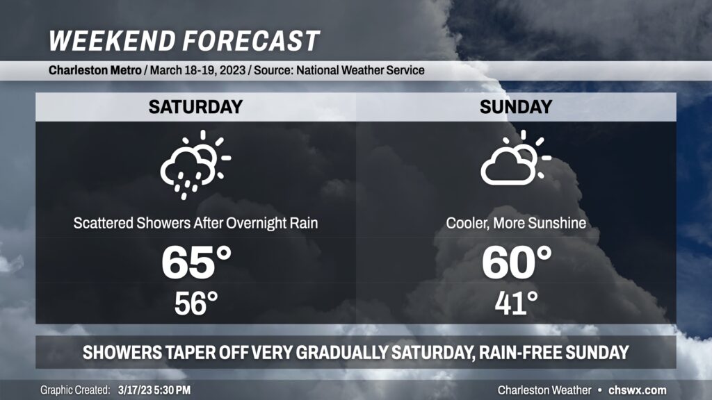
A cold front will come through the area early Saturday, putting an end to the brief warmup that closed out the work week. Lows will run in the mid-50s, but highs will only top out in the low to mid-60s in the afternoon. The bulk of the rain falls overnight, but scattered showers — and perhaps an embedded downpour or two — will remain possible through mid-afternoon, it looks like. A shower may not be completely out of the picture into the evening hours. With that in mind, I don’t see tomorrow as a total rainout — suspect most of us will get a fair bit of rain-free time in.
Sunday will be much cooler as high pressure continues to build in from the west. Despite more sunshine, highs will struggle to 60° as cool air continues to blow into the area from the north, with wind speeds generally around 5-10 MPH.
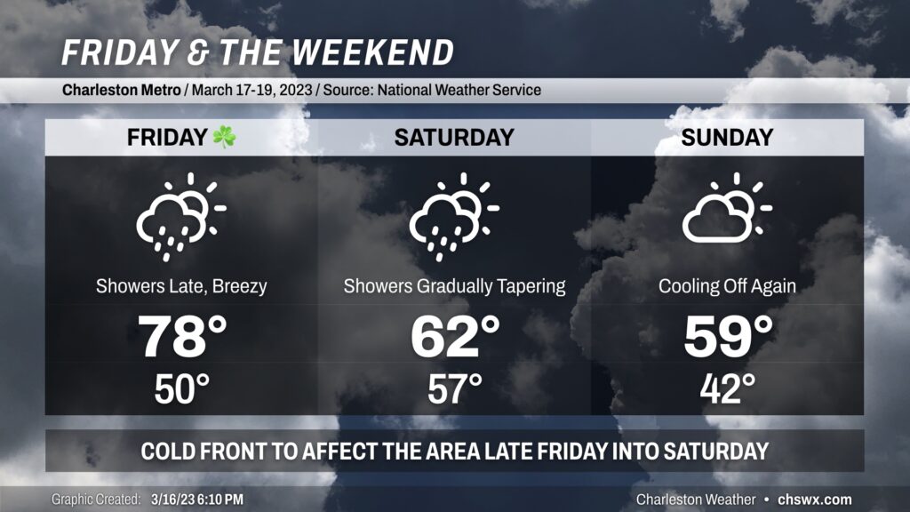
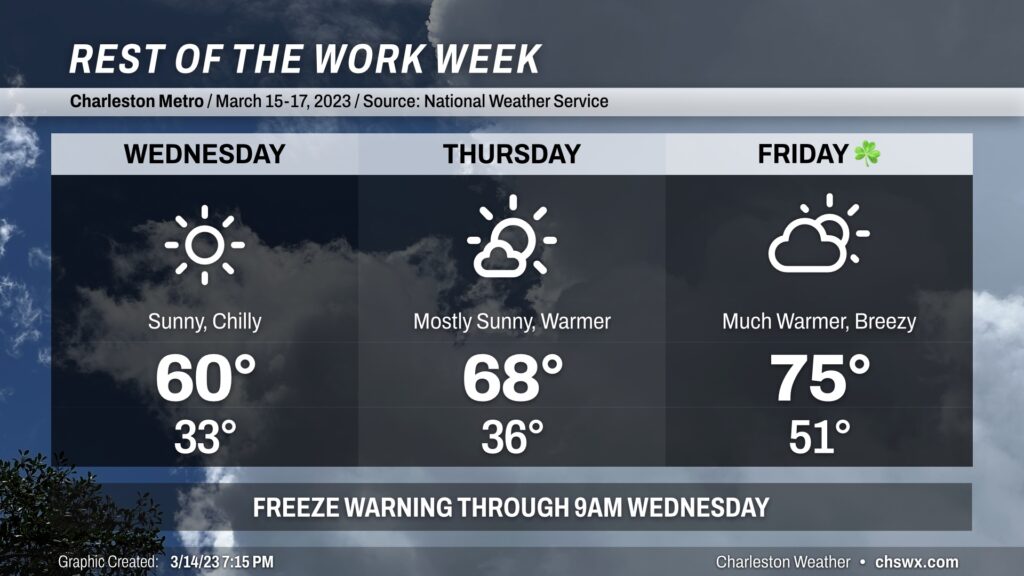
St. Patrick’s Day will be a warm one as southerly winds pick up ahead of a cold front. Gusts 20-30 MPH will be possible at times especially in the afternoon, which may have impacts on any outdoor activities. Expect highs almost 10° warmer than Thursday as they top out in the upper 70s. Increasing cloud cover will likely be the only thing keeping us from a run at 80°. We look to get much of the day in rain-free, though shower chances will be on the increase after sunset as the front draws closer. If your St. Patrick’s celebration extends into the night, you’ll want to keep rain gear handy.
Showers continue into Saturday morning as the front moves by. Scattered showers may continue to be an issue into Saturday evening, though I don’t see the day as a total rainout. Keep rain gear handy just in case, though. Highs look a lot different Saturday, with low 60s at best behind the front.
Skies go partly cloudy on Sunday with temperatures heading back below mid-March normals — struggling to 60° — as high pressure builds back into the area. We look to stay rain-free Sunday, so as long as you’ve got a jacket, the weekend isn’t a total wash.
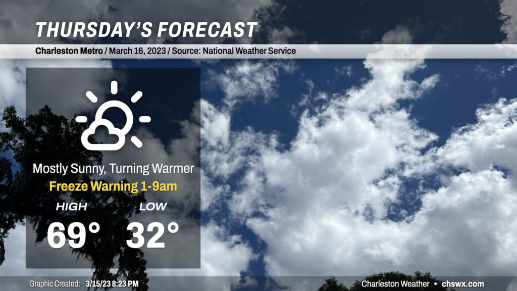
Be sure you’re protecting pets and plants tonight as another period of freezing temperatures will be possible across the metro away from the coast. Even where temperatures don’t dip below freezing, calm winds will make for much more favorable conditions for frost to develop. So, regardless of where you are, be sure to cover those sensitive plants and have loved ones in and warm.
Thereafter, a warming trend will commence as high pressure starts to slip offshore, turning winds a little more southerly. We’ll see highs top out very near 70° on what should prove to be a nice Thursday across the metro area. A few more clouds will begin to fill in later in the day ahead of a cold front.
A Freeze Warning is in effect tonight across the Charleston metro area. Protect sensitive plants and bring in your pets tonight. We should stay just above freezing closer to the coast, but some frost can’t be ruled out. Best bet is to err on the side of caution and go ahead and protect that vegetation.