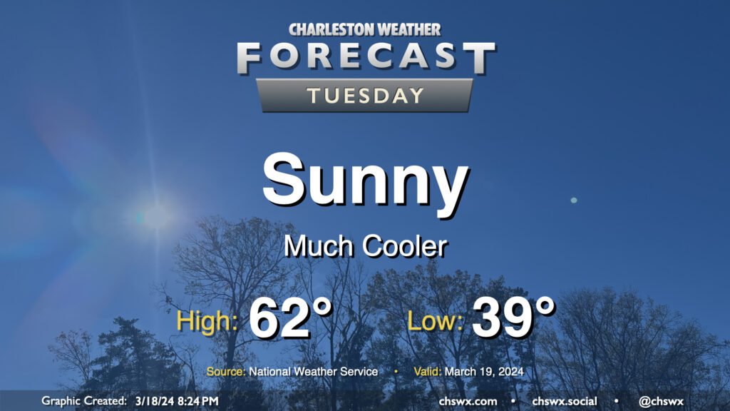
After the past couple weeks of warmth, Tuesday might come as a bit of a shock as lows dip into the upper 30s across a good bit of the metro to start the day as cool high pressure builds in throughout the day. Temperatures will only get into the low 60s, far below normal for mid-March (the normal high for March 19 is 71°). At least the sun will be out, and the March sun angle should make these cooler-than-normal temperatures feel pretty decent.
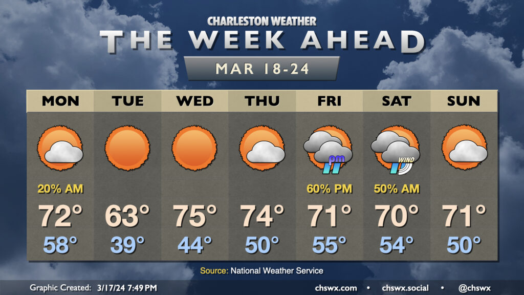
The week ahead starts off with the aftermath of a cold front, but that won’t be felt long as temperatures head right back toward, if not slightly above, mid-March norms as astronomical spring begins.
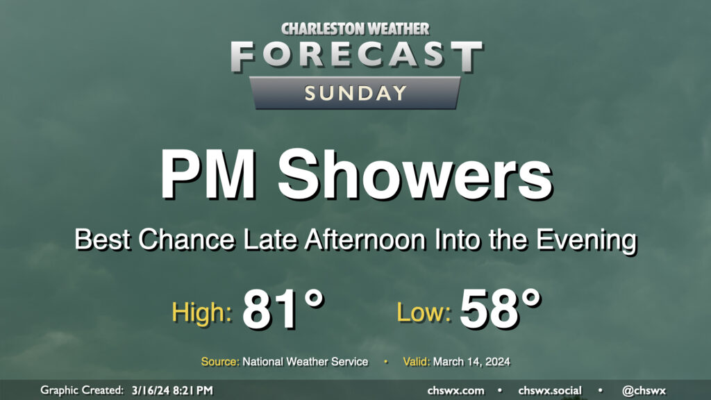
We have one more rather warm day ahead for St. Patrick’s Day, but changes are coming as a front moves into the area late Sunday. Showers will kick up along with this front, and while we’ll get much of Sunday in rain-free, the risk for showers increases later in the afternoon through the evening. Temperatures on Sunday start in the upper 50s, warming to the low 80s despite increasing cloud cover ahead of the unsettled weather.
The front will clear the area early Monday morning, leaving behind much cooler temperatures in its wake. Tuesday may be particularly chilly as highs only get to the low 60s, but we’ll rebound quickly for the second half of next week (though staying well south of the 80s).
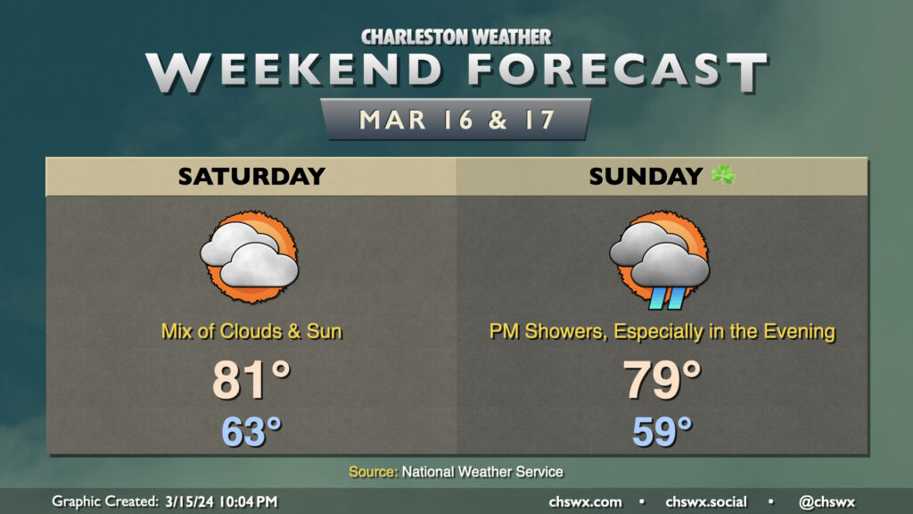
The weekend won’t be the sunniest, but it’ll still be on the warm side for a couple more days before a Sunday night cold front resets the needle a bit on this recent period of warmth.
We narrowly missed a record high on Friday; it was 86° at the airport, with the record of 87° set in 1967 getting a little nervous this afternoon. It won’t be quite as warm on Saturday with more in the way of cloud cover as a front lingers nearby, but we should still make it to the low 80s in the afternoon with a mix of clouds and sun. Showers look unlikely at this juncture as we sit in a lull between disturbances.
We’ll get St. Patrick’s morning in generally on the dry side (and a touch cooler too with lows in the upper 50s vs. Saturday’s low 60s), but showers should begin to increase by afternoon as the aforementioned cold front gets closer. By evening, expect a fair bit of shower activity to overspread the area. This should last into the overnight before tapering off by Monday morning, which will kick off a week of weather featuring temperatures much closer to mid-March norms.