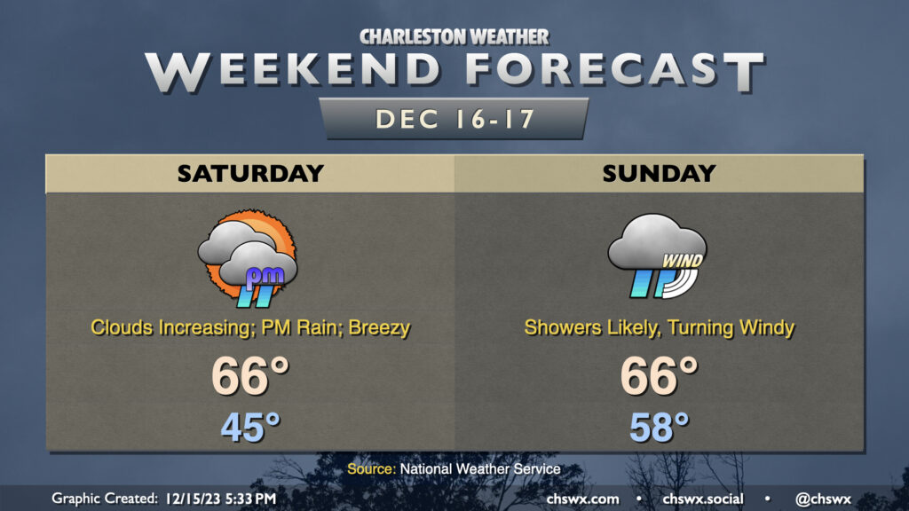
Sunday: Nor’easter impacts peak with heavy rain, gusty winds, and coastal flooding
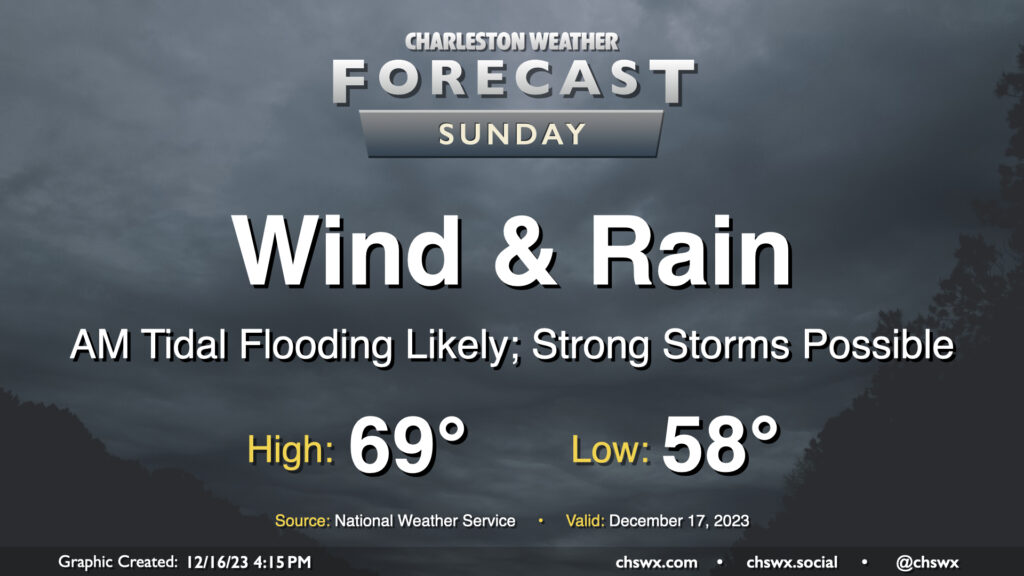
A fairly lousy and potentially high-impact weather day lies ahead for Sunday as a strengthening nor’easter moves along the coast. Wind and rain will begin to pick up early Sunday morning, with gusts near 45 MPH at times (and potentially even higher on bridges and overpasses). Rainfall could turn out to be quite significant, especially within any thunderstorms that can fire; before it’s over, many of us could see 3-5″ of rain with even higher amounts in some spots. Flooding is increasingly a concern as a result, especially with the potential for an 8′ water level around the 11:17am high tide coinciding with continued heavy rain. Finally, if surface-based instability can develop, a severe thunderstorm or two with locally damaging wind gusts and maybe even a tornado could be possible. All this to say that Sunday’s a good “stay inside” day.
Read more »