Charleston Weather Blog

Forecast explanations, atmospheric science, and other cool weather-related stuff for Charleston, SC

The week ahead: Cooling back off with a couple shots of rain

/ December 13, 2020 at 10:33 PM

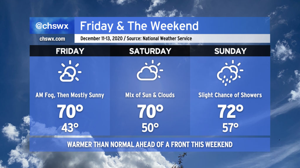
After what ended up being a fairly nice weekend, we have one more day in the 70s before we’re back to more seasonable — if not a bit below-normal — temperatures across the Lowcountry for the last full week before Christmas. (Yes, it’s almost Christmas. It’s shocking to me, too.)

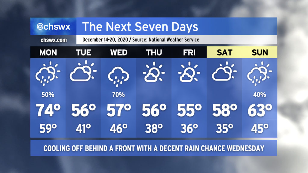
A cold front will swing through Monday, bringing a chance of showers to the area generally from mid-morning to early afternoon. High pressure will wedge in behind it, cooling us off but also keeping some cloud cover around for Tuesday. Another storm system will ride up the coast Wednesday, potentially turning into a decent nor’easter for the Mid-Atlantic states and New England. We’ll see mostly sunny skies with continued chilly temperatures to close out the work week. Clouds increase for the weekend, with perhaps some showers on Sunday.

Read more »

Friday and the weekend: Warm, with slight shower chances Sunday

/ December 10, 2020 at 9:44 PM

We’ve got a warmer-than-normal weekend ahead of us as high pressure slips offshore and a cold front approaches from the west.

Friday will remain mostly sunny after some patches of possibly dense fog in the morning. Highs will top out right around 70°, making for a nice afternoon across the area. Similar temperatures are expected Saturday despite more cloud cover. A slight shower chance comes into the forecast late Saturday, continuing into Sunday. Temperatures will top out in the low 70s on Sunday ahead of the cold front.

No washout is expected this weekend — just keep rain gear handy in case a shower comes through. The majority of the rain associated with the front will come through Monday, with the heaviest rains looking to remain to our north.