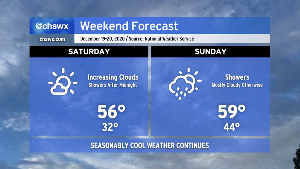
If you want to get outside a bit this weekend and enjoy some legitimate sweater weather, Saturday is the day to do it — we’ll have a mix of sun and clouds with highs topping out in the mid-50s. Rain should hold off until after midnight, with periods of showers in the cards for Sunday. It’ll be a touch warmer despite the rain, but temperatures will continue to run below normal through the last shopping weekend before Christmas.
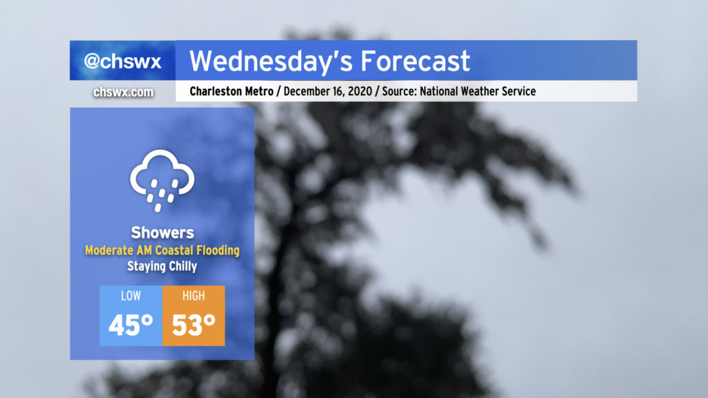
This evening, a coastal low is beginning to develop off the Georgia coast. This low will move northward tonight into tomorrow, eventually turning into quite the nor’easter for New England. Locally, expect periods of showers to continue tonight into Wednesday as the low lifts northward and a cold front approaches from the west. Temperatures will remain chilly, only topping out in the low 50s in the afternoon. The front will clear the area during the evening, giving way to drier air for Thursday.
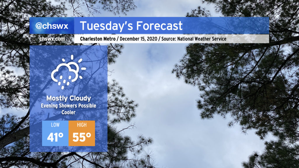
Clouds will increase overnight into Tuesday morning, giving the day a mostly cloudy look with just a few peeks of sun possible in the morning and early afternoon hours. It’ll feel noticeably colder in the wake of today’s cold front — highs should only top out in the mid-50s.
As low pressure organizes off the coast and begins to move northward, some overrunning should take place, generating scattered light showers across the area by mid-afternoon. Showers will continue into the evening, with the best rain chances arriving with the cold front Wednesday.