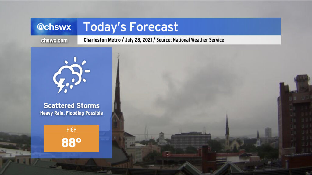
Today will continue to feature scattered showers and thunderstorms, especially this morning as slow-moving storms develop and move in from the west. Flooding will certainly be a concern wherever thunderstorms set up and rain for long periods. The next high tide will be at 12:07 PM.
It won’t rain all day, however; high-res models have this batch of storms eventually fizzling out by early this afternoon. Another round of storms could fire along the coast this evening, and this may drive additional heavy rain concerns before departing later tonight.
This will be our last day in the 80s until next week; the hottest temperatures of the season will begin Thursday and last into Sunday with highs well into the 90s and heat indices approaching 110°. (More on that later today.)
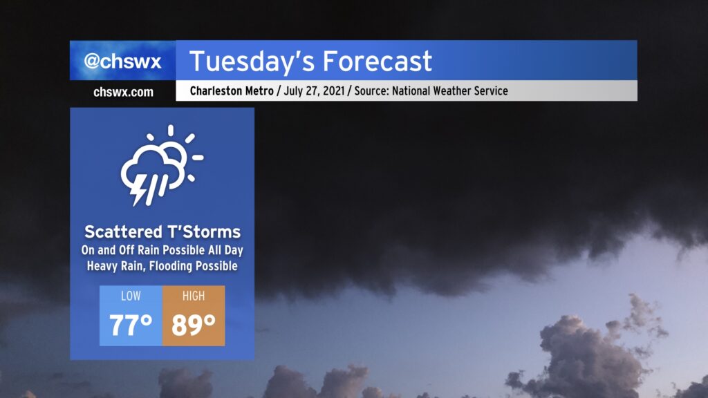
We’ve got a muggy and potentially soggy Tuesday ahead. While it won’t rain all day, expect plenty of shower and thunderstorm coverage to bring just about everyone some rain at some point tomorrow. Given plentiful tropical moisture, some of this rainfall could become quite heavy at times, leading to the potential for isolated bouts of flooding where the heaviest rain falls. Heavy rain will be possible possibly as soon as shortly after daybreak, similarly to today, as it likely won’t take much heating to start convection. We’ll want to watch the 11:18am high tide closely as high-resolution guidance suggests storms in the area around that time.
Temperatures will remain on the warm and muggy side. We’ll start in the upper 70s across much of the area, with 80° lows possible along the coast and in downtown Charleston. Highs will only top out in the upper 80s given the expected shower and thunderstorm coverage.
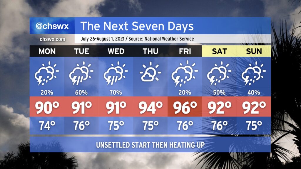
High rain chances continue into Wednesday before moisture departs and we heat up for Thursday and especially on Friday, which could be the hottest day of 2021 thus far if the forecast of 96° remains on track. Stay tuned.
After a very rare weekend of relatively low humidity (for late July, anyway) we’ll see dewpoints return to the low to mid-70s as tropical moisture builds back into the area. Monday will feature isolated showers and thunderstorms primarily driven by the seabreeze, but as we get into Tuesday and Wednesday, a low pressure system — labeled by the National Hurricane Center as Invest 90L with a 50% chance of tropical development — will be approaching the coastline as we get into mid-week. Regardless of what it ends up doing from a tropical standpoint, it will enhance our shower and thunderstorm chances Tuesday and Wednesday, particularly in the afternoons. Temperatures will top out in the low 90s each day.
As we get closer to the end of the week, the strong high pressure over the central US noses its way into the eastern US. This, in turn, will drive down rain chances and drive up temperatures. Temperatures should top out in the mid-90s Thursday and Friday.
Owing to just how “mild” this summer has actually been, the hottest it’s been this year is 94°, which we’ve reached three times (twice in May and last on June 15). If Friday’s forecast of 96° verifies, that will be the warmest we’ve been all year.
By the weekend, we could see an uptick again in showers and thunderstorms as the ridge backs off a little bit and we get underneath some northwest flow aloft. NWS noted in its afternoon discussion that this could open up the pathway for summer thunderstorm complexes — the technical term for which is “mesoscale convective system” — to roar through the area starting this weekend. Something to watch, but nothing we need to be overly concerned about right now.
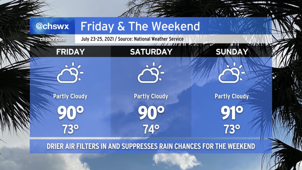
After another day of very heavy rain in the Charleston metro area — this time in West Ashley — we mercifully get Friday and the weekend to dry out a little bit as a front sags south of the area, turning winds to the east and northeast. This will keep temperatures right around, if not slightly below, late July normals. Heat indices will even be reasonably in check — upper 90s on Friday, but down to the mid-90s for Saturday and Sunday.
With the drier air comes a little less cloud cover and far lower shower and thunderstorm chances (though I suppose you can never totally rule out an afternoon shower or storm in late July). Wildfire smoke transported all the way from the western U.S. looks to filter into the area starting tonight and will last for the next few days. This will make for some interesting sunrises and sunsets. It doesn’t look like this smoke will be close enough to the ground to cause any major air quality impacts, at least right now. We’ll keep an eye on this in case it changes, but for now, good air quality is in the forecast for Friday.
We’ll also want to keep an eye on the risk for salt water flooding with the evening high tides this weekend. Onshore flow will combine with astronomical influences to produce a few rounds of sunny-day flooding through at least Sunday. Be ready for coastal flood advisories and possibly some closed roads due to salt water on the roads. Fortunately, we don’t look to have much if any rain on top, mitigating a more serious flooding issue.
All in all, it’ll be a pretty good July weekend — I hope you can take advantage.
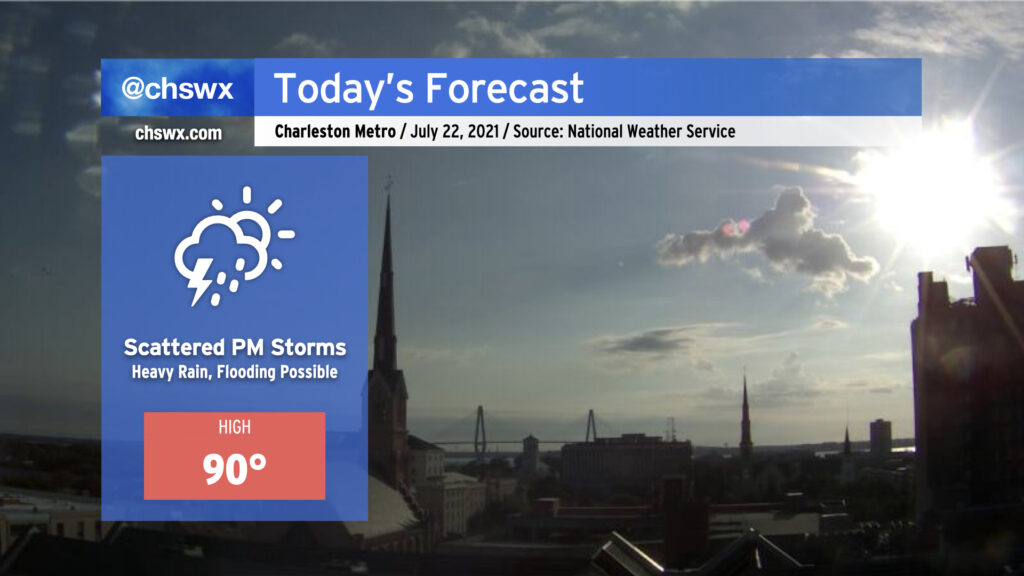
We start this Thursday with temperatures already approaching 80° as of 8am. Highs around 90° look to be common before showers and thunderstorms erupt this afternoon.
Today’s setup could portend a flooding event in downtown Charleston this afternoon and evening. Westerly winds look to pin the seabreeze closer to the coast, and with a front advancing from the north, there will be numerous focal points for showers and thunderstorms to develop. Atmospheric moisture is readily available, with precipitable water values running over 2″ once again today (anything 2″ or over generally requires more scrutiny for flooding). Finally, we are in a king tide period, and this morning’s thinking from NWS on tonight’s high tide is that it will fall just short of the 7′ level at which sunny-day salt water flooding typically begins. (It may yet be high enough, though, to begin to produce some flooding on Fishburne and Hagood.)
Guidance suggests that showers and thunderstorms generally should start to form between 1-3 PM. Storm motions will approach the coastline today, and with a seabreeze trying to push the opposite direction, this certainly invites concern about heavy rainfall stalling out for a period of time. The high-resolution model ensemble this morning once again paints a 30% chance of 3″ of rain in 3 hours across the metro area this evening, further lending credence to this concern. While this isn’t a slam dunk, it’s important to keep an eye on the weather today as impacts to the evening commute are certainly in the cards. More on this later today — stay tuned.