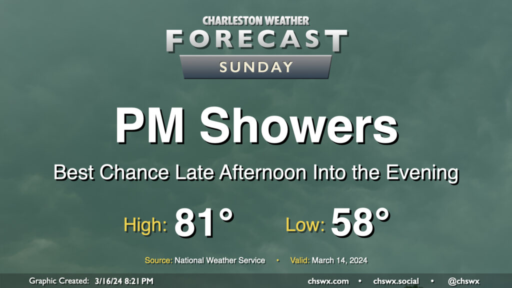
We have one more rather warm day ahead for St. Patrick’s Day, but changes are coming as a front moves into the area late Sunday. Showers will kick up along with this front, and while we’ll get much of Sunday in rain-free, the risk for showers increases later in the afternoon through the evening. Temperatures on Sunday start in the upper 50s, warming to the low 80s despite increasing cloud cover ahead of the unsettled weather.
The front will clear the area early Monday morning, leaving behind much cooler temperatures in its wake. Tuesday may be particularly chilly as highs only get to the low 60s, but we’ll rebound quickly for the second half of next week (though staying well south of the 80s).
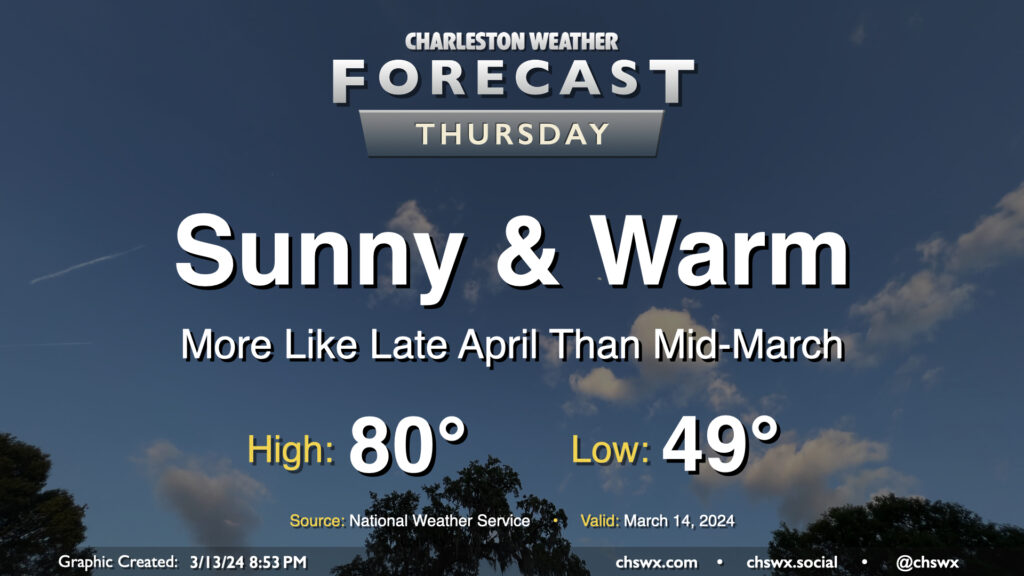
Thursday looks like an excellent weather day across the Lowcountry, something out of the late-April playbook but in mid-March. We’ll start the day around 50° once again, warming to the low 80s in the afternoon with maybe a few clouds amongst otherwise clear skies as ridging aloft strengthens briefly for the day. Expect winds generally in the 5-10 MPH range, picking up a little in the afternoon in the wake of a sea breeze. Enjoy!
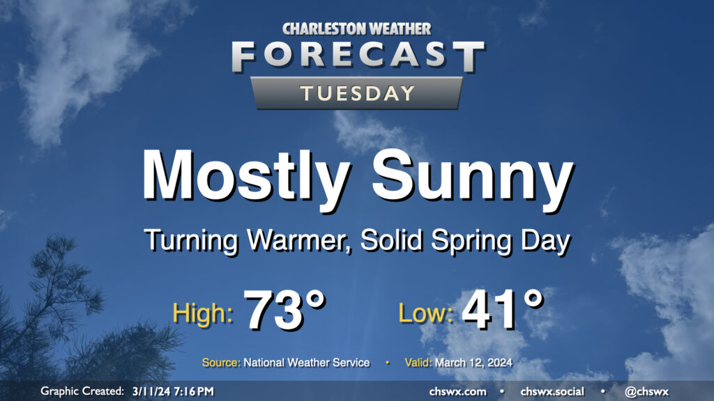
After one more somewhat chilly night — expect low 40s across much of the metro, with mid-to-upper 30s possible further inland — we start a warming trend that’ll get us into the 80s by the end of the week. Tuesday looks rather delightful: expect highs to top out in the low 70s away from the locally cooler coastline. Comfortably dry air will be in place with relative humidity bottoming out around 30% in the afternoon, and we’ll keep a solid amount of sunshine throughout the day. Winds will start to swing more southwesterly in the afternoon and kick up to around 5-10 MPH. Not bad!
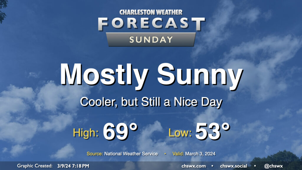
After the cold front that helped instigate quite a busy morning of weather gets offshore, we end up with a rather nice Sunday as cloud cover clears out, leaving mostly sunny skies in its wake. Temperatures will start in the low 50s and warm to the upper 60s to around 70° in the afternoon. The only fly in the ointment will be the breeze: expect gusty conditions throughout the day as high pressure builds in, with winds 10-15 MPH perhaps gusting to 25-30 MPH at times.
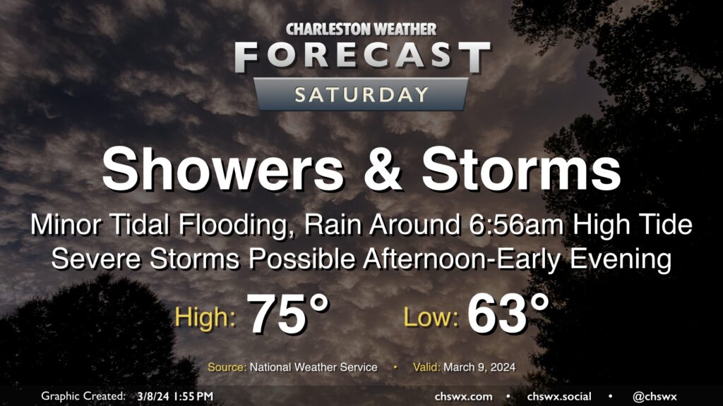
After one round of thunderstorms moved through Wednesday, a second round of unsettled weather, featuring potentially flooding rains in the morning and severe thunderstorms in the afternoon, lies ahead on Saturday.
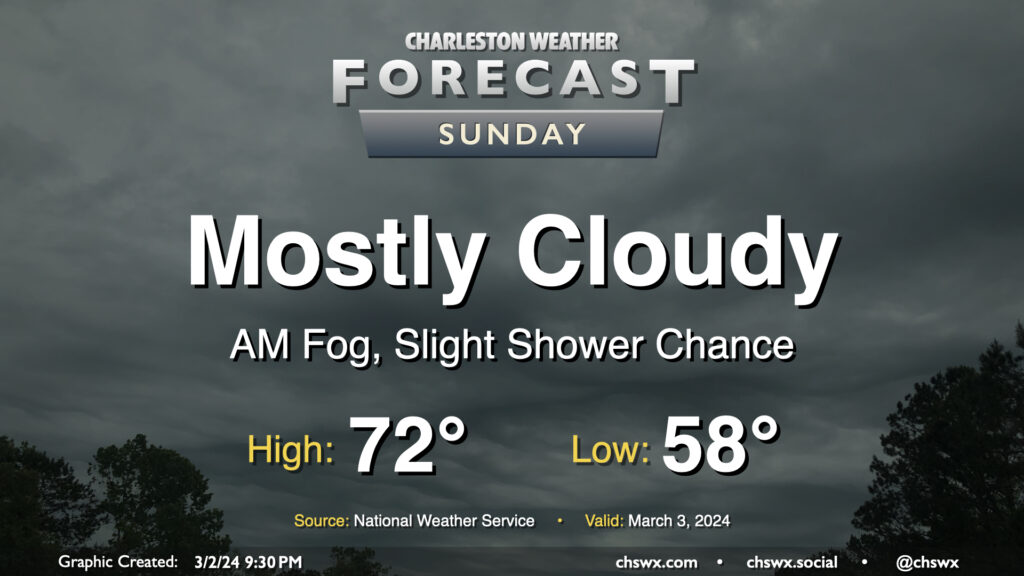
Clouds will continue to hang around on Sunday with the specter of a shower or two remaining in the forecast. We’ll likely start the day with patches of potentially dense fog at times, so be ready for low visibility in the morning. The fog’s expected to mix out shortly after daybreak, leaving behind generally overcast to mostly cloudy skies for the remainder of the day. It’ll be a warm start, with temperatures in the upper 50s yielding to highs in the low 70s in the afternoon. As mentioned, a few showers are possible, but it’s quite possible that much of us get the day in rain-free. Still not a terrible idea to keep rain gear handy, though, just in case.
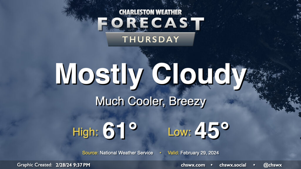
We’ll wake up to much cooler air on Leap Day as a cold front will be long-gone by Thursday morning. Temperatures will start in the mid-40s, warming only to the low 60s at best as high pressure wedges into the area. We’ll get some peeks of sun at times, but the mid-and-high cloud deck will prove formidable. It’ll be a breezy day as well, especially in the early going. By evening, we will start to see more in the way of low-level moisture return to the area, which could bring a few showers late Thursday.
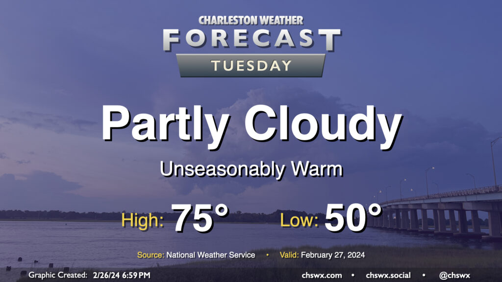
We turn even warmer on Tuesday as high pressure moves further offshore and more warmer air is drawn northward. Temperatures start several degrees above normal, generally in the low 50s (and even warmer closer to the coast). From there, we’ll head well into the mid-70s in the afternoon despite an uptick in cloud cover compared to Monday as a disturbance moves by to the north. We’ll stay out of the rain, though. Winds will run a little on the breezy side as well, but nothing too crazy.
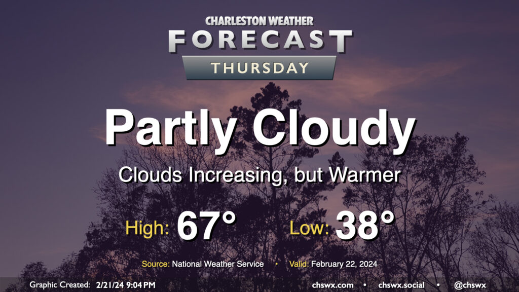
One more quiet day of weather lies ahead before a brief round of rain for Friday. Temperatures on Thursday start in the upper 30s — still running a little below normal for this point in February — but warm to the mid-to-upper 60s in the afternoon as southerly flow moderates the airmass a little bit more. We’ll start the day on the clear side, but clouds will gradually increase ahead of a cold front that’ll affect the area on Friday with the first shower chances in a few days.
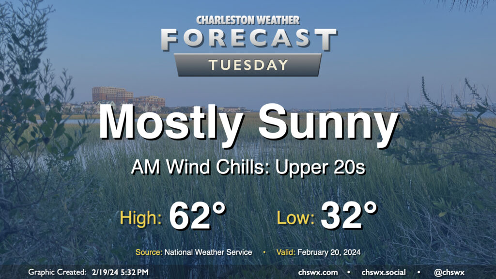
We have a chilly night ahead as clearing skies and light winds allow for good radiational cooling conditions. This should allow morning lows on Tuesday to reach freezing for the first time since January 22, when we started the day at a frigid 23°. It won’t be quite as cold — freezing temperatures in the metro would be relatively short-lived — but with some light wind in the morning, it’ll feel more like the upper 20s as we get back to regular order after Washington’s Birthday. There will be plenty of sunshine, though, and that’ll help counteract some cooler air continuing to filter into the area, allowing highs to top out in the low 60s once again.