We set a record high today at downtown Charleston: 80° broke the record of 79° set in 1976. We’ll get a brief interlude in the warmth Friday as high pressure wedges southward across the area, turning winds more northeasterly and kicking up the cloud cover to keep temperatures running about 15-20° cooler than we saw today. Moisture is scant, though, so no rain is expected — we’ll just be chilled out briefly before the wedge front lifts northward on Saturday, returning us to the 70s and 80s for the weekend. We remain rain-free through Tuesday before the pattern turns more unsettled as we get deeper into the next work week.
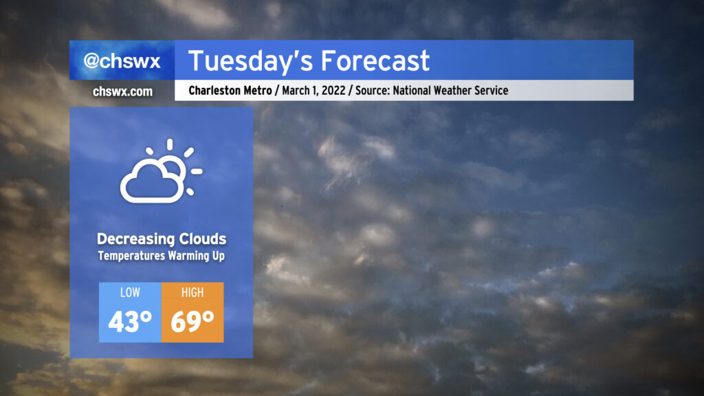
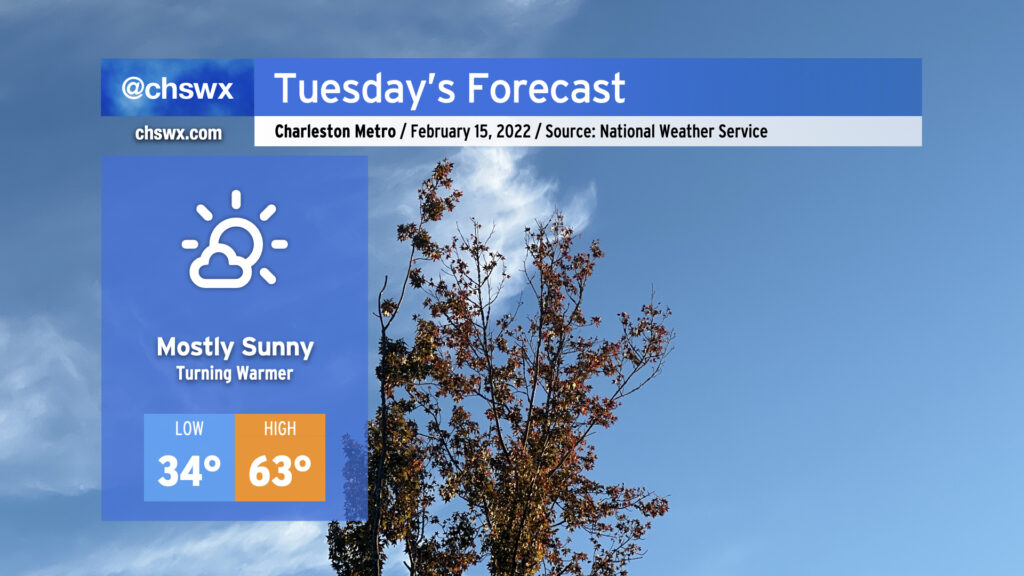
Tuesday looks to be a rather nice day across the area as early cloud cover moves away in the afternoon, yielding temperatures in the upper 60s to around 70° as more sunshine begins to filter in. High pressure will be building in and taking residence over the area for several days, which will keep fair and increasingly warm weather in the forecast as we kick off meteorological spring, which runs from March 1 to May 31.
The only weather-ish concern will be the risk for some minor coastal flooding with the ~7am high tide Tuesday. Water levels could peak around 7.0-7.2′, putting some salt water on vulnerable roadways particularly on the western side of the peninsula near the Joe and MUSC. Any flooding should be relatively short-lived, and with winds shifting offshore after tomorrow, the risk for coastal flooding will end just as quickly as it arrived.
We’ll run a little cloudier and cooler on Sunday as increased moisture and an approaching upper-level system come together across the area. There will be some breaks in the clouds from time to time to let some sun peek through, but overall expect highs to top out in the low-to-mid-60s. Rain should hold off until after dark when the best ingredients pass by, though, so you should be able to get at least a fair bit of Sunday in rain-free. If you’ve got outdoor activities in the afternoon and evening hours, monitoring radar trends for a few showers is a good idea, but there are no other major concerns with the forecast.
Wednesday was a very unusually warm February day in the Lowcountry. The high of 86° handily obliterates the daily record for February 23 of 82° set in 2018, but today also marked just the fourth time since records began in 1938 that the high temperature reached 86° in February. Previously, this happened on February 25, 2018, February 16, 1989 (when the high was 87°, setting the all-time February record), and February 28, 1962.
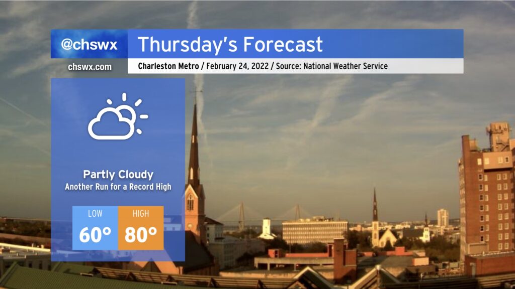
We look to take another trip into the 80s tomorrow. While surface flow coming a touch more off the Atlantic may modulate temperatures a bit, it is still certainly possible we may at least tie the daily record of 83° set in 2018. Fog may be a greater issue tonight and tomorrow morning, though, with lighter winds making for more favorable conditions for fog development. This fog could be dense, so be ready for visibility restrictions as you commute Thursday morning. The slightly more onshore trajectory could also help spread sea fog inland later in the day, which would have a chilling effect on temperatures as well. As usual with our weather, there’s so many variables to watch, even when there’s no precipitation involved. But regardless, prepare for another absurdly warmer-than-normal February day.
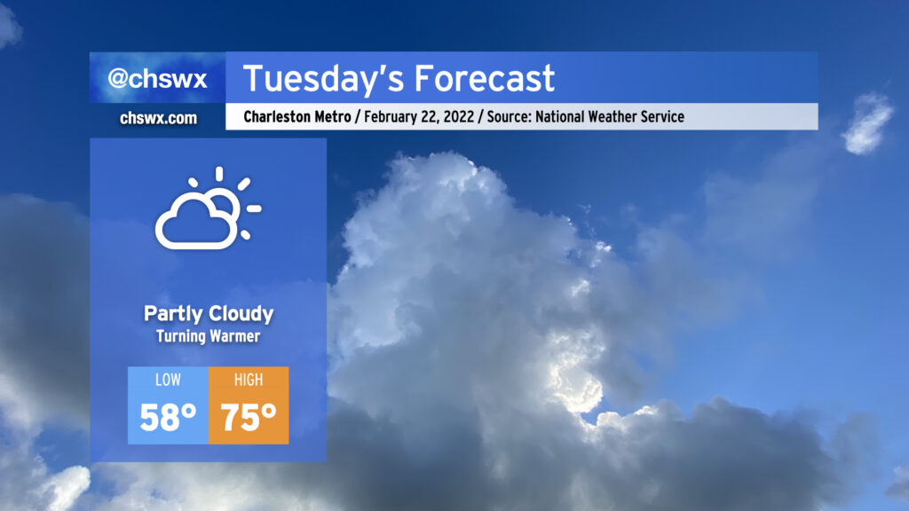
Atlantic high pressure remains the main weather feature as we head into Tuesday. This will keep partly cloudy skies in the forecast and allow temperatures to warm well into the 70s in the afternoon. Temperatures will really begin to ramp up starting Wednesday as a cold front stalls nearby, with highs in the 80s expected Wednesday-Friday before the front gets through and cools things right back off for the weekend.
After the possibility of a few showers tonight, we’ll maintain rain-free conditions through at least Friday if not Saturday before the pattern turns cooler and more unsettled as we start to get into next week.
After an unexpectedly wet Wednesday — the product of strong convergence within a moist onshore flow — we’ll turn warmer for Thursday as winds go southerly ahead of the front. Temperatures in the mid-70s appear likely by the afternoon despite mostly cloudy skies. A shower or two can’t be totally ruled out, but the feature that brought us the rain today will not be in place tomorrow.
As the front gets closer later Thursday evening, shower chances will begin to head back up from the west, with the best chances of rain generally around and after midnight into Friday. A rumble of thunder can’t be totally ruled out, but severe weather is currently not expected.
The front gets through Friday with additional showers and maybe a thunderstorm. We then cool off for the weekend, with temperatures returning closer to normal values (low-mid 60s) for this time of year.
After a relatively chilly day to start the work week, we’ll begin to see temperatures rebound beginning Tuesday. Lows will once again scrape freezing in the morning, but we’ll be seeing highs top out in the low 60s in the afternoon with mostly sunny skies expected.
Temperatures continue to head up as the week goes on. Wednesday should scrape close to 70° in the afternoon, then we get warmer Thursday into Friday as a cold front approaches. Looks like our best rain chances for this week arrive beginning Thursday afternoon into Friday as the front gets through the area. More exact timings will become clearer over the next couple days, so stay tuned as those forecasts are fine-tuned. The good news is that the weekend’s weather looks seasonable and quiet, with temperatures within spitting distance of normal and rain-free conditions expected.
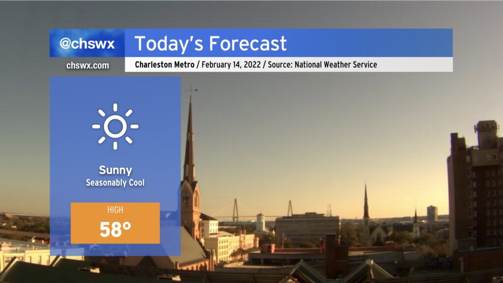
Temperatures are much cooler today in the wake of a cold front that moved by the area yesterday. We’ve started the day in the mid-30s at many spots, and temperatures don’t look to crack 60° this afternoon despite full sunshine. It’s a…erm…lovely day for the cool-weather fans in our midst. Looking for something warmer from Mother Nature? You don’t have to wait long — we’re back in the 70s by mid-week.
After a sunny respite on Saturday, clouds and showers are returning to the forecast for Sunday into Monday as moisture lifts atop a southward-building wedge of high pressure and a trough of low pressure sets up along the coast. Expect showers to develop mostly offshore overnight into early Sunday, with the best chance for any showers to be found near the coast. Many of us could stay dry until Sunday evening, when low pressure developing offshore begins to send more precipitation northward and westward. This feature will keep precipitation in our forecast into much of Monday as well.
Sunday’s going to remain pretty chilly as the wedge builds southward amidst a persistent northeasterly breeze. We’ll start the day in the mid-30s with wind chills dipping into the 20s. Cloud cover will inhibit much in the way of warming, with highs only looking to top out in the low 50s in the afternoon.
While it will certainly feel like there should be frozen precipitation, the good news is that the airmass is just not cold enough to accomplish that. Why is this good news, you ask? Because in these kinds of setups, the most likely frozen precipitation type would be freezing rain. (Gross.)
Hang in there through tomorrow and Monday, though — the rest of the week looks to be rather nice, with temperatures near normal and decent sunshine as high pressure builds in.
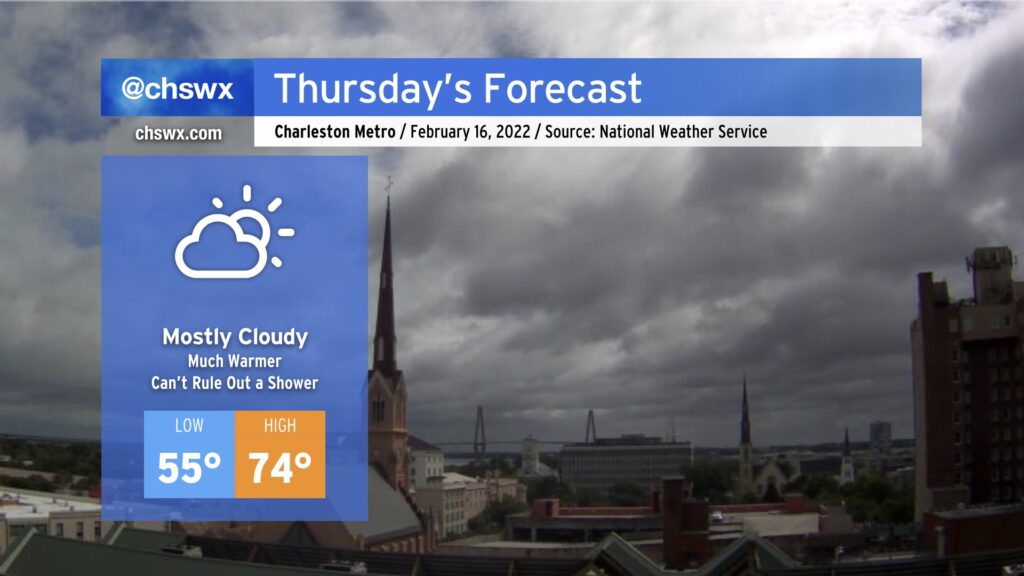
Thursday will offer up an early taste of spring as breezy southerly winds ahead of our next cold front pump warm air into the area. After starting the day in the mid-50s — keeping in mind the normal high for early February is 62° — temperatures will head into the 70s in the afternoon under a mix of clouds and sun. Some of the high-resolution guidance members do show a stray shower or two in the area, but a mostly dry atmospheric column should keep those few and far between.
As mentioned before, it’ll be breezy: southerly winds could gust to about 20 MPH or so at times during the day, so keep this in mind if you’re thinking about an outdoor lunch.
There remains an outside shot at some coastal flooding again Wednesday morning, but the more southerly flow should help keep any tidal flooding relatively minor. Still, watch out around the 9:39 AM high tide for a few salt water-covered roads in vulnerable spots, particularly near MUSC and The Citadel.