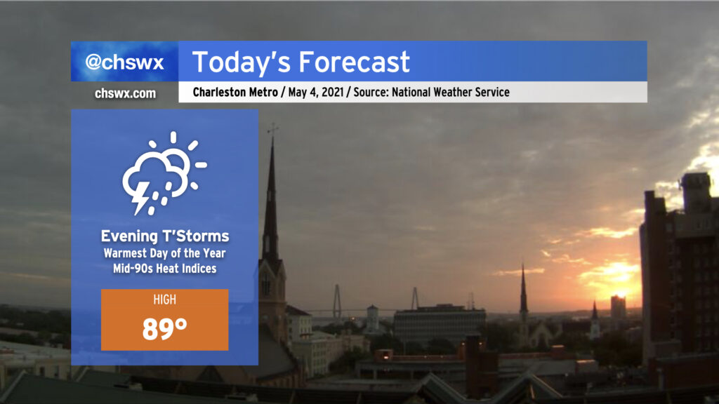
After the high topped out at 88° yesterday, we look to take at least one step closer to 90° today with another very summer-like day ahead. Humid air will allow heat indices to head up into the mid-90s for the first time this year. We’ll stay dry for much of the day absent any triggers for thunderstorm development, with our best chance of showers and thunderstorms coming later this evening (much like last night). Once again, we’ll be looking to our west throughout the day to nail down timing of any showers and thunderstorms that impact the area. Much like last night, there will be a damaging wind risk as well with the strongest thunderstorms, so keep an ear out to forecast updates throughout the day.
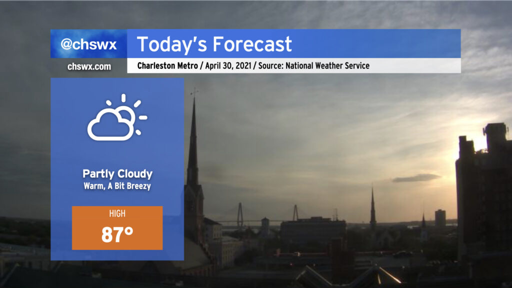
This morning, we find a cold front moving into the Upstate of SC. Said front looks to cross the area this afternoon with mostly little fanfare; expect mostly clear skies by sundown. Despite the front, today will be the warmest day of the week as deep downslope flow in the wake of the front allows temperatures to warm into the upper 80s. Dewpoints will trend downward, though, and it will feel pretty good outside despite the higher heat to close April. The weekend looks pretty good, with an especially nice day coming up on Saturday — more later today!
We’re going to feel a little more like late May than late April tomorrow as high pressure slides a little more offshore with strong ridging remaining aloft. Humidity creeps up a little bit, and with a little compressional warming beginning ahead of a cold front, temperatures will get into the mid-80s in the afternoon. We will remain rain-free for at least one more day given the ridging aloft; with only a slight chance of thunderstorms on Friday as the front swings through, it is conceivable we will stay rain-free through the weekend as high pressure builds back in behind it, cooling things off a little for Saturday.
Minor coastal flooding will remain an issue with the evening high tides through Friday. Winds will then shift offshore and lingering astronomical influences will wane, ending this cycle of coastal flooding.
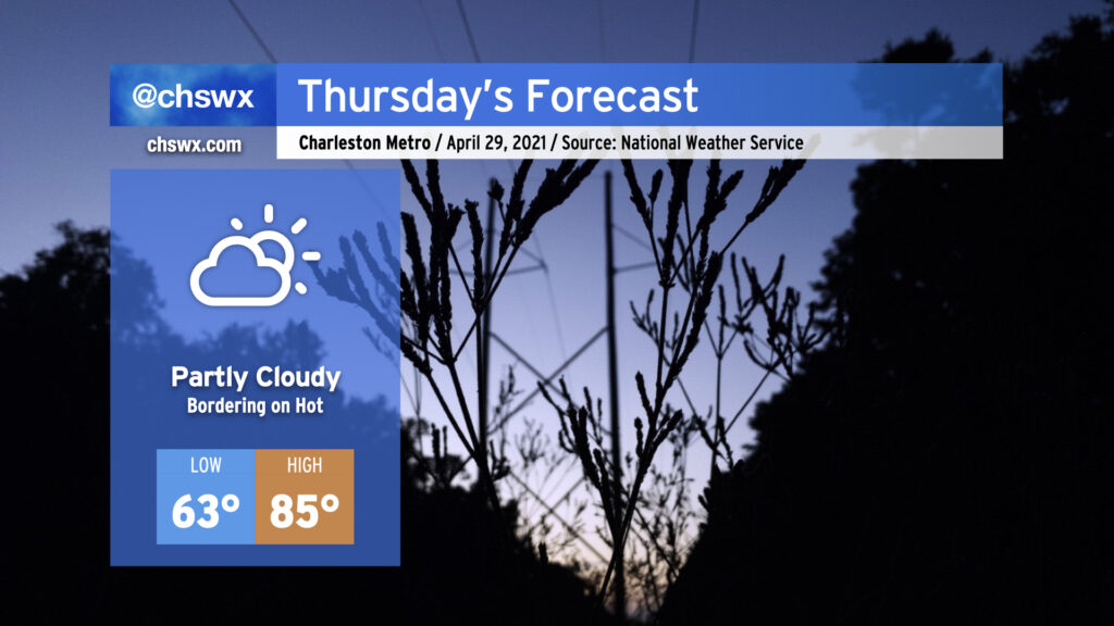
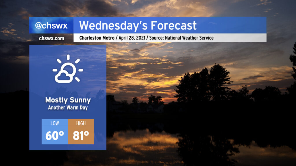
If you liked today, you’ll like Wednesday — we’ll get back up into the low 80s under mostly sunny skies. Temperatures will run a little warmer in the morning thanks to a little more cloud cover overnight, but will still be largely comfortable around 60°. The warming trend continues into Thursday, when we’ll reach into the mid-80s across the area ahead of a cold front. Said front looks to bring some showers and thunderstorms into the forecast for Friday, but the exact details of how rain will go down are still a little iffy. Stay tuned.
Coastal flooding will remain a concern with the 10:10 PM high tide Wednesday night as lingering astronomical influences and onshore flow persists. We’ll likely have another Coastal Flood Advisory as a result.
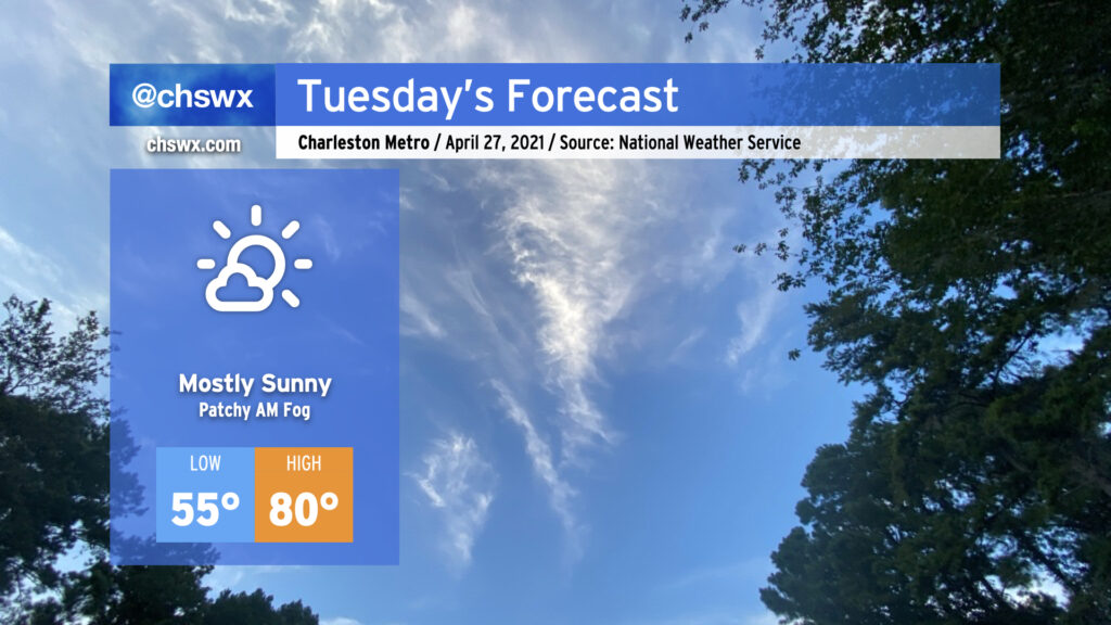
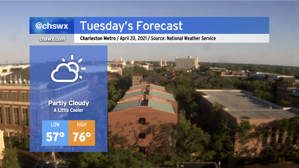
We’ve got another nice day ahead on Tuesday with high pressure remaining in control both at the surface and aloft. Temperatures will start in the mid-50s before rising to about 80° in the afternoon (it’ll run a few degrees cooler at the beaches) under mostly sunny skies. There could be a few patches of fog in the morning, but nothing too out of band.
We’ll want to keep an eye on high tide Tuesday evening for another round of minor tidal flooding. High tide is expected around 9:18 PM, and water levels could approach 7.2′. Be ready to reroute in case roads close or are otherwise covered with water.
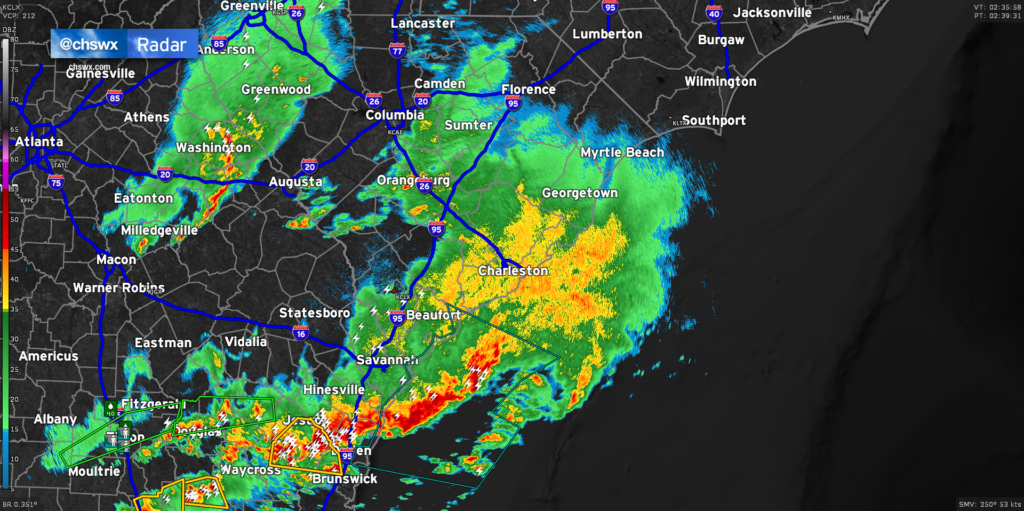
Radar continues to show light to moderate rain moving across much of the Lowcountry late this evening, with some embedded pockets of heavier rain. Showers and a few thunderstorms will remain possible for the next couple hours before tapering off after midnight. Most of this should be out of here by 2-3am.
The risk for severe weather has ended across the Charleston Metro Area, and tide levels continue to retreat after peaking shy of 6.4′ MLLW earlier this evening, so there are no further major weather concerns tonight.
Many spots saw over 1″ of rain based on reports. It’s much-needed, and it’s sure great to get it without all the extracurricular activity. We’ll have a few days to dry out before the next risk for rain arrives later next week.
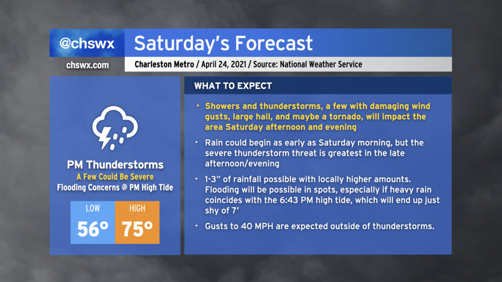
Today marks 23 days without measurable rainfall at the airport. This is the driest start to April since 1976, when it took until the last day of the month to record some measurable rainfall. We will not match that streak this time, though, as a potent storm system will bring us gusty winds, a fair bit of rain, and possibly some severe weather on Saturday.
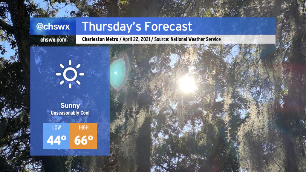
A cold front has gotten through the area this evening, and temperatures are on their way down in its wake. By morning, we’ll be bottoming out in the mid-40s, and you’ll be excused if you’re not quite sure whether it’s late April or not. Despite unencumbered sunshine, temperatures will only reach the mid-60s as chilly high pressure builds in overhead. The April sun angle should still make short sleeves reasonably comfortable, though.
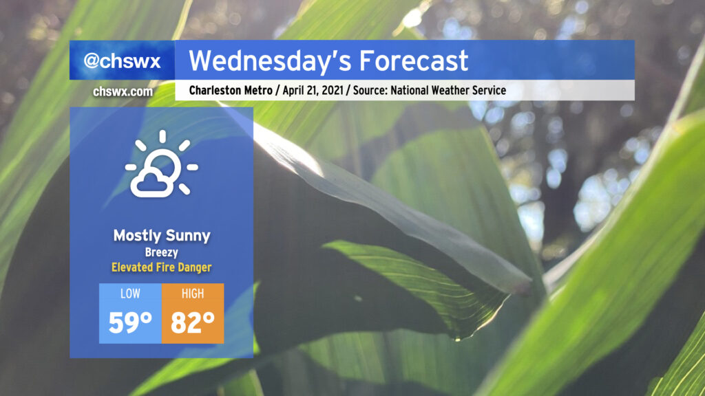
Wednesday promises to be another warm day across the Lowcountry ahead of a cold front. A dearth of moisture will lead to mostly clear skies despite the front, and with winds picking up out of the west due to a tightening pressure gradient (30+ MPH gusts are possible), we will need to keep an eye on the risk for wildfire danger tomorrow given continued dry conditions across the area. Highs will top out in the low 80s with heat index values running potentially cooler than the air temperature with very low humidity expected. (I don’t get to say that often around here!) The aforementioned cold front will move through the area in the evening, bringing a wind shift to the northwest and a relatively quick cooldown. Cool advection will help knock Thursday morning’s temperatures down into the mid-40s, a tad chilly for this point in April.
Saturday continues to be our next best hope for significant rainfall across the area. It’s looking pretty good for that, too, with perhaps even some thunderstorms getting into the mix as well in the afternoon and evening hours. If you have outdoor plans Saturday, be looking at indoor options.
We’ll see increasing cloud cover on Tuesday as high pressure slips offshore, allowing for a little more moisture return off the Atlantic. Temperatures will also run a few degrees cooler than we saw today, but we still should remain relatively comfortable.
It looks as if we get much, if not all, of Tuesday in rain-free. A couple of the models continue to come in with some shower activity Tuesday evening into early Wednesday morning, but it’s unclear if this is overdone. Any rain that falls would be relatively light, but we’ll take whatever we can get. Otherwise, our next substantial rain chance arrives this weekend, most likely Saturday night. More on that as we get through the week.