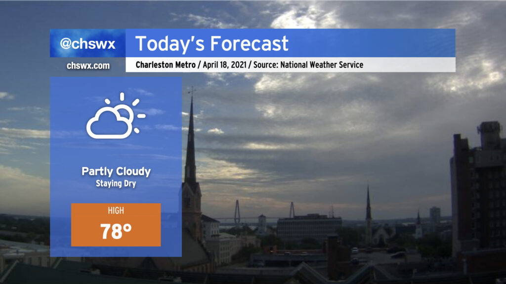
After yesterday turned out to be quite a stunner, we have more good weather in store for today. Temperatures will head into the upper 70s with partly cloudy skies throughout the day. Cloud cover will come and go as debris clouds from showers and storms to our south encroach into the area at times, but we look to remain rain-free.
Our dry stretch of weather likely continues into Tuesday at a minimum. Our best chance of rain this month — and it has been a dry month, with only a trace of rain at the airport so far — may not arrive until later Saturday. More on this later today.
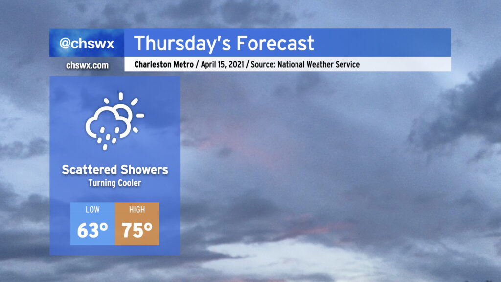
A cold front will sink into the area during the day on Thursday, cooling us down and kicking off scattered showers across the area from about mid-morning into the evening. It won’t rain all day or all the time, but be ready to don the rain gear as the day goes on. One thing you’ll notice is that we will run a few degrees cooler in the afternoon — this cooldown will persist into next week, but won’t be too heinous.
Rain chances will take a break on Friday before returning to the area on Saturday, which is increasingly looking somewhat wet. Shower chances will persist into the weekend and perhaps into the first part of next week. Temperatures will remain on the cool side of normal throughout.
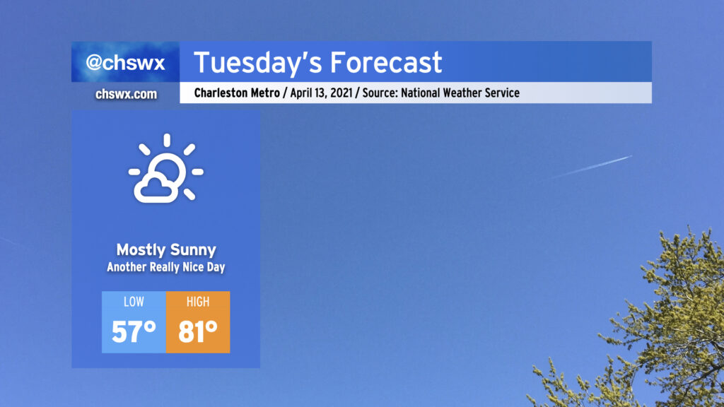
After a dry cold front swings through tonight, we’ll start Tuesday comfortably cool with lows in the mid-50s. By the afternoon, we’ll be back in the low 80s with low humidity. All in all, another nice Tuesday that you probably wish was a Saturday.
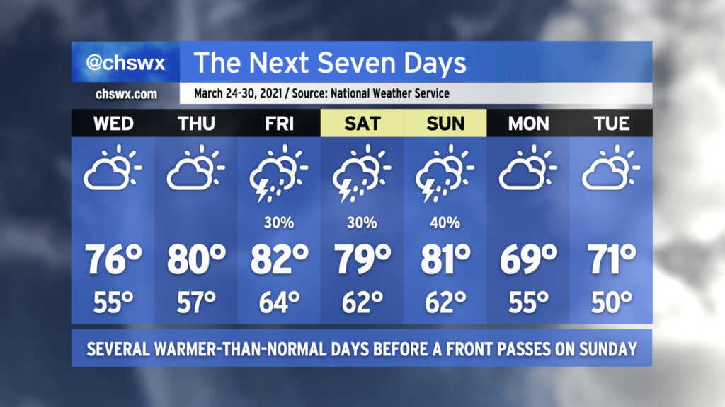
As we get into Wednesday, a cold front will make its approach to the area. We could see a few showers in the evening, but rain chances are generally low (20-30%). Thursday looks mostly dry and about 5-6° cooler with temperatures in the mid-70s. We stay cool and partly cloudy on Friday and into the weekend, with some slight rain chances from Saturday to Monday.
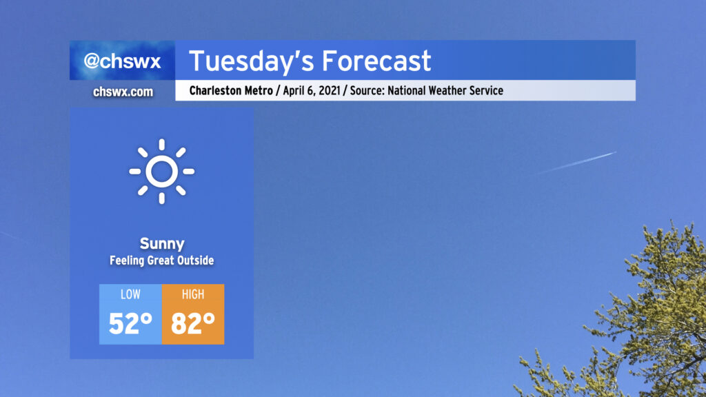
There’s really not much to say about tomorrow other than it’s going to feel pretty good outside with high pressure at the surface and ridging continuing to build aloft, putting the kibosh on any cloud that even thinks about getting going. Highs in the 80s with low humidity and full sunshine will make you wish it wasn’t Tuesday. This great stretch of weather continues Wednesday with a few more clouds. Thursday looks dry, but clouds will thicken back up as the day goes on ahead of our next storm system, which brings shower and storm chances into the area for Friday. But for now, soak it in as you can! Before you know it, we’ll have six months of humidity.
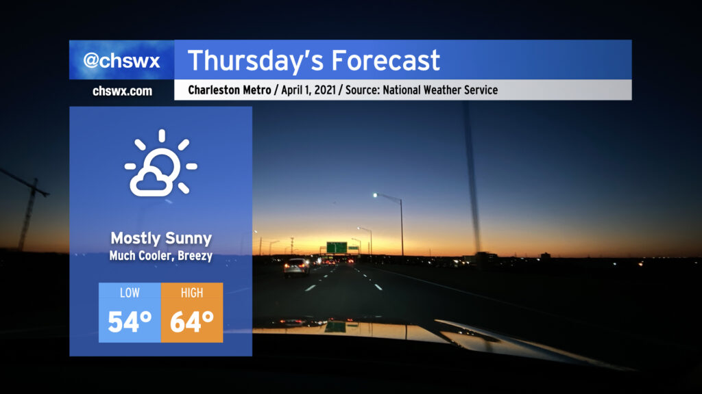
It was a busy weather evening, with numerous reports of hail inland from the coast, a lot of lightning, and a lot of heavy rain. The storms will give way to a cold front swinging through overnight, and by Thursday morning, we will begin to see quite a cooldown. We’ll go from a high of 82° on Wednesday to highs struggling into the mid-60s for Thursday. (No fooling.) It’ll be breezy in the wake of the front, too. However, the sun will be out, and the early April sun angle will feel pretty good when balanced with the cooler air temperatures.
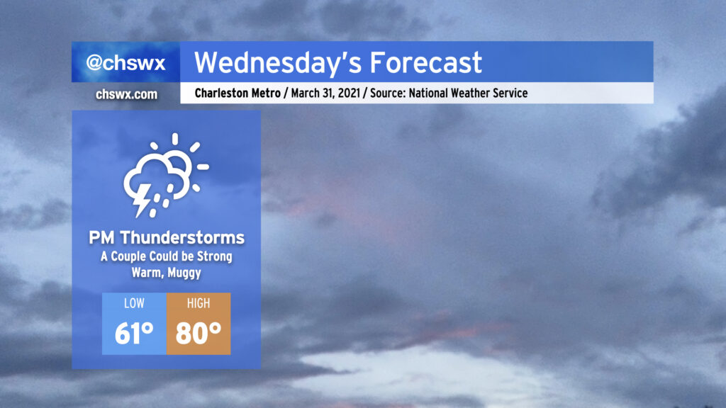
A cold front will approach the area from the west throughout the day Wednesday, with shower and thunderstorm chances increasing later in the day as the front gets closer. A couple showers or storms can’t be ruled out in the afternoon well ahead of it, but the best rain chances will start early in the evening through the overnight. One or two storms could turn strong with gusty winds and hail, especially for those of you who are further inland. However, widespread severe weather is not expected.
We’ll be at the apex of this week’s temperature rollercoaster with highs topping out around 80° in the afternoon. Afterward, it’s a much different story…
We’ll put scattered showers into the weather mix for tomorrow as a trough of low pressure sets up offshore, perhaps allowing a little rain to head up into our neck of the woods primarily in the morning to midday timeframe (with slight chances in the afternoon). Temperatures will warm into the lower 70s in the afternoon.
Tuesday night, a warm front will lift north of the area, which will prevent temperatures from falling much below the low 60s as we get into Wednesday morning. Highs will top out in the low 80s on Wednesday afternoon, with the risk of a few thunderstorms coming along for the ride as we are well into the warm sector of our next storm system. A couple strong to severe storms are not out of the question, either, so we’ll want to watch that potential. After the front gets through, the bottom falls out of the mercury, but at least the sun stays out into the weekend!
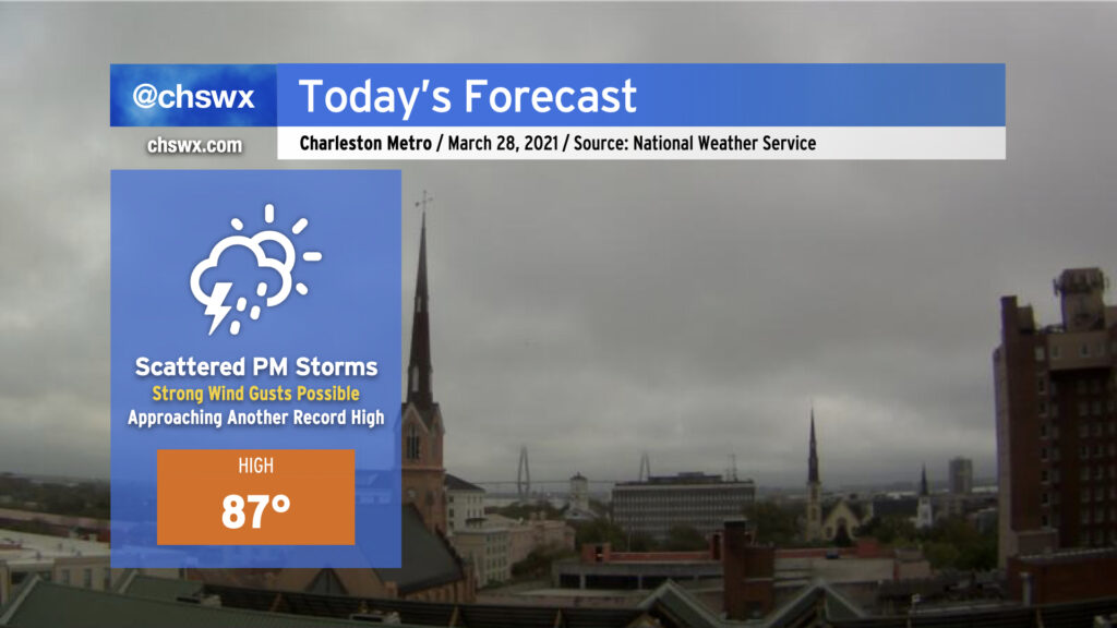
After two days of record warmth, we look once again to approach record highs ahead of a cold front. The NWS forecast high of 87° is one degree off the record of 88° set in 2017 — it’ll be close.
We are already seeing a few downpours pop off in the I-95 corridor near St. George and Holly Hill this morning. However, the better rain chances arrive this afternoon and evening as a line of thunderstorms ahead of a cold front approaches the area. I’d expect thunderstorms to be approaching the I-95 corridor around 4-6 PM, with the line — perhaps in a more broken, weakened state — moving through the Charleston metro area by early to mid-evening. Our risk for severe weather today is low, but not necessarily zero, as a couple storms could still produce damaging wind gusts as they move by (especially if they arrive early enough to interact with the seabreeze circulation). Water temperatures remain generally in the mid-60s, which should lend a stabilizing influence as the storms approach the coast.
As always, keep an eye on forecast updates throughout the day as arrival time estimates are fine-tuned and we see how trends evolve with the strength of these storms.
After temperatures overachieved today, we look to continue remaining a little warmer than normal as we go into Wednesday. Ridging aloft will continue to build over the next couple days, and by the end of the week we should be getting into the 80s ahead of a cold front that swings through Sunday. We look to remain rain-free through Friday, when a weakening cold front gets into the Carolinas and eventually stalls out and falls apart. While a strong storm or two can’t be ruled out, widespread severe weather is not anticipated.
As mentioned earlier, another, stronger cold front will swing through Sunday with a few thunderstorms, taking us back to closer to normal temperatures for Monday and beyond.
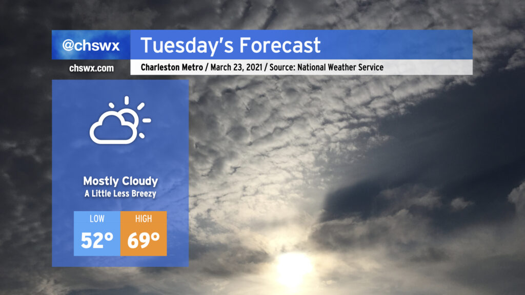
Cloud cover will look to be a bit more persistent on Tuesday, once again keeping temperatures right around 70° in the afternoon with low pressure stuck offshore, roughly about where the NC and SC border would be. Conditions should remain rain-free throughout the day, and we should get the sun peeking in and out as well.