Tuesday: A chill in the air, but a lot more sun
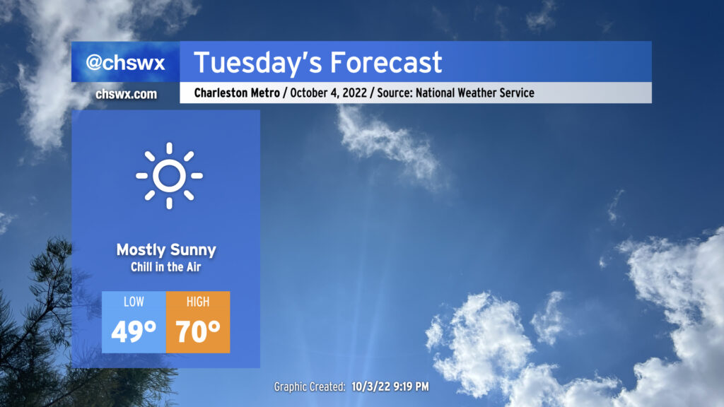
If you liked Monday’s temperatures but would prefer more sun, Tuesday will have you covered. Skies are clearing as I write this post, and we will have a much brighter day ahead. More clear skies will allow temperatures to fall into the upper 40s across much of the metro area away from the immediate coast. The NWS forecast will be around 49°; if that verifies, that would be the first sub-50° low since it was 46° on May 10. Temperatures will rebound only to about 70° despite nearly full sunshine as we sit on the southern periphery of a deep trough of low pressure aloft and a northerly breeze keeps cool air filtering in.
The only potential snag in tomorrow’s weather will be the potential for a little coastal flooding with the mid-afternoon high tide. We might see some salt water coming out of drains around Lockwood Dr. as well as on Hagood and Fishburne near the Joe and Johnson Hagood Stadium. However, a widespread tidal flooding event is not expected.
Warming trend continues the rest of the week
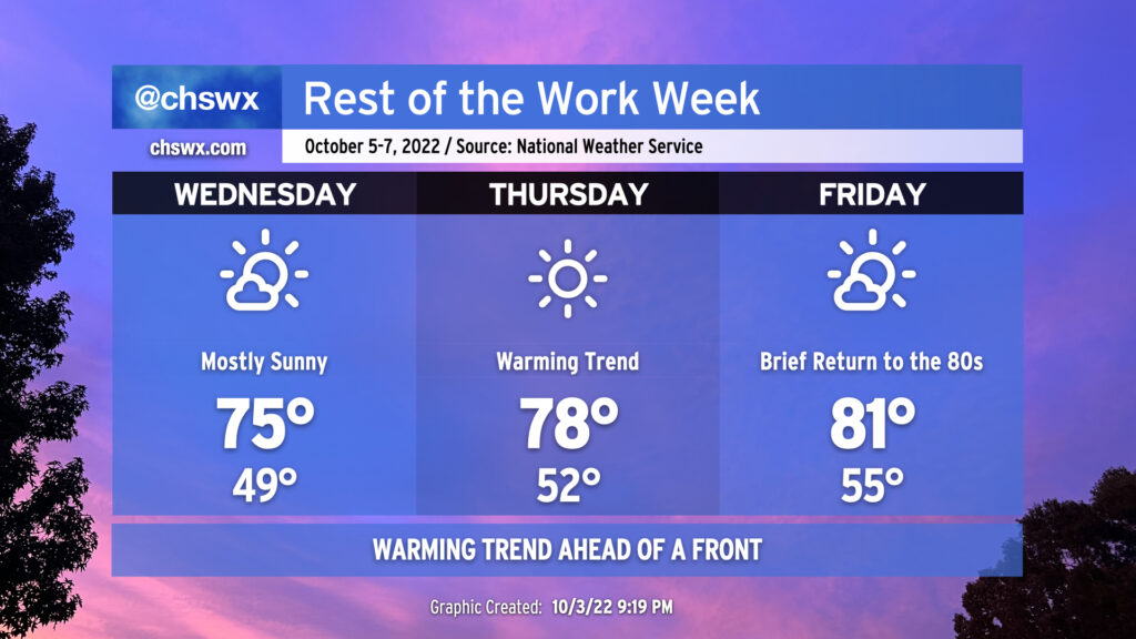
The aforementioned trough will be lifting out of the area heading toward the second half of the week, and temperatures will respond appropriately. We may see another round of 40s on Wednesday morning, but the afternoon should run about 5° warmer than Tuesday. The airmass continues to modify Thursday into Friday, with the 80s returning ahead of a dry cold front that will swing through on Saturday; said front will cool us back off well below climatology for early October for the weekend into early next week. We’ll continue to dry out from Ian’s deluge for the rest of the week, too.
Tropical update: Chances lowered for the disturbance approaching the Windwards
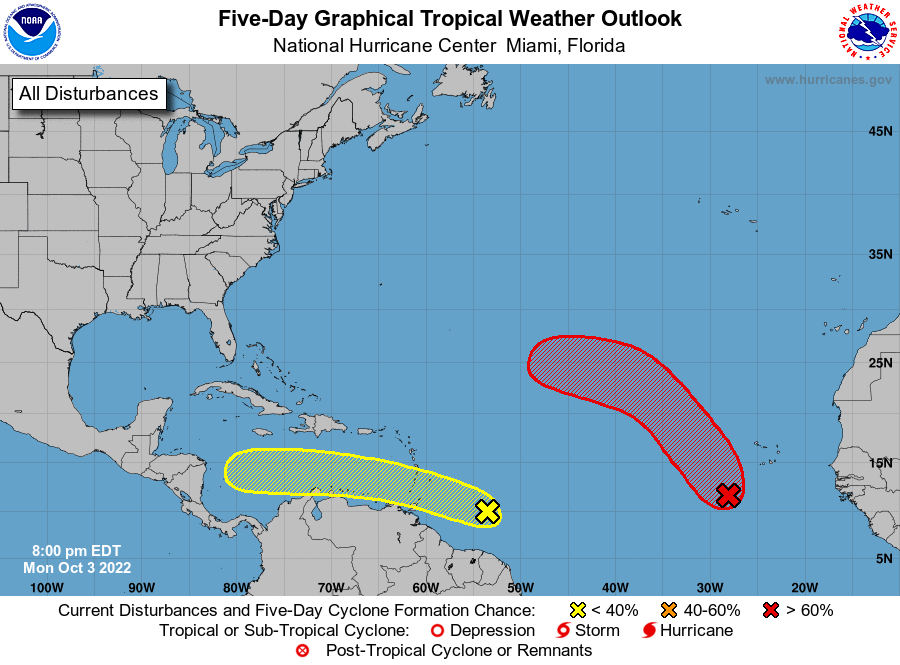
There remain a couple areas of interest for tropical development in the Atlantic basin this evening. The first, near the Cabo Verde Islands, is likely to develop into a tropical depression over the next few days. It’ll make a turn west before recurving northward around high pressure in the central Atlantic. As a result, this disturbance poses no threat to us.
The second disturbance is approaching the Windward Islands. NHC has reduced the probability of development on this storm slightly to 30% over the next five days. Not all the models develop this storm into a tropical cyclone, but even if it does end up developing, ridging over the Gulf should send this one well into the Yucatan Peninsula of Mexico. This disturbance appears to pose no threat to us; will keep an eye on it just in case.