Thursday: Showers and storms tapering ahead of a cold front
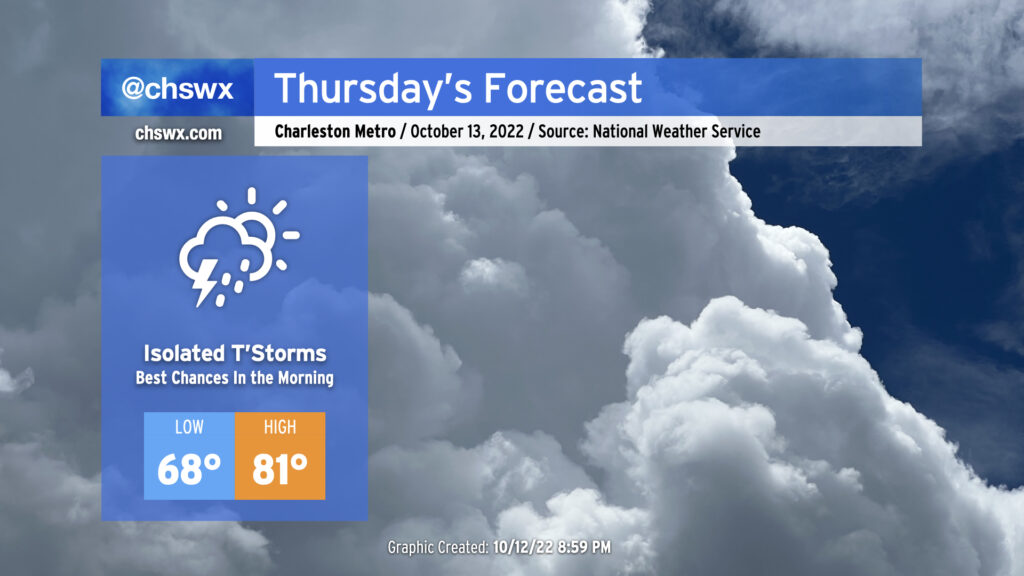
Overnight showers and thunderstorms will begin to taper off as we head toward daybreak Thursday. We may deal with some slick roads in the morning, though, so be ready for that possibility for your commute. The good news: We’re done with the recent round of tidal flooding induced by the full moon and onshore winds, so no concerns there.
The cold front will be moving through the state throughout the day and won’t clear the area until after sunset Thursday. Ahead of the front, a few showers and thunderstorms could redevelop as temperatures recover into the low 80s in the afternoon. Drier air punching into the area will modulate that threat somewhat, but don’t be surprised to see a shower or storm in your neck of the woods in the afternoon.
Friday & the weekend: Excellent weather
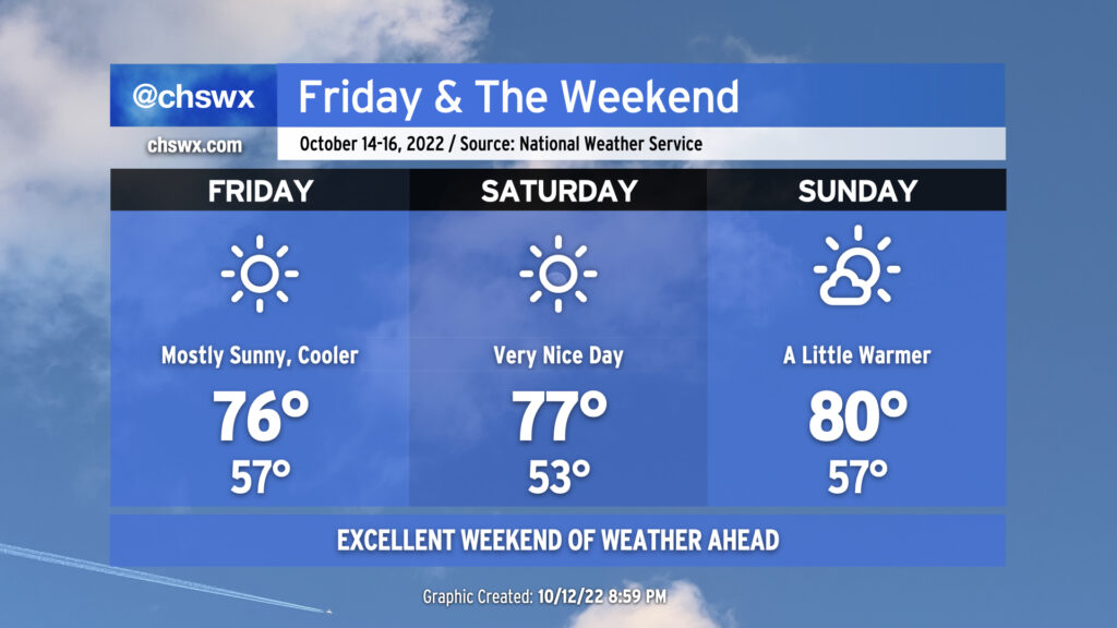
Once the aforementioned cold front gets through, we’ll be rewarded with an excellent weekend of weather. Cooler and drier air behind the front will clear out cloud cover and help produce brilliant skies for Friday with highs only getting into the mid-70s. Similar weather is on tap for Saturday, with a crisp low-50s start to the day yielding to mid-to-upper 70s in the afternoon under full sunshine. The airmass begins to modify a bit more for Sunday; we’ll start the day in the mid-to-upper 50s and highs will head to around 80° in the afternoon with just a cloud or two at times.
Tropical update: Mostly quiet
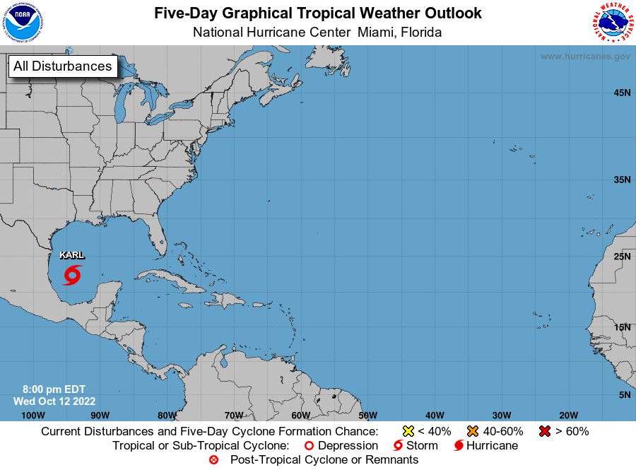
Tropical Storm Karl continues to spin in the far southwest Gulf of Mexico this evening. It is forecast to head almost due south into Mexico, making landfall likely sometime Saturday.
Otherwise, all is quiet — there are a few tropical waves out there, but nothing to write home about especially in the face of hostile wind shear across a good bit of the Atlantic.